Campus Drive–UMD station

Last updated • 3 min readFrom Wikipedia, The Free Encyclopedia
Campus Drive–UMD
MTA light rail station
Purple Line Campus Drive-UMD 0815.jpg
The station under construction in August 2024
General information
Location College Park, Maryland 20742
Coordinates 38°59′14″N76°56′45″W / 38.9873°N 76.9457°W / 38.9873; -76.9457
Owned by Maryland Transit Administration
Operated byMaryland Transit Solutions
Platforms2 side platforms
Tracks2
Construction
Structure typeat-grade
Parkingno
AccessibleYes
History
Opening2027;3 years' time (2027) (scheduled) [1]
Services
Preceding station MDOT-MTA Logo.svg Maryland Transit Administration Following station
Adelphi Road–UMGC–UMD
toward Bethesda
Purple Line Baltimore Avenue–College Park–UMD
Location
Campus Drive-UMD station

Campus Drive–UMD is a light rail station that is currently under construction. It will be part of the Purple Line in Maryland. The station will be located at the intersection of Campus Drive and Library Lane on the campus of the University of Maryland.

Contents

History

Construction of the station began in 2019 with the removal of trees surrounding the path of the line through campus and the conversion of Campus Drive to a one-way street to create room for the tracks and related infrastructure. [2] In January 2020, lead contractor Purple Line Transit Partners (PLTP) announced that the eastern half of the line from College Park to New Carrollton would open in late 2022, with the remainder scheduled for completion in June 2023. [3] At the same time, construction of the infrastructure surrounding the station continued with the relocation of UMD's "M" Circle" from a traffic circle on Campus Drive to a site on the roadside to allow for the demolition of the circle to make way for Purple Line tracks. Following completion of the new circle in September 2020, all Purple Line construction was paused due to a dispute between PLTP and the state over $800 million in unpaid cost overruns. PLTP withdrew from the project, forcing the MTA to take over construction of the line while an agreement was reached with a new contractor. As a result, UMD students, staff, and visitors reported difficulty with navigating the campus due to unfinished construction and the associated roadblocks and detours. [4]

The MTA continued to directly manage construction of the line until June 26, 2022, when Maryland Transit Solutions (MTS) were approved as the new lead contractor. At the same time, MTS and the MTA announced that completion would be delayed from March 2022 to fall 2026 to allow for the entire line to be completed at once. A UMD spokesperson also announced that the university was advocating for construction on campus to be completed as soon as possible despite the significant delay. [5] After the agreement with MTS, construction on campus ramped back up, with additional construction-related closures and detours along the line's route. This included the closure of three out of the five entrances to the primary on-campus lot for commuter students in January 2023, leading to congestion, a lack of spaces, and confused drivers and pedestrians. [6] In Summer 2024, concerns over noise pollution from heavier construction on Campus Drive led UMD to close several dorms that were the closest to the construction. The Diamondback also reported potential concerns over air quality on campus, with a UMD atmospheric and oceanic science professor reporting that the university had conducted air quality measurements and determined that there was no danger of health effects from poor air quality. An epidemiology and biostatistics and applied environmental health professor added that the release of dust, paint, and adhesives from construction activities could still lead to health risks to people who are exposed to them regardless of overall air quality. [7]

While major construction on campus was originally expected to be completed by 2025, on May 8, 2024 UMD president Darryll Pines announced that most construction will likely be completed by fall 2024. Despite this, the line is still not expected to open for passengers before December 2027. [8]

Finished tracks on Campus Drive in August 2024. Purple Line Campus Drive Tracks.jpg
Finished tracks on Campus Drive in August 2024.

Station layout

The station consists of two side platforms on either side of Campus Drive, just south of Cole Field House. [9]

P
Platform level
Side platform, doors will open on the right
Westbound      Purple Line toward Bethesda (Adelphi Road–UMGC–UMD)
Eastbound      Purple Line toward New Carrollton (Baltimore Avenue–College Park–UMD)
Side platform, doors will open on the right

Related Research Articles

<span class="mw-page-title-main">Maryland Transit Administration</span> Public transit authority of the state of Maryland

The Maryland Transit Administration (MTA) is a state-operated mass transit administration in Maryland, and is part of the Maryland Department of Transportation. The MTA operates a comprehensive transit system throughout the Washington-Baltimore metropolitan area. There are 80 bus lines serving the Baltimore Metropolitan Area, along with rail services that include the Light Rail, Metro Subway, and MARC Train. In 2023, the system had a ridership of 52,922,000, or about 219,600 per weekday as of the second quarter of 2024.

<span class="mw-page-title-main">College Park–University of Maryland station</span> Rail station in College Park, Maryland, US

College Park–University of Maryland station is a Washington Metro and MARC station located in College Park, Maryland, near the University of Maryland, College Park campus. It is served by the Metro Green Line and limited service on the MARC Camden Line. The light rail Purple Line is planned to begin service at the station in 2027.

<span class="mw-page-title-main">Charles/MGH station</span> Rapid transit station in Boston, Massachusetts, US

Charles/MGH station is a rapid transit station on the MBTA Red Line, elevated above Charles Circle on the east end of the Longfellow Bridge in the West End neighborhood of Boston, Massachusetts. The station is named for Charles Circle and the adjacent Massachusetts General Hospital (MGH) campus. It has two side platforms, with a glass-walled headhouse structure inside Charles Circle. Charles/MGH station is fully accessible.

<span class="mw-page-title-main">San Diego Trolley</span> Light rail system in San Diego County, California

The San Diego Trolley is a light rail system operating in San Diego County, California. The trolley's operator, San Diego Trolley, Inc., is a subsidiary of the San Diego Metropolitan Transit System (MTS). The trolley operates as a critical component of MTS, with connections to and integrated travel tickets with the local bus systems.

<span class="mw-page-title-main">Tel Aviv Light Rail</span> Mass transit system for Tel Aviv, Israel

The Tel Aviv Light Rail, also known as Dankal is a mass transit system for Gush Dan, the Tel Aviv metropolitan area in central Israel. The system will include different modes of mass transit, including rapid transit (metro), light rail transit (LRT), and bus rapid transit (BRT). Overseen by NTA Metropolitan Mass Transit System Ltd., a government agency, the project will complement the intercity and suburban rail network operated by Israel Railways.
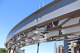
<span class="mw-page-title-main">Purple Line (Maryland)</span> Under construction light rail line in Maryland

The Purple Line is a 16.2-mile (26.1 km) light rail line being built to link several Maryland suburbs of Washington, D.C.: Bethesda, Silver Spring, College Park, and New Carrollton. Currently slated to open in late 2027, the line will also enable riders to move between the Maryland branches of the Red, Green, and Orange lines of the Washington Metro without riding into central Washington, and between all three lines of the MARC commuter rail system. The project is administered by the Maryland Transit Administration (MTA), an agency of the Maryland Department of Transportation (MDOT), and not the Washington Metropolitan Area Transit Authority (WMATA), which operates Metro.

<span class="mw-page-title-main">16th Street Mall</span> Pedestrian and transit mall in Denver, Colorado, United States

The 16th Street Mall is a pedestrian and transit mall in Denver, Colorado that opened in 1982. The mall, 1.25 miles long, runs along 16th Street in downtown Denver, from Wewatta Street to the intersection of 16th Avenue and Broadway. The intricate granite stone sidewalks and streets were designed by architect I.M Pei to resemble the scale pattern of the western diamondback rattlesnake. It is home to over 300 stores, 50 restaurants, and the Denver Pavilions shopping mall. In April 2022, construction started on a $149-million multi-year rebuild of the 40-year-old infrastructure, expected to finish in late 2024.
<span class="mw-page-title-main">Roosevelt Island station</span> New York City Subway station in Manhattan

The Roosevelt Island station is a station on the IND 63rd Street Line of the New York City Subway. Located in Manhattan on Roosevelt Island in the East River, it is served by the F train at all times and the <F> train during rush hours in the reverse peak direction.

<span class="mw-page-title-main">21st Street–Queensbridge station</span> New York City Subway station in Queens

The 21st Street–Queensbridge station is a station on the IND 63rd Street Line of the New York City Subway. Located at the intersection of 21st Street and 41st Avenue within Queensbridge in Long Island City, Queens, it is served by the F train at all times and the <F> train during rush hours in the reverse peak direction.

<span class="mw-page-title-main">San Ysidro Transit Center</span> San Diego Trolley station

San Ysidro Transit Center is a San Diego Trolley station in the San Ysidro neighborhood of San Diego, California. The station is the southern terminus of the Blue Line and is located on a short rail spur off the San Diego and Arizona Eastern Railway main line which hosts the Blue Line to downtown San Diego.
<span class="mw-page-title-main">University of Maryland, College Park</span> Public university in College Park, Maryland, US

The University of Maryland, College Park is a public land-grant research university in College Park, Maryland, United States. Founded in 1856, UMD is the flagship institution of the University System of Maryland.

<span class="mw-page-title-main">"M" Circle</span> Commemorative traffic circle at the University of Maryland

The "M" Circle is a commemorative traffic circle on the campus of the University of Maryland, College Park. Created in 1976 to celebrate the American Bicentennial, the circle is noted for the large floral "M" that sits in its center. The flowers that make up the "M" are replaced twice annually, red 'Vodka' begonias are planted each spring for the warmer months and replaced with yellow pansies each fall.
<span class="mw-page-title-main">Takoma Langley Crossroads Transit Center</span>

The Takoma Langley Crossroads Transit Center is a bus transit center in Langley Park, Maryland. It is at the intersection of University Boulevard and New Hampshire Avenue, and is the largest bus-only transfer in the Washington, D.C. metropolitan area. It is a future transfer point for the Purple Line.

Adelphi Road–UMGC–UMD is a light rail station that is currently under construction. It will be part of the Purple Line in Maryland. The station will be located on the west border of the University of Maryland at the intersection of Adelphi Road and Campus Drive.

Baltimore Avenue–College Park–UMD is a light rail station that is currently under construction. It will be part of the Purple Line in Maryland. The station will be located at the intersection of Baltimore Avenue and Rossborough Lane on the eastern campus of the University of Maryland.

Riverdale Park North–UMD is a light rail station that is currently under construction. It will be part of the Purple Line in Maryland. The station will be located at the intersection of River Road and Haig Drive on the eastern campus of the University of Maryland in the M Square Research Park.

<span class="mw-page-title-main">New Carrollton–Fort Totten Line</span> Bus route in Washington, D.C. region

The New Carrollton–Fort Totten Line, designated Route F6, is a weekday-only bus route operated by the Washington Metropolitan Area Transit Authority between the New Carrollton station of the Orange Line station of the Washington Metro and the Fort Totten station of the Red and Green Lines of the Washington Metro. The line operates every 30 minutes during peak hours and 60 minutes all other times, weekdays only. F6 trips are roughly 60 minutes. This route provides weekday service between Fort Totten and New Carrollton stations without having to take the train into Downtown DC.

<span class="mw-page-title-main">College Park–Bethesda Line</span>

The College Park–Bethesda Line, designated Route J4, was a rush hour-only MetroExtra bus route operated by the Washington Metropolitan Area Transit Authority between the College Park–University of Maryland station of the Green and Yellow Lines of the Washington Metro and Bethesda station of the Red Line of the Washington Metro. The J4 operated throughout the neighborhoods in Prince George's and Montgomery counties in Maryland. This line ran along current construction for the upcoming Purple Line between College Park and Bethesda.

The College Park–North Bethesda Line, designated Route C8, is a bus route that operates Monday to Saturday that is operated by the Washington Metropolitan Area Transit Authority, United States, between College Park–University of Maryland station of the Green Line and North Bethesda station of the Red Line of the Washington Metro. The line operates every 30 minutes at all times. Trips are roughly 70–80 minutes long.

References

  1. Shaver, Katherine (2022-01-26). "Md. board approves $3.4 billion contract to complete Purple Line". The Washington Post.
  2. Condon, Christine (April 24, 2019). "After construction delays, the Purple Line development team has a new CEO". The Diamondback . Retrieved August 15, 2024.
  3. Barthel, Margaret (January 17, 2020). "The Purple Line Is Chugging Along: Here's What You Need To Know". WAMU . Retrieved August 15, 2024.
  4. Truss-Williams, Anaya (October 2, 2020). "A pause on Purple Line construction adds to unfinished projects at UMD". The Diamondback. Retrieved August 15, 2024.
  5. Vuttaluru, Shreya (February 7, 2022). "Purple Line construction set to ramp up this spring under new contractor". The Diamondback. Retrieved August 15, 2024.
  6. Byrne, Bridget (March 6, 2023). "Purple Line construction frustrates UMD commuters who park in Lot 1". The Diamondback. Retrieved August 15, 2024.
  7. Abdel-Motagaly, Sumaya (March 14, 2024). "UMD community concerned about Purple Line construction's environmental, health impacts". The Diamondback. Retrieved August 15, 2024.
  8. Glaros, Lillian (May 10, 2024). "UMD construction updates: Major Purple Line construction likely to finish in fall 2024". The Diamondback. Retrieved August 15, 2024.
  9. "University Blvd Adelphi Rd - Univ M" (PDF). Maryland Purple Line. Maryland Transit Administration. May 7, 2013. Archived from the original (PDF) on November 18, 2013. Retrieved April 12, 2018.
Purple Line
BSicon exlINT.svg
BSicon uextKINTa.svg
Bethesda
WMATA Red.svg
BSicon hPORTALg.svg
BSicon uexhHSTe.svg
Connecticut Avenue
BSicon uexhKRZWae.svg
BSicon uexHST.svg
Lyttonsville
BSicon uexHST.svg
16th Street–Woodside
BSicon uexINT.svg
Silver Spring
MARC train.svg WMATA Red.svg
BSicon uexSTR.svg
BSicon RP4.svg
Bonifant Street
BSicon uexHST.svg
Silver Spring Library
BSicon uexSTR.svg
BSicon RP4+l.svg
Wayne Avenue
BSicon uexHST.svg
BSicon RP4.svg
Dale Drive
BSicon uexSTR.svg
BSicon RP4oW.svg
BSicon MASKe.svg
BSicon MSTRq.svg
BSicon uextSTRa@g.svg
BSicon uexlHST.svg
BSicon RP4.svg
Manchester Place
BSicon PORTALg.svg
BSicon uexHST.svg
Long Branch
BSicon uexSTR.svg
BSicon vRP2yRP4+r.svg
MD Route 193.svg
MD 193
University Boulevard
BSicon uexHST.svg
BSicon vRP2HST.svg
Piney Branch Road
BSicon uexINT.svg
BSicon vRP2BHF.svg
Takoma Langley
BSicon uexHST.svg
BSicon vRP2HST.svg
Riggs Road
BSicon uexSTR.svg
BSicon vRP2oW.svg
BSicon uexHST.svg
BSicon vRP2HST.svg
Adelphi Road–UMGC–UMD
BSicon RP4+r.svg
BSicon uexSTR.svg
BSicon vRP2yRP4r.svg
BSicon uexHST.svg
BSicon RP4.svg
Campus Drive–UMD
BSicon uexSTR.svg
BSicon RP4l.svg
BSicon RP4+r.svg
Campus Drive
BSicon uexHST.svg
BSicon RP4.svg
Baltimore Avenue–UMD
BSicon uexSTR.svg
BSicon RP4+l.svg
BSicon RP4rf.svg
BSicon uexSTR.svg
BSicon RP4l.svg
BSicon uexINT.svg
College Park–University of Maryland
MARC train.svg WMATA Green.svg
BSicon uexHST.svg
Riverdale Park North–UMD
BSicon uexSTR.svg
BSicon vRP2yRP4+l.svg
MD Route 201.svg
MD 201
Kenilworth Avenue
BSicon uexSTR.svg
BSicon vRP2yRP4r.svg
BSicon uexhHSTae.svg
Riverdale Park–Kenilworth
BSicon uexHST.svg
Beacon Heights–East Pines
BSicon uexYRDq.svg
BSicon uexABZg+r.svg
Glenridge Maintenance Facility
BSicon uexHST.svg
Glenridge
BSicon uexSTR.svg
BSicon RP4.svg
Ellin Road
BSicon uexKINTe.svg
New Carrollton
BSicon LOGO Amtrak2.svg MARC train.svg WMATA Orange.svg

Wheelchair symbol.svg All stations are accessible