
Carlisle is a cathedral city in Cumbria, England. It is governed by a non-metropolitan district named after the city and county town. From April 2023, the city will be the Cumberland District’s administrative centre, named after and covering a similar area to the historic county of the same name.

Cumbria is a ceremonial and non-metropolitan county in North West England, bordering Scotland. The county and Cumbria County Council, its local government, came into existence in 1974 after the passage of the Local Government Act 1972. Cumbria's county town is Carlisle, in the north of the county. Other major settlements include Barrow-in-Furness, Kendal, Whitehaven and Workington.

Westmorland (, formerly also spelt Westmoreland; is a historic county in North West England spanning the southern Lake District and the northern Dales. It had an administrative function from the 12th century until 1974. Between 1974 and 2023 Westmorland lay within the administrative county of Cumbria. In April 2023, Cumbria County Council will be abolished and replaced with two unitary authorities, one of which, Westmorland and Furness, will cover all of Westmorland, thereby restoring the Westmorland name to a top-tier administrative entity. The people of Westmorland are known as Westmerians.
Cumberland is a historic county in far North West England. It covers part of the Lake District as well as the north Pennines and Solway Firth coast. Cumberland had an administrative function from the 12th century until 1974, when it was subsumed into Cumbria, a larger administrative area which also covered Westmorland and parts of Yorkshire and Lancashire. In April 2023, Cumberland will be revived as an administrative entity when Cumbria County Council is abolished and replaced by two unitary authorities; one of these is to be named Cumberland and will include most of the historic county, with the exception of Penrith and the surrounding area.

Penrith is a market town and civil parish in the county of Cumbria, England, about 17 miles (27 km) south of Carlisle. It is less than 3 miles (5 km) outside the Lake District National Park, in between the Rivers Petteril and Eamont and just north of the River Lowther. It had a population of 15,181 at the 2011 census.

Cumbria Constabulary is the territorial police force in England covering Cumbria. As of September 2017, the force had 1,108 police officers, 535 police staff, 93 police community support officers, and 86 special constables.

Aikton is a small village in the north of the English county of Cumbria. The nearest town is Wigton 3 miles away, and the nearest city is Carlisle at 8 miles. Aikton is located 5+1⁄2 miles (8.9 km) south of the Scottish border, in the centre of the Channel of the River Eden. It is in the historic county of Cumberland.

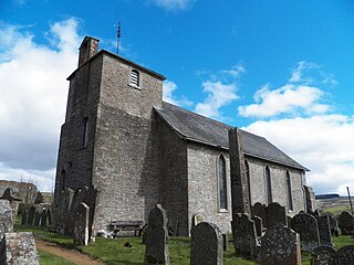
Clifton is a small linear village and civil parish in Cumbria, England. Historically part of Westmorland, it lies 3 miles (4.8 km) south east of Penrith.
Bewcastle is a large civil parish in the City of Carlisle district of Cumbria, England. It is in the historic county of Cumberland.

Hesket is a large civil parish in the Eden District of Cumbria, England, on the main A6 between Carlisle and Penrith. At the 2001 census it had a population of 2,363, increasing to 2,588 at the 2011 census, and estimated at 2,774 in 2019. The parish formed in 1894 with the passing of the Local Government Act 1894 and was enlarged to incorporate the parish of Plumpton Wall following a County Review Order in 1934. Hesket is part of the historic royal hunting ground of Inglewood Forest. Settlement in the parish dates back to the Roman occupation.

St Cuthbert Without, or simply St Cuthbert, is a civil parish within the City of Carlisle in Cumbria, England.

Inglewood Forest is a large tract of mainly arable and dairy farm land with a few small woodland areas between Carlisle and Penrith in the English non-metropolitan county of Cumbria or ancient county of Cumberland.
The history of Cumbria as a county of England begins with the Local Government Act 1972. Its territory and constituent parts however have a long history under various other administrative and historic units of governance. Cumbria is an upland, coastal and rural area, with a history of invasions, migration and settlement, as well as battles and skirmishes between the English and the Scots.
Botcherby is a former village in Cumbria, England, now considered a suburb of the city of Carlisle. It is located east of the River Petteril south of its confluence with the River Eden, Cumbria.

Cliburn is a village and civil parish in the Eden district of Cumbria, England. The civil parish includes the hamlet of Town Head. In 2001 the population was 204, increasing to 274 at the 2011 Census.

Holme St Cuthbert is a small village and civil parish in the borough of Allerdale, in the county of Cumbria, United Kingdom. The village is located approximately 23 miles to the south-west of Carlisle, Cumbria's county town, and was historically in the county of Cumberland.

Brisco or Birksceugh is a village in the civil parish of St Cuthbert Without, in the Carlisle district, in the county of Cumbria, England. It is located a few miles south of the city of Carlisle, near Junction 42 of the M6 motorway. There is St Ninian's well in the village. In the Imperial Gazetteer of England and Wales of 1870-72 the township had a population of 323.
The history of medieval Cumbria has several points of interest. The region's status as a borderland coping with 400 years of warfare is one. The attitude of the English central government, at once uninterested and deeply interested, is another. As a border region, of geopolitical importance, Cumbria changed hands between the Angles, Norse, Strathclyde Brythons, Picts, Normans, Scots and English; and the emergence of the modern county is also worthy of study.
The Cumbria Rugby Union is the governing body for the sport of rugby union in the county of Cumbria in England. The union is the constituent body of the Rugby Football Union (RFU) for Cumbria, and administers and organises rugby union clubs and competitions in the county. It also administers the Cumbria rugby representative teams.
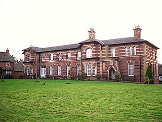
Garlands Hospital was a mental health facility at Carleton near Carlisle in Cumbria, England.

