
Cascumpec Bay is within Prince Edward Island in Canada and is adjacent to the Gulf of Saint Lawrence.
Cascumpec Bay is within Prince Edward Island in Canada and is adjacent to the Gulf of Saint Lawrence.
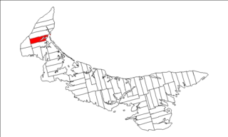
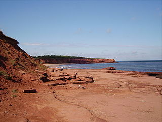
Cascumpec Bay is located where Prince Edward Island's north shore at its northwestern extreme turns northeasterly to become the east shore of the island's Northeast Peninsula. The bay covers an area of approximately 40 square kilometres (15 sq mi) and is relatively shallow. Cascumpec Bay fronts the Gulf of Saint Lawrence along its eastern side but is protected from gulf by a series of sandy barrier islands. Most of the protection is provided by the Cascumpec Sand Hills, a single long barrier island given its name because of its extensive sand dunes. Several estuaries are located along the landward sides of the bay, including the Kildare River, Mill River, Foxely River and Trout River. The lands at the south end of the bay east of the Foxely River are almost entirely composed of peat and are known locally as the Black Banks. Apart from the Black Banks, the Sand Hills, and most other islands, the rest of the land surrounding the bay is largely devoted to intensive agriculture.
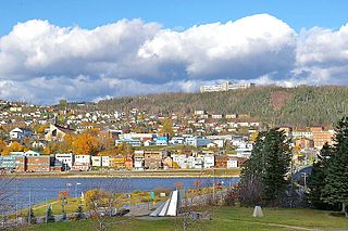
Alberton Harbour is a northern lobe of Cascumpec Bay, separated from the main body of the bay by Oultons Island. Alberton Harbour has its own passage into the Gulf of Saint Lawrence between the north end of the Sand Hills and the south extreme of Kildare Point, a sand spit that directs the Kildare River into the harbour instead of into the gulf. The passage made Alberton Harbour an attractive shelter during the age of sailing and encouraged local seafaring settlements. On the west side of Alberton Harbour opposite the passage is the town of Alberton with about 1100 residents. Also on the harbour is Northport, a fishing village to the south of Alberton with about 250 residents. These are the only two incorporated settlements near Cascumpec Bay.
The name Cascumpec originated as the Mi'kmaq name "Kaskamkek", which means "bold sandy shore". In the 18th century, the name mutated slightly to the French name "Cachecampec", and then to the English adaptation "Kascumpeck". Since then, the pronunciation has changed very little, but the current spelling was settled only in 1966. [1]
Cascumpec Bay ecosystem is identified by Nature Canada as an Important Bird Area. Of particular interest are its use for migration staging by large numbers of migrating Canada geese, and as nesting habitat for great blue heron and osprey. Also, the Cascumpec Sand Hills sometimes host nests of piping plover and colonies of common tern.

The Gulf of St. Lawrence fringes the shores of the provinces of Quebec, New Brunswick, Nova Scotia, Prince Edward Island, Newfoundland and Labrador, in Canada, plus the islands Saint-Pierre and Miquelon, possessions of France, in North America.

The Northumberland Strait is a strait in the southern part of the Gulf of Saint Lawrence in eastern Canada. The strait is formed by Prince Edward Island and the gulf's eastern, southern, and western shores.

Queens County is a county in the province of Prince Edward Island, Canada. It is the largest county in the province by population with 89,770 (2021) and land. Charlottetown is the county seat of Queens County, and is the largest city and the capital of Prince Edward Island.

Toronto Harbour or Toronto Bay is a natural bay on the north shore of Lake Ontario, in Toronto, Ontario, Canada. Today, the harbour is used primarily for recreational boating, including personal vessels and pleasure boats providing scenic or party cruises. Ferries travel from docks on the mainland to the Islands, and cargo ships deliver aggregates and raw sugar to industries located in the harbour. Historically, the harbour has been used for military vessels, passenger traffic and cargo traffic. Waterfront uses include residential, recreational, cultural, commercial and industrial sites.

Foxley River is a Canadian rural community in Prince County, Prince Edward Island.
Lot 5 is a township in Prince County, Prince Edward Island, Canada created during the 1764–1766 survey of Samuel Holland. It is part of Egmont Parish.

North Rustico is a Canadian town located in Queens County, Prince Edward Island.
Alberton is a Canadian town located in Prince County, Prince Edward Island. It is situated in the western part of the county in the township of Lot 5.
Gaspé Bay is a bay of the Gulf of St. Lawrence, located on the northeast coast of the Gaspé Peninsula, Gaspésie-Îles-de-la-Madeleine region, Quebec, Canada.

Prince County is located in western Prince Edward Island, Canada. The county's defining geographic feature is Malpeque Bay, a sub-basin of the Gulf of St. Lawrence, which creates the narrowest portion of Prince Edward Island's landmass, an isthmus upon which the city of Summerside is located.

Georgetown is a community located within the municipality of Three Rivers in Kings County, Prince Edward Island, Canada. It is the Capital of Kings County. Previously incorporated as a town, it amalgamated with the town of Montague, the rural municipalities of Brudenell, Cardigan, Lorne Valley, Lower Montague, and Valleyfield, and portions of three adjacent unincorporated areas in 2018.
Pridham Road, labelled Route 154, is a 2-lane collector highway in western Prince County, Prince Edward Island, Canada. It is near the town of Alberton. Its maximum speed limit is 80 km/h (50 mph).
Alberton-Roseville was a provincial electoral district for the Legislative Assembly of Prince Edward Island, Canada. It was formerly known as Alberton-Miminegash from 1996 to 2007.
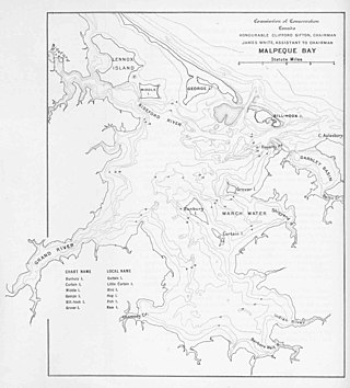
Malpeque Bay is a 204 km2 (79 sq mi) estuarine bay on the north shore of Prince Edward Island, Canada.
The Hunter River, informally nicknamed the "River Clyde", is a Canadian river in northwestern Queens County, Prince Edward Island.
The geography of Prince Edward Island is mostly pastoral with red soil, white sand, and scattered communities. Known as the "Garden of the Gulf", the island is located in the Gulf of Saint Lawrence north of Nova Scotia and east of New Brunswick, with which it forms the Northumberland Strait.

Dorset Island, or Cape Dorset Island, is one of the Canadian Arctic islands located in Hudson Strait, Nunavut, Canada. It lies off the Foxe Peninsula area of southwestern Baffin Island in the Qikiqtaaluk Region. It is serviced by an airport and a harbour.

The Cascumpeque Light is a deactivated lighthouse on the western north coast of Prince Edward Island, Canada. The station was established in 1856 and the lighthouse itself was built in 1899.
Hog Island is a 14.5 km (9.0 mi) long barrier island located off the northwest coast of Prince Edward Island in Canada. The island is notable for its unique sandhill ecosystem and cultural significance to the Mi'kmaq people.
Pituamkek National Park Reserve is a Canadian national park reserve encompassing a chain of barrier islands along the northern coast of Prince Edward Island. The park reserve was formally established on July 4, 2024, with a proposed protected area of approximately 30 km2 (12 sq mi), although the boundaries of the park reserve are not yet finalized.