
The Gulf of St. Lawrence is the outlet of the North American Great Lakes via the St. Lawrence River into the Atlantic Ocean. The gulf is a semi-enclosed sea, covering an area of about 226,000 square kilometres (87,000 sq mi) and containing about 34,500 cubic kilometres (8,300 cu mi) of water, which results in an average depth of 152 metres (499 ft).

Jacques Cartier was a French-Breton maritime explorer for France. Jacques Cartier was the first European to describe and map the Gulf of Saint Lawrence and the shores of the Saint Lawrence River, which he named "The Country of Canadas" after the Iroquoian names for the two big settlements he saw at Stadacona and at Hochelaga.

Holland College is the provincial community college for the Canadian province of Prince Edward Island (PEI). It is named after British Army engineer and surveyor Captain Samuel Holland. It was formed by the Government of Prince Edward Island in 1969 as a result of an education reform policy undertaken as part of the Prince Edward Island Comprehensive Development Plan which saw the closure of the province's two post-secondary institutions structured on religious lines, St. Dunstan's University and Prince of Wales College, and the creation of the non-denominational University of Prince Edward Island (UPEI) and Holland College.

Cavendish is an unincorporated rural community in the township of Lot 23, Queens County, Prince Edward Island, Canada.

Alberton is a Canadian town located in Prince County, Prince Edward Island. It is situated in the western part of the county in the township of Lot 5. The population was 1,145 as of the 2016 census.
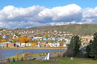
Gaspé Bay is a bay located on the northeast coast of the Gaspé Peninsula, Quebec, in the Gulf of St. Lawrence. The town of Gaspé, Quebec lies on a part of its southern shore, while most of its northern shore is in the Forillon National Park. The main rivers draining to the bay are the Dartmouth River and the York River.
Brudenell River Provincial Park is a provincial park in Prince Edward Island, Canada. It lies on the north side of the Brudenell River. Brudenell River is the largest provincial park in eastern Prince Edward Island. Some of its land is used by Rodd Brudenell Resort. It has two public 18-hole golf courses, Brudenell River Golf Course and Dundarave Golf Course.

Cabot Beach Provincial Park is a provincial park in Prince Edward Island, Canada. It is located in Malpeque Bay.
Cedar Dunes Provincial Park is an ocean-front provincial park in Prince Edward Island, Canada. It is located south of West Point, facing the Northumberland Strait.

Green Park Provincial Park is a provincial park in Prince Edward Island, Canada. It is located on the western shore of Malpeque Bay. It is the site of a former shipyard; in the 19th century, ship building was a major industry on Prince Edward Island. The province acquired the land in the 1960s. It is home to the Green Park Shipbuilding Museum and Yeo House, the historic home of a shipping magnate.
Panmure Island Provincial Park is a provincial park in Prince Edward Island, Canada. It is located along a causeway connecting Prince Edward Island with Panmure Island. The Native Council of Prince Edward Island hosts their annual Abegweit Pow Wow in the park.

Strathgartney Provincial Park is a provincial park in Prince Edward Island, Canada. Its trails connect it to Bonshaw Provincial Park. In June 2021, it was announced that a portion of the parked will be leased privately and turned into luxury campgrounds.

Argyle Shore Provincial Park is a provincial park in on in Prince Edward Island, Canada. It opened in 1961 and is 9.59 ha. The park's name comes from the area's early 19th-century settlers from Argyle Shire, Scotland.

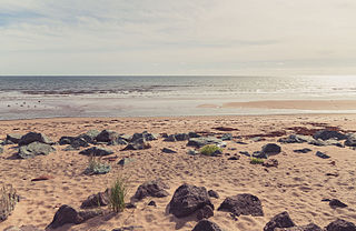
Basin Head Provincial Park is a provincial park located in Basin Head, Prince Edward Island, Canada. It is best known by its nickname "Singing Sands", in reference to the pure white sand that "sings" when stepped on, due to a high silica content. This sand is geologically unique to the area.

Buffaloland Provincial Park is a provincial park in Prince Edward Island, Canada. It is home to a bison sanctuary.

Kings Castle Provincial Park is a provincial park in the southeastern portion of Prince Edward Island, Canada.

Chelton Beach Provincial Park is a provincial park in Prince Edward Island, Canada.

Linkletter Provincial Park is a provincial park in Prince Edward Island, Canada located at Bedeque Bay a short distance west of Linkletter, Prince Edward Island and Summerside, Prince Edward Island.

Jacques-Cartier is an electoral district in the West Island of Montreal, Canada, that elects members to the National Assembly of Quebec. It is the only provincial electoral district in Quebec with an Anglophone majority.

Lake Sautauriski is a freshwater body crossed from north to south by the Sautauriski River, flowing in the unorganized territory of Lac-Jacques-Cartier, in the La Côte-de-Beaupré Regional County Municipality, in the administrative region of Capitale-Nationale, in province of Quebec, in Canada.
