
The Gulf of St. Lawrence is the outlet of the North American Great Lakes via the St. Lawrence River into the Atlantic Ocean. The gulf is a semi-enclosed sea, covering an area of about 226,000 square kilometres (87,000 sq mi) and containing about 34,500 cubic kilometres (8,300 cu mi) of water, at an average depth of 152 metres (500 ft).
Summerside is a Canadian city in Prince County, Prince Edward Island. It is the second largest city in the province and the primary service centre for the western part of the island.
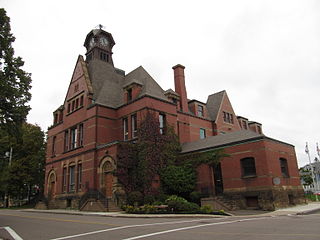
Cornwall is a Canadian town located in Queens County, Prince Edward Island. The town is located immediately west of the provincial capital Charlottetown.
Canadian Forces Base Summerside was an air force base located in St. Eleanors, Prince Edward Island, Canada, now part of the city of Summerside.

Holland College is the provincial community college for the Canadian province of Prince Edward Island (PEI). It is named after the British Army engineer and surveyor Captain Samuel Holland.
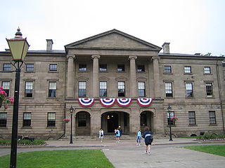
Province House is where the Prince Edward Island Legislature, known as the Legislative Assembly of Prince Edward Island, has met since 1847. The building is located at the intersection of Richmond and Great George Streets in Charlottetown; it is Canada's second-oldest seat of government.

Cavendish is an unincorporated rural community in the township of Lot 23, Queens County, Prince Edward Island, Canada.
The Charlottetown Driving Park (CDP), located in Charlottetown, Prince Edward Island, Canada is a harness racing track for racing standardbred horses.

Cabot Beach Provincial Park is a provincial park in Prince Edward Island, Canada. It is located in Malpeque Bay.

Green Park Provincial Park is a provincial park in Prince Edward Island, Canada. It is located on the western shore of Malpeque Bay. It is the site of a former shipyard; in the 19th century, ship building was a major industry on Prince Edward Island. The province acquired the land in the 1960s. It is home to the Green Park Shipbuilding Museum and Yeo House, the historic home of a shipping magnate.

Strathgartney Provincial Park is a provincial park in Prince Edward Island, Canada. Its trails connect it to Bonshaw Provincial Park. In June 2021, it was announced that a portion of the parked will be leased privately and turned into luxury campgrounds.
Belmont Provincial Park is a provincial park in Prince Edward Island, Canada. It is located on the coast of Malpeque Bay.
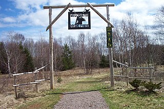
Bonshaw Provincial Park is a provincial park with hiking trails in Prince Edward Island, Canada. It has over 18km of hiking trails. Its main trail is named Ji'ka'we'katik-meaning "the place where bass is plentiful"-its traditional Mi'kmaq name.

Union Corner Provincial Park is a provincial park in Prince Edward Island, Canada.

Prince County is located in western Prince Edward Island, Canada. The county's defining geographic feature is Malpeque Bay, a sub-basin of the Gulf of St. Lawrence, which creates the narrowest portion of Prince Edward Island's landmass, an isthmus upon which the city of Summerside is located.

Miscouche is a municipality that holds community status in Prince Edward Island, Canada. It is located in Prince County.
Belmont is a Canadian rural farming community located in the larger community of Lot 16 in central Prince County, Prince Edward Island. Lot 16 is actually three communities: Belmont, Central, and Southwest Lot 16, and is one of the last communities on Prince Edward Island to continue using their lot designation from the original Island survey by Samuel Holland in the 18th century.
West Royalty is a neighbourhood of the city of Charlottetown in central Queens County, Prince Edward Island, Canada.
Linkletter is a rural municipality in Prince Edward Island, Canada. It is located in Prince County.
Mark Arendz Provincial Ski Park is a provincial park in Prince Edward Island, Canada.
