Linkletter, Prince Edward Island

Last updated
Linkletter
Canada Prince Edward Island location map 2.svg
Red pog.svg
Linkletter in Prince Edward Island
Coordinates: 46°24′18″N63°50′56″W / 46.405°N 63.849°W / 46.405; -63.849 Coordinates: 46°24′18″N63°50′56″W / 46.405°N 63.849°W / 46.405; -63.849
CountryCanada
Province Prince Edward Island
County Prince County
Time zone AST
  Summer (DST) ADT
Area code 902

Linkletter is a rural municipality in Prince Edward Island, Canada. [1] It is located in Prince County.

Contents

The community is named after settler George Linkletter, who arrived from Greenwich, Connecticut in 1783 after receiving a royal land grant. [2] His son George Linkletter II would have his estate as the namesake of the community of Summerside. When George Linkletter settled on Prince Edward Island, he and his family also began Linkletter farms which still operates as a potato farm today. Although George Linkletter began the farm in 1783 after settling, it was not till the 1940s before they specialized in potato farming. [3]

Demographics

Federal census population history of Linkletter
YearPop.±%
1981286    
1986305+6.6%
1991 289−5.2%
1996 304+5.2%
2001 332+9.2%
2006 321−3.3%
2011 320−0.3%
2016 310−3.1%
2021 315+1.6%
Source: Statistics Canada
[4] [5] [6] [7] [8] [9] [10] [11]

In the 2021 Census of Population conducted by Statistics Canada, Linkletter had a population of 315 living in 129 of its 137 total private dwellings, a change of

See also

Related Research Articles

<span class="mw-page-title-main">Summerside, Prince Edward Island</span> City in Prince Edward Island, Canada

Summerside is a Canadian city in Prince County, Prince Edward Island. It is the second largest city in the province and the primary service centre for the western part of the island.

<span class="mw-page-title-main">Tignish, Prince Edward Island</span> Town in Prince Edward Island, Canada

Tignish is a Canadian town located in Prince County, Prince Edward Island.

Union Road is a rural municipality in Prince Edward Island, Canada. It is located in Queens County.

Alberton is a Canadian town located in Prince County, Prince Edward Island. It is situated in the western part of the county in the township of Lot 5.

<span class="mw-page-title-main">Prince County, Prince Edward Island</span> Place

Prince County is located in western Prince Edward Island, Canada. The county's defining geographic feature is Malpeque Bay, a sub-basin of the Gulf of St. Lawrence, which creates the narrowest portion of Prince Edward Island's landmass, an isthmus upon which the city of Summerside is located.

<span class="mw-page-title-main">Kensington, Prince Edward Island</span> Town in Prince Edward Island, Canada

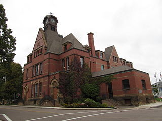
Kensington is a Canadian town located in Prince County, Prince Edward Island. It is 15 km (9.3 mi) northeast of the city of Summerside. In 2021, its population was 1,812.

<span class="mw-page-title-main">Georgetown, Prince Edward Island</span> Place in Prince Edward Island, Canada

Georgetown is a community located within the municipality of Three Rivers in Kings County, Prince Edward Island, Canada. It is the Capital of Kings County. Previously incorporated as a town, it amalgamated with the town of Montague, the rural municipalities of Brudenell, Cardigan, Lorne Valley, Lower Montague, and Valleyfield, and portions of three adjacent unincorporated areas in 2018.

O'Leary is a town located in Prince County, Prince Edward Island. Its population in the 2016 Census was 815 people.

<span class="mw-page-title-main">Miscouche</span> Place in Prince Edward Island, Canada

Miscouche is a municipality that holds community status in Prince Edward Island, Canada. It is located in Prince County.

Miminegash is a rural municipality in Prince Edward Island, Canada. It is located 8 miles (13 km) northwest of Alberton and 11 miles (18 km) southwest of Tignish. It is part of a small area in Lot 3 known as either the St. Louis, Palmer Road, or Miminegash area. This area is often associated with Tignish due to the shared Acadian roots between these areas.

<span class="mw-page-title-main">Morell, Prince Edward Island</span> Rural municipality in Prince Edward Island, Canada

Morell is a rural municipality in Prince Edward Island, Canada. It is located in Kings County east of Bristol.

Mount Stewart is a rural municipality in Prince Edward Island, Canada. It is located in the northeastern part of Queens County, at the head of the once-navigable portion of the Hillsborough River at the point where the river begins to narrow significantly. Mount Stewart had a population of 226 at the time of the 2021 Census.

Murray River is a rural municipality in Prince Edward Island, Canada. It is located in Kings County.

Tyne Valley is a rural municipality in Prince Edward Island, Canada. It is located in Prince County. Incorporated in 1966, the community is located in the township of Lot 13 at the intersection of Routes 12 and 167.

Abram-Village is a rural municipality in Prince County, Prince Edward Island, Canada.

Victoria is a rural municipality in Prince Edward Island, Canada. A historic seaport, the community is situated at the extreme southwestern edge of Queens County in the township of Lot 29.

Meadowbank, previously Meadow Bank, is a former rural municipality in the Canadian province of Prince Edward Island within Queens County.

St. Peters Bay is a municipality that holds community status in Prince Edward Island, Canada. It was incorporated in 1953. St. Peters Bay is well known for its annual Blueberry Festival and Parade, which draws in tourists and locals alike.

Warren Grove is a municipality that holds community status in Prince Edward Island, Canada. It was incorporated in 1985.

References

  1. "Municipal Councils and Contact Information" (PDF). Government of Prince Edward Island. January 27, 2017. Retrieved February 4, 2017.
  2. "From the very start to today". Linkfarm.com. Linkletter Farms Ltd. 2021. Retrieved 2022-10-13. In 1783, John Linkletter's son, George Linkletter and his family made their way to Prince Edward Island, and were given land by the King of England. They settled in Lot 17, which today encompasses several communities including Linkletter and Summerside.
  3. "Linkletter farms". peifa.ca. PEIFA. 2017-09-29. Retrieved 2022-10-13. As time went on the family became heavily involved in farming and by the 1940s they began specializing in potatoes.
  4. "1986 Census: Population - Census Divisions and Census Subdivisions" (PDF). Statistics Canada. September 1987. Retrieved February 2, 2022.
  5. "91 Census: Census Divisions and Census Subdivisions - Population and Dwelling Counts" (PDF). Statistics Canada. April 1992. Retrieved February 2, 2022.
  6. "96 Census: A National Overview - Population and Dwelling Counts" (PDF). Statistics Canada. April 1997. Retrieved February 2, 2022.
  7. "Population and Dwelling Counts, for Canada, Provinces and Territories, and Census Subdivisions (Municipalities), 2001 and 1996 Censuses - 100% Data (Prince Edward Island)". Statistics Canada. August 15, 2012. Retrieved February 2, 2022.
  8. "Population and dwelling counts, for Canada, provinces and territories, and census subdivisions (municipalities), 2006 and 2001 censuses - 100% data (Prince Edward Island)". Statistics Canada. August 20, 2021. Retrieved February 2, 2022.
  9. "Population and dwelling counts, for Canada, provinces and territories, and census subdivisions (municipalities), 2011 and 2006 censuses (Prince Edward Island)". Statistics Canada. July 25, 2021. Retrieved February 2, 2022.
  10. "Population and dwelling counts, for Canada, provinces and territories, and census subdivisions (municipalities), 2016 and 2011 censuses – 100% data (Prince Edward Island)". Statistics Canada. February 8, 2017. Retrieved February 2, 2022.
  11. 1 2 "Population and dwelling counts: Canada, provinces and territories, and census subdivisions (municipalities), Prince Edward Island". Statistics Canada. February 9, 2022. Retrieved March 3, 2022.