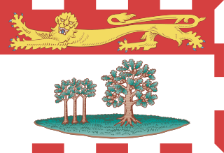
Prince Edward Island (PEI) is a province of Canada and one of the three Maritime provinces. It is the smallest province of Canada in both land area and population, but the most densely populated. Part of the traditional lands of the Miꞌkmaq, it was colonized by the French in 1604 and later ceded to the British following the conclusion of the Seven Years War in 1763. It was federated into Canada as a province in 1873. Its capital is Charlottetown.

The Northumberland Strait is a strait in the southern part of the Gulf of Saint Lawrence in eastern Canada. The strait is formed by Prince Edward Island and the gulf's eastern, southern, and western shores.
The Confederation Bridge is a box girder bridge carrying the Trans-Canada Highway across the Abegweit Passage of the Northumberland Strait, linking the province of Prince Edward Island with the province New Brunswick on the mainland. Opened May 31, 1997, the 12.9-kilometre (8 mi) bridge is Canada's longest bridge and also the world's longest bridge over ice-covered water.

Stratford is a town located in Queens County, Prince Edward Island.
Summerside is a Canadian city in Prince County, Prince Edward Island. It is the second largest city in the province and the primary service centre for the western part of the island.

The Prince Edward Island Railway (PEIR) was a historic Canadian railway in Prince Edward Island (PEI). The railway ran tip-to-tip on the island, from Tignish in the west to Elmira in the east, with major spurs serving Borden-Carleton's train ferry dock, the capital in Charlottetown, Montague and Georgetown and the original eastern terminus at Souris. A major spur from Charlottetown served Murray Harbour on the south coast.

Nepean is a part of Ottawa, Ontario, located west of Ottawa's inner core. It was an independent city until amalgamated with the Regional Municipality of Ottawa–Carleton in 2001 to become the new city of Ottawa. However, the name "Nepean" continues in common usage in reference to the area. The population of Nepean is about 170,544 people.

Cavendish is an unincorporated rural community in the township of Lot 23, Queens County, Prince Edward Island, Canada.

Montague is a former town located within the town of Three Rivers in Kings County, Prince Edward Island, Canada. It amalgamated with the town of Georgetown, the rural municipalities of Brudenell, Cardigan, Lorne Valley, Lower Montague, and Valleyfield, and portions of three adjacent unincorporated areas in 2018.

Borden-Carleton is a town in Prince County the Canadian province of Prince Edward Island. It is situated on the south shore fronting on the Northumberland Strait. The town was originally incorporated as a community on April 12, 1995, through the amalgamation of the town of Borden and the community of Carleton. The town of Borden opted to demote its status to a community in light of a declining tax base with the pending completion of the Confederation Bridge and the closure of the Marine Atlantic ferry service. Borden-Carleton became a town on July 31, 2012.

Prince County is located in western Prince Edward Island, Canada. The county's defining geographic feature is Malpeque Bay, a sub-basin of the Gulf of St. Lawrence, which creates the narrowest portion of Prince Edward Island's landmass, an isthmus upon which the city of Summerside is located.

Georgetown is a town located within the municipality of Three Rivers in Kings County, Prince Edward Island, Canada. It is the Capital of Kings County. In 2018 it amalgamated with the town of Montague, the rural municipalities of Brudenell, Cardigan, Lorne Valley, Lower Montague, and Valleyfield, and portions of three adjacent unincorporated areas.
Breadalbane is a municipality that holds community status in Prince Edward Island, Canada. Located in Queens County, Prince Edward Island, its population as of 2011 is 173.
Murray River is a municipality that holds community status in Prince Edward Island, Canada. It is located in Kings County.

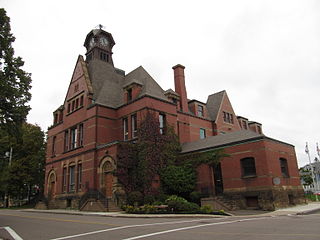
Charlottetown is the capital and largest city of the Canadian province of Prince Edward Island, and the county seat of Queens County. Named after Charlotte of Mecklenburg-Strelitz, queen consort of King George III of the United Kingdom, Charlottetown was an unincorporated town until it was incorporated as a city in 1855.
Bedeque is a former municipality that previously held community status in the Canadian province of Prince Edward Island. It was dissolved through its amalgamation with the Community of Central Bedeque on November 17, 2014 to create the Community of Bedeque and Area.

Kinkora Regional High School, is a Canadian secondary school in Kinkora, Prince Edward Island. It was the first rural high school in PEI. The school draws students from the communities of Borden-Carleton, Bedeque, Emerald, Middleton, and Kinkora.
Bedeque and Area is a municipality that holds community status in Prince Edward Island, Canada. It was formed through the amalgamation of the communities of Bedeque and Central Bedeque on November 17, 2014. It had a population of 310 in 2011.
