Clyde River, Prince Edward Island

Last updated
Clyde River
Clyde River in June 15.png
Clyde River
Canada Prince Edward Island location map 2.svg
Red pog.svg
Clyde River in Prince Edward Island
Coordinates: 46°13′26″N63°15′18″W / 46.224°N 63.255°W / 46.224; -63.255 Coordinates: 46°13′26″N63°15′18″W / 46.224°N 63.255°W / 46.224; -63.255
CountryCanada
Province Prince Edward Island
County Queens County
Time zone AST
  Summer (DST) ADT
Area code(s) 902

Clyde River is a rural municipality in Prince Edward Island, Canada. [1] Clyde River is located in Queens County in the central part of Prince Edward Island and just 15 minutes away from Charlottetown. The original community name was Dog River (changed to Clyde River sometime around 1864). It was named after the River Clyde in Scotland. Heritage is predominantly Scottish and English.

Contents

Demographics

Federal census population history of Clyde River
YearPop.±%
1981490    
1986523+6.7%
1991 554+5.9%
1996 601+8.5%
2001 581−3.3%
2006 618+6.4%
2011 576−6.8%
2016 653+13.4%
2021     
Source: Statistics Canada
[2] [3] [4] [5] [6] [7] [8]

Clyde River had a population of 653 in 2016. [8]

Attractions

Clyde River Presbyterian Church

The land for the church was purchased in 1856 by Angus MacFadyen with the construction of the church starting shortly after. The church was first opened by Rev. James Allen. In 1870 the congregation experienced remarkable growth with in the church therefore a section was added onto the church to sit the growing congregation. In the early days of the church Burnside Presbyterian was a part of the New London congregation. Over the years the church has been a part of the Queen's Square congregation, West River and Brookfield congregation. Then in 1938 Nine Mile Creek, Canoe Cove and Churchill united with Clyde River to form the Central Parish charge. In 2009 the Central Parish consists of Clyde River and Canoe Cove with Churchill being a memorial church in the parish. Today there is worship service every Sunday at 11:00 am and Sunday School for children. [9]

Stone House

The Stone House was built from Island sandstone in 1842, located adjacent to the Trans Canada High Way in Clyde River, PEI. In 1843, the property was purchased by Ambrose Lane and the house was used as hunting lodge. After the passing of the owner in 1853, the house had various owners. In the 1970s the house was purchase by the Atwell family. Now the Stone House is referred to as the Atwell House. The house is one of eight remaining sandstone homes that were constructed in the 1800s. The house is unique because if the 21 inch cavity walls, the size and placement of the windows and doors, the Island sandstone construction, the interior arrangement of rooms and the dormer of the front elevation. Today the Wood family resides in the Stone House. [10]

Clyde River Golf and Country Club

Clyde River Golf and Country Club is a premier 18 hole golf course that is located 10 minutes west of Prince Edward Island's capital Charlottetown. The golf course was designed by O. MacEachern and has been opened since 1991. The course features the Clyde River and both parkland and woodland styles between the front and back nine. The golf and country club will give a memorable experience because of the excellent golf, amazing staff and great food. [11]

Burnside Community Care

The Burnside Community Care Facility opened in fall of 2018. Burnside Community Care is owned and managed by Alan Macphee. The Facility houses 38 residents and residents can choose between having a single, shared, or apartment style living. The team at Burnside is led by registered nurses, care workers and kitchen staff. The workers ensure a country home experience for their residents so that they can stay connected to their community and enjoy the benefits of being kept up to date on local news and events. The team considers it to be an honour to be employed at Burnside Community Care as it gives them the opportunity to giveback to the community and to its elders. [12]

Clyde River Pioneer Cemetery

The cemetery is located on the bank of the Clyde River approximately half of a kilometre from the Clyde River Road. The cemetery is respected because of its historical association with the early Scottish pioneers to the surrounding area and for the association of the history to the Baptist faith. The site is enclosed by a fence and trees. To date there is approximately 19 gravestones that are on the site. The families laid to rest at the Cemetery include: Harvey, Henderson, Livingston, Maclean, Murray and Wares. The first burial took place in 1842 and the last took place in 1908. The community of Clyde River has worked hard to maintain the up keeping of the site. In 1995 a sign was installed indicating the cemetery. [13]

Livingston House

The Livingston House was built on the Clyde River Road in 1840. Until the mid 1900s the house was home to three generations. At the time the house had eight bedroom. In 1999 Wanda Livingston and her husband Eric MacPhail undertook significant renovations to the house earning them the PEI Museum and Heritage Foundation awards in 1999. Today the Nelson family owns the house and they have done renovations to make their home modern while preserving its original special features. [14]

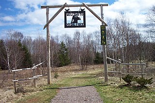
Murchison Place Park

In June 2007 the Murchison Place was opened as beautiful sun-safe community playground and park. The park is located on the corner of the Clyde River Road and Trans Canada Highway. The land was donated to the community from the family of Dr. and Mrs. A.J. Murchison. To restore the land a 2-year plan was put into place to haul away broken trees, remnants of old building to landscape the property. To make the park a safe environment for children a fence was built around the perimeter of the property. Green spaces of the park got planned in to trees, shrubs and perennials. Students in the community built a gazebo, deck, bird houses and picnic tables for the park. Community volunteers in the community helped build a 700 feet wooden walking trail. The trial around the park and the ramp to the gazebo ensure that the park is wheelchair accessible. After the park was officially open work sill continued with the construction of a play park, tree house, adult swings and a basketball court. The community works together to maintain the park as there is annually spring and fall cleans up. Today many events are held in the Park such as Sunday school classes, family picnics, community socials, art and music shows which offers something for all ages in the community. [15]

Clyde River Baptist Church

The Baptist Church is Clyde River was built on a piece of land purchased from John Murray on the Clyde River Road. The church first opened on January 22, 1893 and still worships every Sunday at 10:00 am. [16]

Riverview Community Centre

The Riverview Community used to be the school house in Clyde River. Now the building acts as Clyde River's community centre. The building was maintained and owned by the Clyde River Women's Institute for many years but is now under the ownership of the Community of Clyde River. The centre is used to host Women's Institute meetings and functions, community social gatherings and Council meetings. [17]

Related Research Articles

Cornwall, Prince Edward Island Town in Prince Edward Island, Canada

Cornwall is a Canadian town located in Queens County, Prince Edward Island.

North Rustico Town in Prince Edward Island, Canada

North Rustico is a Canadian town located in Queens County, Prince Edward Island.

Alberton, Prince Edward Island Town in Prince Edward Island, Canada

Alberton is a Canadian town located in Prince County, Prince Edward Island. It is situated in the western part of the county in the township of Lot 5.

Georgetown, Prince Edward Island Place in Prince Edward Island, Canada

Georgetown is a community located within the municipality of Three Rivers in Kings County, Prince Edward Island, Canada. It is the Capital of Kings County. Previously incorporated as a town, it amalgamated with the town of Montague, the rural municipalities of Brudenell, Cardigan, Lorne Valley, Lower Montague, and Valleyfield, and portions of three adjacent unincorporated areas in 2018.

Miscouche Place in Prince Edward Island, Canada

Miscouche is a municipality that holds community status in Prince Edward Island, Canada. It is located in Prince County.

Murray Harbour, Prince Edward Island Community in Prince Edward Island, Canada

Murray Harbour is a community that holds rural municipality status in Prince Edward Island, Canada. It is located in southeastern Kings County.

Hunter River, Prince Edward Island Community in Prince Edward Island, Canada

Hunter River is a municipality that holds community status in Prince Edward Island, Canada. It is located in Queens County southwest of North Rustico. It is situated on the Hunter River.

Morell, Prince Edward Island Rural municipality in Prince Edward Island, Canada

Morell is a rural municipality in Prince Edward Island, Canada. It is located in Kings County east of Bristol.

Mount Stewart, Prince Edward Island Rural municipality in Prince Edward Island, Canada

Mount Stewart is a rural municipality in Prince Edward Island, Canada. It is located in the northeastern part of Queens County, at the head of the once-navigable portion of the Hillsborough River at the point where the river begins to narrow significantly. Mount Stewart had a population of 209 at the time of the 2016 Census.

Murray River, Prince Edward Island Rural municipality in Prince Edward Island, Canada

Murray River is a rural municipality in Prince Edward Island, Canada. It is located in Kings County.

Tyne Valley, Prince Edward Island Rural municipality in Prince Edward Island, Canada

Tyne Valley' is a rural municipality in Prince Edward Island, Canada. It is located in Prince County. Incorporated in 1966, the community is located in the township of Lot 13 at the intersection of Routes 12 and 167.

Abram-Village Rural municipality in Prince Edward Island, Canada

Abram-Village is a rural municipality in Prince County, Prince Edward Island, Canada.

Cardigan, Prince Edward Island Place in Prince Edward Island, Canada

Cardigan, Prince Edward Island was a municipality that held community status in Prince Edward Island, Canada. It was a fishing community in eastern Kings County.

Linkletter, Prince Edward Island Rural municipality in Prince Edward Island, Canada

Linkletter is a rural municipality in Prince Edward Island, Canada. It is located in Prince County.

Sherbrooke, Prince Edward Island Rural municipality in Prince Edward Island, Canada

Sherbrooke is a rural municipality in Prince Edward Island, Canada.

Meadowbank, Prince Edward Island Former rural municipality in Prince Edward Island, Canada

Meadowbank, previously Meadow Bank, is a former rural municipality in the Canadian province of Prince Edward Island within Queens County.

Resort Municipality, Prince Edward Island Resort municipality in Prince Edward Island, Canada

Resort Municipality, officially named the Resort Municipality of Stanley Bridge, Hope River, Bayview, Cavendish and North Rustico, is the lone municipality in Prince Edward Island, Canada that holds resort municipality status. It was established in 1990.

Miltonvale Park Community in Prince Edward Island, Canada

Miltonvale Park is a municipality that holds community status in Prince Edward Island, Canada. It was incorporated in 1974.

Warren Grove Community in Prince Edward Island, Canada

Warren Grove is a municipality that holds community status in Prince Edward Island, Canada. It was incorporated in 1985.

Winsloe South Place in Prince Edward Island, Canada

Winsloe South is a former municipality in Prince Edward Island, Canada that held community status between 1986 and 2017. It amalgamated with Brackley on December 15, 2017.

References

  1. "Municipal Councils and Contact Information" (PDF). Government of Prince Edward Island. January 27, 2017. Archived from the original (PDF) on December 29, 2016. Retrieved February 4, 2017.
  2. "1986 Census: Population - Census Divisions and Census Subdivisions" (PDF). Statistics Canada. September 1987. Retrieved February 2, 2022.
  3. "91 Census: Census Divisions and Census Subdivisions - Population and Dwelling Counts" (PDF). Statistics Canada. April 1992. Retrieved February 2, 2022.
  4. "96 Census: A National Overview - Population and Dwelling Counts" (PDF). Statistics Canada. April 1997. Retrieved February 2, 2022.
  5. "Population and Dwelling Counts, for Canada, Provinces and Territories, and Census Subdivisions (Municipalities), 2001 and 1996 Censuses - 100% Data (Prince Edward Island)". Statistics Canada. August 15, 2012. Retrieved February 2, 2022.
  6. "Population and dwelling counts, for Canada, provinces and territories, and census subdivisions (municipalities), 2006 and 2001 censuses - 100% data (Prince Edward Island)". Statistics Canada. August 20, 2021. Retrieved February 2, 2022.
  7. "Population and dwelling counts, for Canada, provinces and territories, and census subdivisions (municipalities), 2011 and 2006 censuses (Prince Edward Island)". Statistics Canada. July 25, 2021. Retrieved February 2, 2022.
  8. 1 2 "Population and dwelling counts, for Canada, provinces and territories, and census subdivisions (municipalities), 2016 and 2011 censuses – 100% data (Prince Edward Island)". Statistics Canada. February 8, 2017. Retrieved February 2, 2022.
  9. "CENTRAL PARISH PRESBYTERIAN PASTORAL CHARGE". www.centralparish.com. Retrieved 2017-11-29.
  10. Canada, Province of Prince Edward Island. "www.gov.pe.ca/hpo/app.php?nav=details&p=2929". www.gov.pe.ca. Retrieved 2017-11-29.
  11. "Clyde River Golf Club – Clyde River, PE". www.clyderivergolf.ca. Retrieved 2017-11-29.
  12. "About Us". 2013-10-27. Retrieved 2017-11-29.
  13. "HistoricPlaces.ca - HistoricPlaces.ca". www.historicplaces.ca. Retrieved 2017-11-29.
  14. "Livingston House, Clyde River, c.1840". peiheritagebuildings.blogspot.ca. Retrieved 2017-11-29.
  15. "The History and Stories of Clyde River" (PDF).
  16. "The History and Stories of Clyde River" (PDF).
  17. "Clyde River". Clyde River. Retrieved 2017-11-29.

Official website