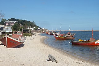
Castellanos | |
---|---|
Populated centre | |
Coordinates: 34°22′40″S55°57′25″W / 34.37778°S 55.95694°W Coordinates: 34°22′40″S55°57′25″W / 34.37778°S 55.95694°W | |
Country | |
Department | Canelones Department |
Population (2004) | |
• Total | 520 |
Time zone | UTC -3 |
Postal code | 90603 |
Dial plan | +598 4313 (+4 digits) |
Castellanos is a populated centre in the Canelones Department of southern Uruguay.
The Departamento de Canelones , with an area of 4,536 km2 (1,751 sq mi) and 518,154 inhabitants, is located in the south of Uruguay. Its capital is Canelones.
Uruguay, officially the Oriental Republic of Uruguay, is a country in the southeastern region of South America. It borders Argentina to its west and Brazil to its north and east, with the Río de la Plata to the south and the Atlantic Ocean to the southeast. Uruguay is home to an estimated 3.44 million people, of whom 1.8 million live in the metropolitan area of its capital and largest city, Montevideo. With an area of approximately 176,000 square kilometers (68,000 sq mi), Uruguay is geographically the second-smallest nation in South America, after Suriname.
It is located on the intersection of Route 6 with Route 65, about 9 kilometres (5.6 mi) south of San Ramón.
Route 6 is a national route of Uruguay. In 1981, it was assigned the name Joaquín Suárez. It connects Montevideo with the northeast of Rivera Department, at Vichadero, with an extension reaching the border with Brazil. The road is approximately 428 kilometres long till Vichadero.
San Ramón is a small city in the north of Canelones Department, in southern Uruguay.
In 2011 Castellanos had a population of 520. [1]
Year | Population |
---|---|
1963 | 300 |
1975 | 418 |
1985 | 447 |
1996 | 509 |
2004 | 579 |
2011 | 520 |
Source: Instituto Nacional de Estadística de Uruguay [2]
City Golf is a village and resort in the Canelones Department of southern Uruguay.
Colinas de Solymar is a small town and northern suburb of Ciudad de la Costa in the Canelones Department of southern Uruguay.
Empalme Olmos is a village in the Canelones Department of southern Uruguay.
Estación Atlántida is a northern suburb of the city Atlántida in the Canelones Department of southern Uruguay.
Estanque de Pando is a northern suburb of Pando in the Canelones Department of southern Uruguay.
Jardines de Pando is a suburb of the city of Pando in the Canelones Department of southern Uruguay.
Marindia is a resort of the Costa de Oro in the Canelones Department of southern Uruguay.
Neptunia is a resort town of the Costa de Oro in the Canelones Department of southern Uruguay.
Montes is a village in the east of Canelones Department of southern Uruguay.
San Antonio is a village in the Canelones Department of southern Uruguay.
San Bautista is a small city in the Canelones Department of southern Uruguay.
Seis Hermanos is a hamlet (caserío) in the Canelones Department of southern Uruguay.
Totoral del Sauce is a village or populated centre in the Canelones Department of southern Uruguay.
Villa Aeroparque is a small town or urban fragment (fraccionamiento) in the Canelones Department of southern Uruguay.
Villa Crespo y San Andrés is a small town or populated centre in the Canelones Department of southern Uruguay. Together with its neighbouring Toledo, they form a population centre of about 13,800. They are both part of the wider metropitan area of Montevideo.
Villa El Tato is an urban fragment (fraccionamiento) in the Canelones Department of southern Uruguay. It is part of the wider metropolitan area of Montevideo.
Villa Felicidad is a hamlet (caserío) in the Canelones Department of southern Uruguay.
Villa San José is a hamlet (caserío) in the Canelones Department of southern Uruguay.
Olmos is a populated centre in the Canelones Department of southern Uruguay.
Villa Porvenir is a caserio in the Canelones Department of Uruguay.
This article about a place in Canelones Department is a stub. You can help Wikipedia by expanding it. |