El Pinar, Uruguay

Last updated
El Pinar
El Pinar 01.jpg
East end of El Pinar at Arroyo Pando.
Ciudad de la Costa El Pinar.jpg
Location of El Pinar in Ciudad de la Costa
Coordinates: 34°47′50″S55°54′35″W / 34.79722°S 55.90972°W / -34.79722; -55.90972 Coordinates: 34°47′50″S55°54′35″W / 34.79722°S 55.90972°W / -34.79722; -55.90972
Country Flag of Uruguay.svg Uruguay
Department Canelones Department
Population
 (2011)
  Total21,091
Time zone UTC -3
Postal code
15800
Dial plan +598 2698 (+4 digits)

El Pinar is a seaside resort of the Canelones Department, Uruguay. In 1994, when Ciudad de la Costa took on the status of a city, El Pinar was incorporated in it.

Contents

Geography

El Pinar is the easternmost locality of Ciudad de la Costa, after which starts the group of resorts known as Costa de Oro. Its south limit is the coastline of the Río de la Plata and it shares borders with Lomas de Solymar to the west, with Neptunia to the east, with the stream Arroyo Pando separating the two, and with Country Villa Juana to the north.

Places of worship

Population

In 2011 El Pinar had a population of 21,091. [1] [2]

YearPopulation
1963394
19751,874
19853,479
199610,383
200417,221
201121,091

Source: Instituto Nacional de Estadística de Uruguay [3]

Street map

Street map of El Pinar Map of El Pinar.png
Street map of El Pinar

Related Research Articles

Cuchilla Alta is a seaside resort of the Costa de Oro, in Canelones Department of Uruguay, Montevideo.

<span class="mw-page-title-main">Shangrilá</span> Resort of Ciudad de la Costa in Canelones Department, Uruguay

Shangrilá is a coastal resort or residential neighbourhood of the Ciudad de la Costa in the Canelones Department of Uruguay.

<span class="mw-page-title-main">Ciudad de la Costa</span> City and Municipality in Canelones, Uruguay

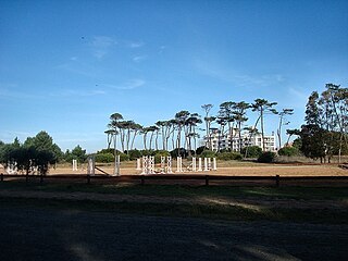
Ciudad de la Costa is a city in Canelones Department of Uruguay, on the banks of the Río de la Plata between the streams Arroyo Carrasco and Arroyo Pando. It is considered an extension of the metropolitan area of Montevideo which it borders to the west, while to the east it borders Costa de Oro. It was declared a city on 19 October 1994 and given its current name. At the 2011 census, it was the second most populated city of Uruguay between Montevideo and Salto.

<span class="mw-page-title-main">Solymar, Uruguay</span> Resort of Ciudad de la Costa in Canelones Department, Uruguay

Solymar is a coastal resort or residential neighbourhood of the Ciudad de la Costa in the Canelones Department of Uruguay. Its name is a contraction of the words "Sun and Sea".

<span class="mw-page-title-main">Colinas de Solymar</span> Resort of Ciudad de la Costa in Canelones Department, Uruguay

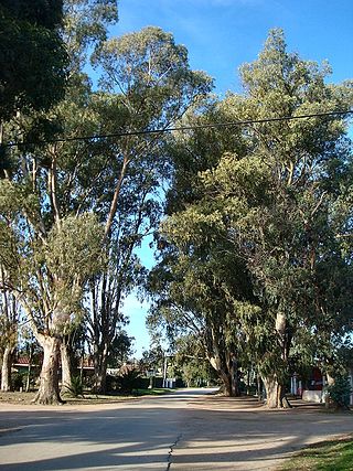
Colinas de Solymar is a small town and northern suburb of Ciudad de la Costa in the Canelones Department of southern Uruguay.

General Seregni is a town in the Canelones Department of southern Uruguay.

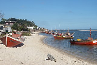
Costa Azul is a village and resort of the Costa de Oro in the Canelones Department of southern Uruguay.

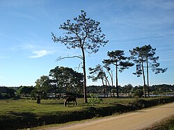
Las Toscas is a resort of the Costa de Oro in the Canelones Department of southern Uruguay.

Marindia is a resort of the Costa de Oro in the Canelones Department of southern Uruguay.

<span class="mw-page-title-main">Neptunia, Uruguay</span> Resort of the Costa de Oro in Canelones Department, Uruguay

Neptunia is a resort town of the Costa de Oro in the Canelones Department of southern Uruguay.

<span class="mw-page-title-main">Salinas, Uruguay</span> City & Municipality in Canelones, Uruguay

Salinas is a city and resort of the Costa de Oro in the Canelones Department of southern Uruguay.

<span class="mw-page-title-main">Villa Argentina</span> Resort of the Costa de Oro in Canelones Department, Uruguay

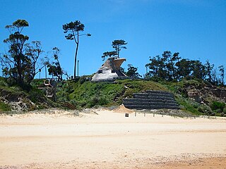
Villa Argentina is a resort (balneario) of the Costa de Oro in the Canelones Department of southern Uruguay. The famous eagle-shaped house overlooking the Río de la Plata, which is attributed to Atlántida, is in fact located in this resort.

Villa El Tato is an urban fragment (fraccionamiento) in the Canelones Department of southern Uruguay. It is part of the wider metropolitan area of Montevideo.

<span class="mw-page-title-main">Parque Carrasco</span> Resort of Ciudad de la Costa in Canelones Department, Uruguay

Parque Carrasco is a residential neighbourhood and resort of Ciudad de la Costa in Canelones, Uruguay.

<span class="mw-page-title-main">Lomas de Solymar</span> Resort of Ciudad de la Costa in Canelones Department, Uruguay

Lomas de Solymar, which also contains the area Médanos de Solymar, is a residential neighbourhood and a resort of Ciudad de la Costa in Canelones, Uruguay.

<span class="mw-page-title-main">Lagomar</span> Resort of Ciudad de la Costa in Canelones Department, Uruguay

Lagomar is a residential neighbourhood and resort of Ciudad de la Costa in Canelones, Uruguay.

<span class="mw-page-title-main">San José de Carrasco</span> Resort of Ciudad de la Costa in Canelones Department, Uruguay

San José de Carrasco is a residential neighbourhood and resort of Ciudad de la Costa in Canelones, Uruguay.

<span class="mw-page-title-main">Barra de Carrasco</span> Resort of Ciudad de la Costa in Canelones Department, Uruguay

Barra de Carrasco is a residential neighbourhood and resort of Ciudad de la Costa in Canelones, Uruguay. Its name means "mouth of the Carrasco Creek".

<span class="mw-page-title-main">El Bosque, Uruguay</span> Resort of Ciudad de la Costa in Canelones Department, Uruguay

El Bosque is a small neighbourhood of Ciudad de la Costa in the Canelones Department of southern Uruguay.

Paso de Carrasco or Paso Carrasco is a city in the Canelones Department of Uruguay.

References

  1. "Censos 2011 Cuadros Canelones". INE. 2012. Archived from the original (XLS) on 10 October 2012. Retrieved 25 August 2012.
  2. "Censos 2011 Canelones (flash plugin needed)". INE. 2012. Archived from the original on 7 September 2012. Retrieved 25 August 2012.
  3. "1963–1996 Statistics / E" (DOC). Instituto Nacional de Estadística de Uruguay. 2004. Retrieved 29 June 2011.