Empalme Olmos

Last updated
Empalme Olmos
Village
Estacion Sudriers Empalme Olmos.jpg
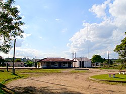
Train station at Empalme Olmos
Uruguay location map.svg
Red pog.svg
Empalme Olmos
Location in Uruguay
Coordinates: 34°42′0″S55°54′0″W / 34.70000°S 55.90000°W / -34.70000; -55.90000
CountryFlag of Uruguay.svg  Uruguay
Department Canelones Department
Population
 (2011)
  Total
4,199
Time zone UTC -3
Postal code
91002
Dial plan +598 2 (+7 digits)

Empalme Olmos is a village in the Canelones Department of southern Uruguay.

Contents

Empalme Olmos is also the name of the municipality to which the town belongs.

Geography

Location

The village is located at the junction of Route 8 with Routes 82 and 34, about 6 kilometres (3.7 mi) northeast of the city of Pando.

History

Its status was elevated to "Pueblo" (village) on 3 November 1952 by the Act of Ley Nº 11.877. [1]

Population

In 2011 Empalme Olmos had a population of 4,199. [2] In 2010, the Intendencia de Canelones had recorded a population of 5,497 for the municipality during the elections. [3]

Location map of the Municipality of Empalme Olmos MunCanEOlmos.svg
Location map of the Municipality of Empalme Olmos
YearPopulation
19631,973
19752,108
19853,144
19963,815
20043,978
20114,199

Source: Instituto Nacional de Estadística de Uruguay [4]

Places of worship

References

  1. "LEY N° 11.877". República Oriental del Uruguay, Poder Legislativo. 1952. Archived from the original on 4 March 2016. Retrieved 7 September 2012.
  2. "Censos 2011 Cuadros Canelones". INE. 2012. Archived from the original on 10 October 2012. Retrieved 25 August 2012.
  3. "Elecciones - Canelones". El Observador. Archived from the original on 12 March 2012. Retrieved 2 February 2012.
  4. "Statistics of urban localities (1963–2004)" (PDF). INE. 2012. Archived from the original (PDF) on 13 November 2009. Retrieved 7 September 2012.

Images

Plaza 30 de noviembre near the train station at Empalme Olmos. Plaza in Empalme Olmos.jpg
Plaza 30 de noviembre near the train station at Empalme Olmos.