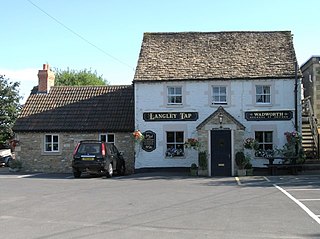
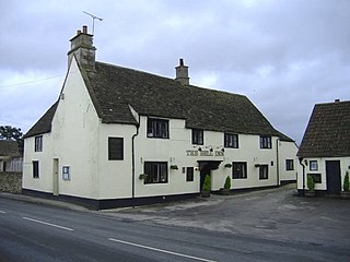
The village is in two parts: one is in the narrow valley of By Brook, while Upper Castle Combe is on higher land to the east, on the B4039 road connecting Chippenham and Chipping Sodbury. No new houses have been built in the historic area since about 1600.[2] South of the upper village is the Castle Combe motor racing circuit.
History
A Roman villa once stood about three miles from the village, indicating Roman occupation of the area. The site has been excavated on at least three occasions, the first by Scrope in 1852 and the most recent in 2010. Some reports refer to the site as the North Wraxall or the Truckle Hill villa. Evidence of a bath house and corn drying ovens were found, the latter from the 4th century.[3] The villa itself apparently contained 16 rooms, and there were additional buildings and a cemetery.[4] Neolithic flint tools and Iron Age brooches were also discovered not far from the villa, in 1985.[5]
The settlement was listed in the Domesday Book of 1086, with 33 households; the Lord was Honfroi de Insula de lLIsle.[6] Castle Combe, Wiltshire prior to 1066 was a tiny hamlet. When Honfroi de Insula de L’ile was given vast grants of land, and was named Dominus with the duty to keep the peace in the region, he was also given permission to build a castle to preserve the peace. He built a Motte and Bailey Castle which was replaced by a stone one when his eldest daughter Adeliza Adelina Alicia de Insula de Lisle married Reginald de Dunstanville.Under the rules of Primogeniture, at Honfroi’s death his vast land holdings went to his eldest daughter because he had no sons.[7]
The village takes its name from the 12th-century castle which stood about 1⁄3 mile (500m) to the north. The site where the castle once stood now only contains the old earthworks and masonry, which are estimated to date from the 12th century. It is believed that the castle was constructed as the seat of the Barony of Combe under Reginald de Dunstanville either during the reign of Henry I or his son. Reginald was thought to support Empress Matilda during the Anarchy, and the castle was constructed during the wave of castle buildings of the Anarchy period.[8]
The 14th-century market cross, erected when the privilege to hold a weekly market in Castle Combe was granted, stands where the three principal streets of the lower village converge.[9] The Market Cross, a scheduled monument, reflects "the significance of the cloth industry in this area".[10] Next to the cross is one of Castle Combe's two village pumps.[11] Small stone steps near the cross were for horse riders to mount and dismount, and close by are the remains of the buttercross, built in the late 19th century from old masonry.[12] This structure, also known as Weavers' Steps and 'the stone', is another scheduled monument.[10]
During the 14th century, the seat of the Barony was transferred to the Manor House within Castle Combe village and a deer park was created next to the castle.[8] The market town prospered during the 15th century when it belonged to Millicent, the wife of Sir Stephen Le Scrope and then of Sir John Fastolf (1380–1459), a Norfolk knight who was the effective lord of the manor for fifty years. By 1340, the village had a fulling mill,[13] confirming the importance of wool by that time. Scrope promoted the woollen industry, supplying his own troops and others for Henry V's war in France. The parish was in the ancient hundred of Chippenham.[14][15]
By the 17th century, John Aubrey stated that a market was held on the site of the old castle.[8] At some time in the late 1700s, the level of the Bybrook River fell, so it could no longer be used to power mills. The cloth industry began leaving the area during that century; "industrial prosperity was over and the population decreased".[16] Notable houses include the Dower House, from the late 17th century is now Grade II listed.[17]
The village was owned by the Scrope family for over five centuries, until 1866 when it was sold to the Gorst family and Edward Chaddock Lowndes (who was previously also known as Gorst). The latter spent a great deal of money on improving the manor house and the estate.[16]
A National School was built in 1826, on a site between the upper and lower villages. The school was taken over by the county council in 1909, and educated children of all ages until 1956 when older pupils were transferred to secondary schools in Chippenham. It closed in 1998 on the opening of a new primary school at Yatton Keynell.[18]
During the Second World War, the RAF Castle Combe airfield was built east of the village, with runways, hangars and a control tower. Between 1946 and 1948 the airfield buildings were used as temporary housing for former military from Poland. The property was sold in 1948,[19] and was later modified for motor racing; the tower is still used during races at Castle Combe Circuit. Also during the war, the Manor was used as a hospital;[16] some time after the war, the manor was converted to a hotel and continues in this use.[20][21]
For decades the village had a number of gristmills and sawmills but all went out of business; Nettleton Mill closed before 1916 and Gatcombe Mill closed circa 1925; both are Grade II listed. The Long Dean Mill shut down in 1956; the Lower mill is now Grade II listed; Colham Mill was demolished in 1962. The last remaining stone tower of the castle stood for centuries, but it too was demolished, in 1950.[16][22]
Listed buildings
Castle Combe parish has 107 listed buildings; nearly all are in the Grade II category.[23]
The Church of England parish church of St Andrew is a Grade I listed building.[24] Part of the chancel is 13th-century; in 1850–51 nearly all of the building, except the 15th-century tower, was taken down and reconstructed to the same plan.[25]
Congregational Church
The first chapel was built in 1757 and extended with a schoolroom in 1846.[26] The current church, opened in 1914, is in the upper part of the village on what is now the B4039 road. The building is a former malt house and is attached to an 18th-century house which became the manse.[27] The church continues in use.[28]
The village was a location for the 1967 film musical Doctor Dolittle.[30] Its frequently rainy summer climate frustrated production, as did attempted sabotage – including by British Army officer (and future explorer) Sir Ranulph Fiennes - because of residents' irritation at the producers' modifications of the area for shooting.[31][32] Other productions include "The Murder of Roger Ackroyd", an episode of Agatha Christie's Poirot, and the films Stardust[33] and The Wolfman. Throughout September 2010, the village was a filming location for Steven Spielberg's production of War Horse.[34]
Raymond Austin set the action of his book Find me a Spy, Catch me a Traitor in the village and at the Manor. The house of Alice Cartalet in the manga and anime series Kiniro Mosaic was based on Fosse Farmhouse, a guesthouse near Castle Combe.[35]
Castle Combe has a car park at the top of the hill, and toilet facilities over the bridge at the bottom of the village. A small museum closed in 2012.[37]
The Manor House was built in the 17th century and rebuilt in the 19th.[38] It has 48 rooms and 365 acres (148ha) of gardens. During World War II, the New Zealand Forestry Officers had the Manor House as their headquarters. In 1947, the owner of the Castle Combe estate sold the houses of the estate and the Manor House became a country club. After 18 months, the club left the premises, and the house was shortly thereafter sold to Bobbie Allen, an amateur hotelier, and her husband. Mrs Allen wrote a book of her experiences, From Claridge's to Castle Combe.[39] The manor house and estate were sold in 1947.[16] The property was owned by the Allen family for some time,[when?] and they sold the Manor House to Mr and Mrs Oliver Clegg[40] who (some time after 1976) sold it to the corporation which now owns the property. By the time it was listed as a Grade II property in 1960, it was already operating as a hotel.[38]
The 5-star Manor House Hotel is in the west end of the village and features 21 rooms, including a suite and 29 cottages. In addition to the golf course (which opened in 1992), the grounds include "a glorious Italianate garden" and the River Bybrook.[41]
Related Research Articles
Lacock is a village and civil parish in the county of Wiltshire, England, about 3 miles (5 km) south of the town of Chippenham, and about 3.7 miles (6.0 km) outside the Cotswolds area. The village is owned almost in its entirety by the National Trust and attracts many visitors by virtue of its unspoiled appearance.
Mere is a market town and civil parish in Wiltshire, England. It lies at the extreme southwestern tip of Salisbury Plain, close to the borders of Somerset and Dorset. The parish includes the hamlets of Barrow Street, Burton, Charnage, Limpers Hill, Rook Street and Southbrook.
Hambleden is a small village and civil parish in south-west Buckinghamshire, England. The village is around 4 miles (6.4 km) west of Marlow, and around 3 miles (4.8 km) north-east of Henley-on-Thames in Oxfordshire.
Box is a large village and civil parish within the Cotswolds Area of Outstanding Natural Beauty in Wiltshire, England, about 3 miles (5 km) west of Corsham and 5 miles (8 km) northeast of Bath. Box also falls in the easternmost part of the Avon Green Belt. Besides the village of Box, the parish includes the villages of Ashley and Box Hill; Hazelbury manor; and the hamlets of Alcombe, Blue Vein, Chapel Plaister, Ditteridge, Henley, Kingsdown, Middlehill, and Wadswick. To the east the parish includes much of Rudloe, formerly a hamlet but now a housing estate, and the defence establishments and related businesses on the site of the former RAF Rudloe Manor.
Biddestone is a village and former civil parish, now in the parish of Biddestone and Slaughterford, in the Wiltshire district, in northwest Wiltshire, England, about 3 miles (5 km) west of Chippenham and 2 miles (3.2 km) north of Corsham. The parish includes the smaller settlement of Slaughterford.
Wylye is a village and civil parish on the River Wylye in Wiltshire, England. The village is about 9+1⁄2 miles (15 km) northwest of Salisbury and a similar distance southeast of Warminster.
Bremhill is a village and civil parish in Wiltshire, England. The village is about 1.6 miles (2.6 km) northwest of Calne and 4 miles (6.4 km) east of Chippenham. The name originates from 'Bramble hill'.
Leigh Delamere is a small village in the civil parish of Grittleton in the English county of Wiltshire, about 4 miles (6 km) northwest of the town of Chippenham. The M4 motorway passes some 250 metres to the south, and the motorway's Leigh Delamere services lie to the east of the village.
Langley Burrell is a village in the civil parish of Langley Burrell Without, just north of Chippenham, Wiltshire, England. It is the largest settlement in the parish, which includes the hamlets of Peckingell and Kellaways.
Sutton Benger is a village and civil parish in the county of Wiltshire, England, 5 miles (8.0 km) northeast of the town of Chippenham. The parish includes the hamlet of Draycot Cerne.
Slaughterford is a small village in the civil parish of Biddestone and Slaughterford, about 5 miles (8 km) west of Chippenham, in Wiltshire, England. The village has a crossing point of the Bybrook River, and lies in a wooded valley between Castle Combe and Box. Anciently it was a separate parish.
Keevil is a village and civil parish in Wiltshire, England, about 4 miles (6 km) east of the centre of Trowbridge and a similar distance south of Melksham. The village lies on a slope between Great Hinton and Bulkington. Semington Brook forms much of the northeast boundary of the parish.
Studley is a small village in the county of Wiltshire, England, belonging to the civil parish of Calne Without.
Stanton St Quintin is a small village and civil parish in the county of Wiltshire in England. It is about 4 miles (6.4 km) north of Chippenham and 5 miles (8.0 km) south of Malmesbury. The parish church dates in part from the 12th century.
Kington St Michael is a village and civil parish about 3 miles (4.8 km) north of Chippenham in Wiltshire, England.
Yatton Keynell is a village and civil parish in Wiltshire, England. The village is on the B4039 road near Castle Combe, about 4 miles (6 km) northwest of Chippenham, and about the same distance to the east of the county border with South Gloucestershire.
Allington is a hamlet in north Wiltshire, England. It is on the edge of the market town of Chippenham, about 2 miles (3 km) north-west of the town centre and about 0.3 miles (500 m) north of the A420 road towards Bristol.
North Wraxall is a village and civil parish in Wiltshire, England. The village is about 6 miles (10 km) west of Chippenham, just north of the A420 road between Chippenham and Bristol.
The Manor House is a 17th-century country house hotel in Castle Combe, Wiltshire in the south of England.
St Andrew's is a parish church in Castle Combe, Wiltshire, England, built in the 13th century with additions in later centuries. It was restored due to structural concerns in the 19th century. It is a Grade I listed building.
This page is based on this Wikipedia article Text is available under the CC BY-SA 4.0 license; additional terms may apply. Images, videos and audio are available under their respective licenses.