Catton Grove Chalk Pit

Last updated
Catton Grove Chalk Pit
Site of Special Scientific Interest
Catton Grove Chalk Pit 2.jpg
Area of Search Norfolk
Grid reference TG 228 108 [1]
Interest Geological
Area 0.6 hectares (1.5 acres) [1]
Notification 1986 [1]
Location map Magic Map

Catton Grove Chalk Pit is a 0.6-hectare (1.5-acre) geological Site of Special Scientific Interest on the northern outskirts of Norwich in Norfolk. [1] [2] It is a Geological Conservation Review site. [3]

Site of Special Scientific Interest Conservation designation denoting a protected area in the United Kingdom

A Site of Special Scientific Interest (SSSI) in Great Britain or an Area of Special Scientific Interest (ASSI) in the Isle of Man and Northern Ireland is a conservation designation denoting a protected area in the United Kingdom and Isle of Man. SSSI/ASSIs are the basic building block of site-based nature conservation legislation and most other legal nature/geological conservation designations in the United Kingdom are based upon them, including national nature reserves, Ramsar sites, Special Protection Areas, and Special Areas of Conservation. The acronym "SSSI" is often pronounced "triple-S I".

Norwich City and non-metropolitan district in England

Norwich is a historic city in Norfolk, England. Situated on the River Wensum in East Anglia, it lies approximately 100 miles (161 km) north-east of London. It is the county town of Norfolk and is considered the capital of East Anglia, with a population of 141,300. From the Middle Ages until the Industrial Revolution, Norwich was the largest city in England after London, and one of the most important.

Norfolk County of England

Norfolk is a county in East Anglia in England. It borders Lincolnshire to the northwest, Cambridgeshire to the west and southwest, and Suffolk to the south. Its northern and eastern boundaries are the North Sea and, to the north-west, The Wash. The county town is Norwich. With an area of 2,074 square miles (5,370 km2) and a population of 859,400, Norfolk is a largely rural county with a population density of 401 per square mile. Of the county's population, 40% live in four major built up areas: Norwich (213,000), Great Yarmouth (63,000), King's Lynn (46,000) and Thetford (25,000).

This Cretaceous site exposes rocks dating to the late Campanian, around 75 million years ago, and it is the type site for the Catton Sponge Bed. Its well preserved fossils include many undescribed sponges and important ammonites. [4]

The Cretaceous is a geologic period and system that spans 79 million years from the end of the Jurassic Period 145 million years ago (mya) to the beginning of the Paleogene Period 66 mya. It is the last period of the Mesozoic Era, and the longest period of the Phanerozoic Eon. The Cretaceous Period is usually abbreviated K, for its German translation Kreide.

The Campanian is the fifth of six ages of the Late Cretaceous epoch on the geologic timescale of the International Commission on Stratigraphy (ICS). In chronostratigraphy, it is the fifth of six stages in the Upper Cretaceous series. Campanian spans the time from 83.6 to 72.1 million years ago. It is preceded by the Santonian and it is followed by the Maastrichtian.

Type locality, also called type area, or type section, is the locality where a particular rock type, stratigraphic unit or mineral species is first identified. If the stratigraphic unit in a locality is layered, it is called a stratotype, whereas the standard of reference for unlayered rocks is the type locality.

The site is private land with no public access.

Related Research Articles

Bramerton Pits

Bramerton Pits is a 0.7-hectare (1.7-acre) geological Site of Special Scientific Interest north of the village of Bramerton in Norfolk on the southern banks of the River Yare. It is a Geological Conservation Review site.

Seale Chalk Pit

Seale Chalk Pit is a 1.2-hectare (3.0-acre) geological Site of Special Scientific Interest west of Guildford in Surrey. It is a Geological Conservation Review site and part of the Seale Chalk Pit and Meadow 3-hectare (7.4-acre) private nature reserve, which is managed by the Surrey Wildlife Trust.

Southerham Works Pit human settlement in United Kingdom

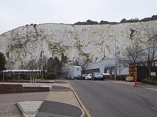
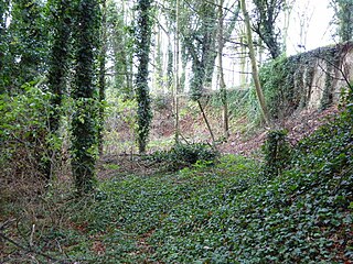
Southerham Works Pit is a 1-hectare (2.5-acre) geological Site of Special Scientific Interest in Lewes in East Sussex. It is a Geological Conservation Review site.

Barrington Chalk Pit

Barrington Chalk Pit is a 97.1 hectare geological Site of Special Scientific Interest near Barrington in Cambridgeshire. It is a Geological Conservation Review site.

Red House Farm Pit

Red House Farm Pit is a 0.5 hectare geological Site of Special Scientific Interest east of Wickham Market in Suffolk. It is a Geological Conservation Review site, and in the Suffolk Coast and Heaths Area of Outstanding Natural Beauty.

Valley Farm Pit, Sudbourne

Valley Farm Pit, Sudbourne is a 0.5 hectare geological Site of Special Scientific Interest north of Orford in Suffolk. It is a Geological Conservation Review site, and in the Suffolk Coast and Heaths Area of Outstanding Natural Beauty.

Aldeburgh Hall Pit is a one hectare geological Site of Special Scientific Interest in Aldeburgh in Suffolk. It is a Geological Conservation Review site, and it is in the Suffolk Coast and Heaths Area of Outstanding Natural Beauty.

Sudbourne Park Pit is a 1.1 hectare geological Site of Special Scientific Interest between Orford and Chillesford in Suffolk. It is a Geological Conservation Review site, and it is in the Suffolk Coast and Heaths Area of Outstanding Natural Beauty.

Creeting St Mary Pits

Creeting St Mary Pits is a 5.4 hectare geological Site of Special Scientific Interest south Creeting St Mary in Suffolk. It is a Geological Conservation Review site.

Great Blakenham Pit

Great Blakenham Pit is a 2.2 hectare geological Site of Special Scientific Interest south of Great Blakenham in Suffolk. It is a Geological Conservation Review site.

Hascot Hill Pit

Hascot Hill Pit is a 0.3 hectare geological Site of Special Scientific Interest south-west of Needham Market in Suffolk. It is a Geological Conservation Review site. It is also a Local Wildlife Site.

Grimston Warren Pit

Grimston Warren Pit is a 6.6-hectare (16-acre) geological Site of Special Scientific Interest east of King's Lynn in Norfolk. It is a Geological Conservation Review site.

Caistor St Edmund Chalk Pit

Caistor St Edmund Chalk Pit is a 23.6-hectare (58-acre) geological Site of Special Scientific Interest south of Norwich in Norfolk. It is a Geological Conservation Review site.

East Runton Cliffs

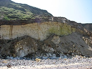
East Runton Cliffs is a 20.6-hectare (51-acre) geological Site of Special Scientific Interest west of Cromer in Norfolk. It is a Geological Conservation Review site.

East Walton and Adcocks Common

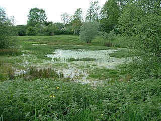
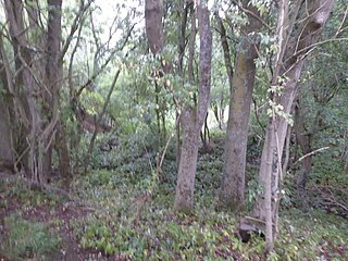
East Walton and Adcock's Common is a 62.4-hectare (154-acre) biological and geological Site of Special Scientific Interest south-east of King's Lynn in Norfolk. It is a Geological Conservation Review site and part of Norfolk Valley Fens Special Area of Conservation

Wells Chalk Pit

Wells Chalk Pit is a 4-hectare (9.9-acre) biological and geological Site of Special Scientific Interest on the eastern outskirts of Wells-next-the-Sea in Norfolk. It is a Geological Conservation Review site, and it is in the Norfolk Coast Area of Outstanding Natural Beauty.

St James Pit

St James' Pit is a 3.5-hectare (8.6-acre) geological Site of Special Scientific Interest in Norwich in Norfolk. It is a Geological Conservation Review site and part of Mousehold Heath Local Nature Reserve.

Broome Heath Pit

Broome Heath Pit is a 1.2-hectare (3.0-acre) geological Site of Special Scientific Interest east of Ditchingham in Norfolk. It is a Geological Conservation Review site and part of Broome Heath Local Nature Reserve

Weybourne Town Pit

Weybourne Town Pit is a 0.7-hectare (1.7-acre) geological Site of Special Scientific Interest west of Sheringham in Norfolk. It is a Geological Conservation Review site and it is in the Norfolk Coast Area of Outstanding Natural Beauty.

References

  1. 1 2 3 4 "Designated Sites View: Catton Grove Chalk Pit". Sites of Special Scientific Interest. Natural England. Retrieved 9 July 2018.
  2. "Map of Catton Grove Chalk Pit". Sites of Special Scientific Interest. Natural England. Retrieved 9 July 2018.
  3. "Catton Grove Chalk Pit (Cenomanian, Turonian, Senonian, Maastrichtian)". Geological Conservation Review. Joint Nature Conservation Committee. Retrieved 25 May 2018.
  4. "Catton Grove Chalk Pit citation" (PDF). Sites of Special Scientific Interest. Natural England. Retrieved 9 July 2018.

Coordinates: 52°38′56″N1°17′31″E / 52.649°N 1.292°E / 52.649; 1.292

Geographic coordinate system Coordinate system

A geographic coordinate system is a coordinate system that enables every location on Earth to be specified by a set of numbers, letters or symbols. The coordinates are often chosen such that one of the numbers represents a vertical position and two or three of the numbers represent a horizontal position; alternatively, a geographic position may be expressed in a combined three-dimensional Cartesian vector. A common choice of coordinates is latitude, longitude and elevation. To specify a location on a plane requires a map projection.