The Norfolk Wildlife Trust (NWT) is one of 46 wildlife trusts covering Great Britain, Northern Ireland, Isle of Man and Alderney. Founded in 1926, it is the oldest of all the trusts. It has over 35,500 members and eight local groups and it manages more than fifty nature reserves and other protected sites. It also gives conservation advice to individuals and organisations, provides educational services to young people on field trips and organises entertainment and information events at nature reserves. The NWT reserves include twenty-six Sites of Special Scientific Interests, nine national nature reserves, twelve Nature Conservation Review sites, sixteen Special Areas of Conservation, twelve Special Protection Areas, eleven Ramsar sites, two local nature reserves, four Geological Conservation Review sites and five which are in Areas of Outstanding Natural Beauty.

Swaffham is a market town and civil parish in the Breckland District and English county of Norfolk. It is situated 12 miles east of King's Lynn and 31 miles west of Norwich.

Dereham, also known historically as East Dereham, is a town and civil parish in the Breckland District of the English county of Norfolk. It is situated on the A47 road, about 15 miles (25 km) west of the city of Norwich and 25 miles (40 km) east of King's Lynn.

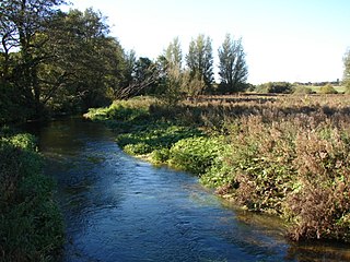
The River Nar is a river in England, a tributary of the River Great Ouse. It rises at Mileham near Litcham in Norfolk and flows 15 miles west through Castle Acre and Narborough, joining the Ouse at King's Lynn. It has had a variety of alternative names, such as the Setch, the Sandringham, and Lynn Flu, though these are rarely, if ever, used today. In 2011 the Nar was recognised by the Environment Agency as one of the top ten most improved rivers in England and Wales.

West Dereham is a village and civil parish in the English county of Norfolk. It covers an area of 13.51 km2 (5.22 sq mi) and had a population of 450 at the 2011 Census. For the purposes of local government, it falls within the district of King's Lynn and West Norfolk.

King's Lynn railway station is the northern terminus of the Fen line in the east of England, serving the town of King's Lynn, Norfolk. It is 41 miles 47 chains (66.9 km) from Cambridge and 96 miles 75 chains (156.0 km) measured from London Liverpool Street.

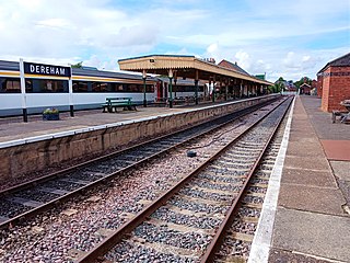
Dereham railway station is currently the northern terminus of the Mid-Norfolk Railway, a heritage line that operates services to Wymondham Abbey. It is located in the town of Dereham, in the English county of Norfolk.

Denver railway station was a station in Denver, Norfolk on the Great Eastern Railway route between King's Lynn and Cambridge, commonly known as the Fen Line. It was also the beginning of a small branch to Stoke Ferry.

Middleton Towers railway station was a station in Leziate, Norfolk. It was on the line between Swaffham and King's Lynn, and closed along with the rest of the line in 1968.

East Winch railway station was at East Winch, Norfolk, England on the line between King's Lynn and Swaffham. It closed in 1968.

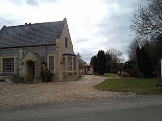
Narborough and Pentney station was in Norfolk, serving the villages of Narborough and Pentney.

Great Fransham is a village and former civil parish in the Breckland district, in the county of Norfolk, England, roughly about an equal distance between Swaffham and Dereham. There is also a Little Fransham; the two villages, both now part of the parish of Fransham, were once served by Fransham railway station. In 1931 the parish had a population of 222. On 1 April 1935 the parish was abolished and merged to form Fransham.

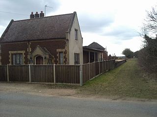
Fransham railway station is a former station in Great Fransham, Norfolk. It was opened as part of the Lynn and Dereham Railway, becoming part of the East Anglian Railway from 1847, on the section of line between Dereham and Swaffham.

Pentney is a village and civil parish in the English county of Norfolk, located about 8 miles (13 km) south east of King's Lynn placing it about halfway between King's Lynn and Swaffham on the A47 road. It covers an area of 10.39 km2 (4.01 sq mi) and had a population of 387 in 184 households at the 2001 census, increasing to 544 at the 2011 Census. For the purposes of local government, it falls within the district of King's Lynn and West Norfolk. It is in the valley of the River Nar, a tributary of the River Great Ouse.
The West Norfolk Junction Railway was a standard gauge eighteen and a half-mile single-track railway running between Wells-next-the-Sea railway station and Heacham in the English county of Norfolk. It opened in 1866 and closed in 1953. At Wells the line made a junction with the Wells and Fakenham Railway and at Heacham it connected with the line from Hunstanton to Kings Lynn.
The Lynn and Dereham Railway was a standard gauge 26+1⁄2-mile (42.6 km) single track railway running between King's Lynn and Dereham in the English county of Norfolk. The Lynn to Dereham line opened in 1846 and closed in 1968, although the section between Middleton Towers and King's Lynn remains open to freight.

Bilney railway station was located on the line between East Winch and Narborough and Pentney. It served the village of West Bilney, and closed in 1866.
The Wymondham to Wells Branch was a railway built in stages by the Norfolk Railway, Eastern Counties Railway and Wells and Fakenham Company between 1847 and 1857. The railway ran from Wymondham in the south, through Dereham and Fakenham to the coastal town of Wells-next-the-Sea; more specifically, the line ran from Wymondham South Junction, where it met the present-day Breckland Line. Passenger services along the line lasted until 1969; the railway continued to be used for freight until 1989. The southern section of the railway now forms the Mid-Norfolk Railway, with part of the northern section serving as the narrow gauge Wells and Walsingham Light Railway.
Ouse Bridge railway station was a railway station in Norfolk, England.

The Bury and Thetford (Swaffham Branch), also known as the Crab and Winkle Line, was a railway line in England. The line ran from Thetford, via Watton to a junction with the Lynn and Dereham Railway at Swaffham.


