
Ouse Washes is a linear 2,513.6 hectare biological Site of Special Scientific Interest stretching from near St Ives in Cambridgeshire to Downham Market in Norfolk. It is also a Ramsar internationally important wetland site, a Special Protection Area under the European Union Birds Directive, a Special Area of Conservation, and a Nature Conservation Review site, Grade I. An area of 186 hectares between March and Ely is managed by the Wildlife Trust for Bedfordshire, Cambridgeshire and Northamptonshire, and another area near Chatteris is managed by the Royal Society for the Protection of Birds. The Wildfowl & Wetlands Trust manages another area near Welney.

Wayland Wood is a 31.7-hectare (78-acre) biological Site of Special Scientific Interest near to Watton in Norfolk. It is a Nature Conservation Review site, Grade 2, and it is managed by the Norfolk Wildlife Trust

Hethel is a small village in Norfolk, England, near the historic market town of Wymondham, and approximately 10 miles (16 km) south of the city of Norwich.

Gamsey Wood is a 4 hectare nature reserve north-east of Woodwalton in Cambridgeshire. It is managed by the Wildlife Trust for Bedfordshire, Cambridgeshire and Northamptonshire.

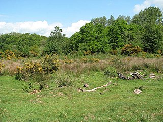
Thompson Water, Carr and Common is a 154.7-hectare (382-acre) biological Site of Special Scientific Interest north of Thetford in Norfolk. Most of it is managed by the Norfolk Wildlife Trust as Thompson Common. It is a Nature Conservation Review site, Grade I, and part of the Norfolk Valley Fens Special Area of Conservation. It is crossed by the Great Eastern Pingo Trail Local Nature Reserve.

Roydon Fen is a 17.2 hectare Local Nature Reserve south of Roydon, on the western outskirts of Diss in Norfolk. It is owned by South Norfolk District Council and managed by the Suffolk Wildlife Trust.

East Wretham Heath is a 141.1-hectare (349-acre) biological Site of Special Scientific Interest south-east of Thetford in Norfolk. It is a Nature Conservation Review site, Grade I, and it is managed by the Norfolk Wildlife Trust. it is part of the Breckland Special Area of Conservation and Special Protection Area.

Weeting Heath is a 141.8-hectare (350-acre) biological Site of Special Scientific Interest west of Thetford in Norfolk, which is managed by the Norfolk Wildlife Trust. It is a Nature Conservation Review site, Grade I, and a National Nature Reserve. It is also part of the Breckland Special Area of Conservation and Special Protection Area.
Hoe Rough is a 12-hectare (30-acre) nature reserve north of Dereham in Norfolk. It is managed by the Norfolk Wildlife Trust, and is part of the Beetley and Hoe Meadows Site of Special Scientific Interest.

Lolly Moor is a 3-hectare (7.4-acre) nature reserve south of Dereham in Norfolk. It is managed by the Norfolk Wildlife Trust.

Foxley Wood is a nature reserve in Foxley, Norfolk, England, the largest ancient woodland and coppice in Norfolk. The Norfolk Wildlife Trust, which manages this reserve, bought it in 1998. It is 123 hectares in size. It is a Site of Special Scientific Interest, a Nature Conservation Review site, Grade 2, and a National Nature Reserve.
Thursford Wood is a 10-hectare (25-acre) nature reserve north-east of Fakenham in Norfolk. It is managed by the Norfolk Wildlife Trust.
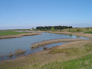
Holme Dunes is a 192-hectare (470-acre) nature reserve near Holme-next-the-Sea in Norfolk. It is managed by the Norfolk Wildlife Trust, and is a National Nature Reserve. It is part of the North Norfolk Coast Site of Special Scientific Interest, Geological Conservation Review site, Nature Conservation Review site, Grade I, Ramsar site, Special Areas of Conservation and Special Protection Area. It is also in the Norfolk Coast Area of Outstanding Natural Beauty.

Ringstead Downs is a 6.9-hectare (17-acre) biological Site of Special Scientific Interest east of Hunstanton in Norfolk. It is in the Norfolk Coast Area of Outstanding Natural Beauty, and it is the western part of the 11-hectare (27-acre) Ringstead Downs nature reserve, which is managed by the Norfolk Wildlife Trust.

Ant Broads and Marshes is a 745.3-hectare (1,842-acre) biological Site of Special Scientific Interest north-east of Norwich in Norfolk. Most of the it is a Nature Conservation Review site, Grade 1, and it is part of the Broadland Ramsar and Special Protection Area, and The Broads Special Area of Conservation. Part of it is the Barton Broad nature reserve, which is managed by the Norfolk Wildlife Trust, and two areas are National Nature Reserves.

Beetley and Hoe Meadows is an 11.4-hectare (28-acre) biological Site of Special Scientific Interest north of Dereham in Norfolk. The site is in two nearby areas, and Hoe Meadow is part of Hoe Rough nature reserve, which is managed by the Norfolk Wildlife Trust
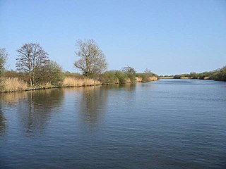
Bure Broads and Marshes is a 741.1-hectare (1,831-acre) biological Site of Special Scientific Interest north-east of Norwich in Norfolk. Most of it is a Nature Conservation Review site, Grade I and National Nature Reserve. Two areas are nature reserves managed by the Norfolk Wildlife Trust, Cockshoot Broad and Ranworth Broad. It is part of the Broadland Ramsar site and Special Protection Area and The Broads Special Area of Conservation,

Upper Thurne Broads and Marshes is a 1,185.9-hectare (2,930-acre) biological Site of Special Scientific Interest north of Great Yarmouth in Norfolk. Part of it is a Nature Conservation Review site, Grade I, and it is in the Norfolk Coast Area of Outstanding Natural Beauty. It is part of the Broadland Ramsar site and Special Protection Area, and The Broads Special Area of Conservation. Two areas, Hickling Broad and Martham Broad, are National Nature Reserves managed by the Norfolk Wildlife Trust.

Pigneys Wood or Pigney's Wood is a 20.9-hectare (52-acre) Local Nature Reserve north of North Walsham in Norfolk. It was formerly owned by the North Norfolk Community Woodland Trust and is now owned and managed by the Norfolk Wildlife Trust.

Scarning Fen is a 4-hectare (9.9-acre) nature reserve west in Dereham in Norfolk. It is managed by the Norfolk Wildlife Trust. It is a Nature Conservation Review site, Grade I, and is part of Potter and Scarning Fens Site of Special Scientific Interest and Norfolk Valley Fens Special Area of Conservation.


