Ceiba, Cidra, Puerto Rico

Last updated
Ceiba
Barrio
Ceiba, Cidra, Puerto Rico locator map.png
Location of Ceiba within the municipality of Cidra shown in red
Caribbean location map.svg
Red pog.svg
Ceiba
Location of Puerto Rico
Coordinates: 18°12′06″N66°10′09″W / 18.201621°N 66.169198°W / 18.201621; -66.169198 [1]
Commonwealth Flag of Puerto Rico.svg  Puerto Rico
Municipality Bandera de Cidra, Puerto Rico.svg Cidra
Area
[1]
  Total4.44 sq mi (11.5 km2)
  Land4.44 sq mi (11.5 km2)
  Water0 sq mi (0 km2)
Elevation
[2]
1,742 ft (531 m)
Population
 (2010)
  Total3,850
  Density867.1/sq mi (334.8/km2)
 Source: 2010 Census
Time zone UTC−4 (AST)

Ceiba is a barrio in the municipality of Cidra, Puerto Rico. Its population in 2010 was 3,850. [3] [4] [5]

Contents

History

Ceiba was in Spain's gazetteers [6] until Puerto Rico was ceded by Spain in the aftermath of the Spanish–American War under the terms of the Treaty of Paris of 1898 and became an unincorporated territory of the United States. In 1899, the United States Department of War conducted a census of Puerto Rico finding that the population of Ceiba barrio and Río Abajo barrio was 1,100. [7]

Historical population
CensusPop.Note
1910 820
1920 1,28256.3%
1930 1,80240.6%
1940 1,725−4.3%
1950 2,08520.9%
1960 2,55822.7%
1980 2,878
1990 3,43419.3%
2000 3,82511.4%
2010 3,8500.7%
U.S. Decennial Census
1899 (shown as 1900) [8] 1910-1930 [9]
1930-1950 [10] 1980-2000 [11] 2010 [12]

Sectors

Barrios (which are, in contemporary times, roughly comparable to minor civil divisions) [13] in turn are further subdivided into smaller local populated place areas/units called sectores (sectors in English). The types of sectores may vary, from normally sector to urbanización to reparto to barriada to residencial, among others. [14] [15] [16]

The following sectors are in Ceiba barrio: [17]

Comunidad Naranjo, El Verde I, Finca Tommy Muñiz, Parcelas Hevia, Sector Agustín Cruz Ojeda, Sector Agustín Santos, Sector Carrasquillo (Sector González), Sector Delgado (El Llano), Sector Escalera, Sector Euclides Rivera, Sector Falcón, Sector Flores, Sector Garced, Sector Jacinto Hernández, Sector Joya Abajo, Sector La Frontera, Sector Las Paletas, Sector Meléndez, Sector Pablo Santos, Sector Peregín Santos, Sector Rafi Ruiz, Sector Ruiz, and Urbanización Estancias de Monte Río.

In Ceiba barrio is the Rodríguez Hevia urban zone and part of the Cidra urban zone. [5]

See also

Related Research Articles

<span class="mw-page-title-main">Cedro Abajo</span> Barrio of Naranjito, Puerto Rico

Cedro Abajo is a barrio in the municipality of Naranjito, Puerto Rico. Its population in 2010 was 4,627.

<span class="mw-page-title-main">Río Abajo, Ceiba, Puerto Rico</span> Barrio of Puerto Rico

Río Abajo is a barrio in the municipality of Ceiba, Puerto Rico. Its population in 2010 was 884.

<span class="mw-page-title-main">Hato Puerco Abajo</span> Barrio of Villalba, Puerto Rico

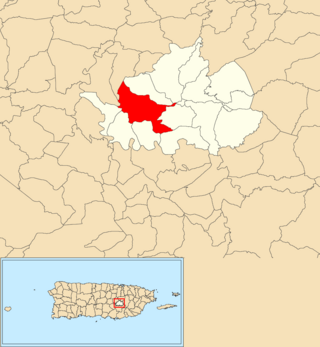
Hato Puerco is a barrio in the municipality of Villalba, Puerto Rico. Its population in 2010 was 1,764.

<span class="mw-page-title-main">Villalba Abajo</span> Barrio of Villalba, Puerto Rico

Villalba is a barrio in the municipality of Villalba, Puerto Rico. Its population in 2010 was 2,880.

<span class="mw-page-title-main">Machos, Ceiba, Puerto Rico</span> Barrio of Puerto Rico

Machos is a barrio in the municipality of Ceiba, Puerto Rico. Its population in 2010 was 3,567.

<span class="mw-page-title-main">Quebrada Seca, Ceiba, Puerto Rico</span> Barrio of Puerto Rico

Quebrada Seca is a barrio in the municipality of Ceiba, Puerto Rico. Its population in 2010 was 1,415.

<span class="mw-page-title-main">Ceiba barrio-pueblo</span> Historical and administrative center (seat) of Ceiba, Puerto Rico

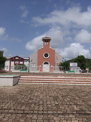
Ceiba barrio-pueblo is a barrio and the administrative center (seat) of Ceiba, a municipality of Puerto Rico. Its population in 2010 was 3,677. As was customary in Spain, in Puerto Rico, the municipality has a barrio called pueblo which contains a central plaza, the municipal buildings, and a Catholic church. Fiestas patronales are held in the central plaza every year.

<span class="mw-page-title-main">Ceiba Alta, Aguadilla, Puerto Rico</span> Barrio of Puerto Rico

Ceiba Alta is a rural barrio in the municipality of Aguadilla, Puerto Rico. Its population in 2010 was 667.

<span class="mw-page-title-main">Río Abajo, Cidra, Puerto Rico</span> Barrio of Puerto Rico

Río Abajo is a barrio in the municipality of Cidra, Puerto Rico. Its population in 2010 was 1,097.

<span class="mw-page-title-main">Rincón, Cidra, Puerto Rico</span> Barrio of Puerto Rico

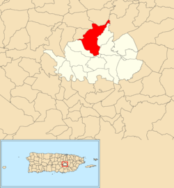
Rincón is a barrio in the municipality of Cidra, Puerto Rico. Its population in 2010 was 4,332.

<span class="mw-page-title-main">Salto, Cidra, Puerto Rico</span> Barrio of Puerto Rico

Salto is a barrio in the municipality of Cidra, Puerto Rico. Its population in 2010 was 176.

<span class="mw-page-title-main">Toíta, Cidra, Puerto Rico</span> Barrio of Puerto Rico

Toíta is a barrio in the municipality of Cidra, Puerto Rico. Its population in 2010 was 1,068.

<span class="mw-page-title-main">Beatriz, Cidra, Puerto Rico</span> Barrio of Puerto Rico

Beatriz is a barrio in the municipality of Cidra, Puerto Rico. Its population in 2010 was 3,095.

<span class="mw-page-title-main">Hato Abajo, Arecibo, Puerto Rico</span> Barrio of Puerto Rico

Hato Abajo is a barrio in the municipality of Arecibo, Puerto Rico. Its population in 2010 was 19,699.

<span class="mw-page-title-main">Cocos, Quebradillas, Puerto Rico</span> Barrio of Puerto Rico

Cocos is a barrio in the municipality of Quebradillas, Puerto Rico. Its population in 2010 was 4,889.

<span class="mw-page-title-main">Guzmán Abajo</span> Barrio of Río Grande, Puerto Rico

Guzmán Abajo is a barrio in the municipality of Río Grande, Puerto Rico. Its population in 2010 was 7,367.

<span class="mw-page-title-main">Bayamón, Cidra, Puerto Rico</span> Barrio of Puerto Rico

Bayamón is a barrio in the municipality of Cidra, Puerto Rico. Its population in 2010 was 5,995.

<span class="mw-page-title-main">Certenejas, Cidra, Puerto Rico</span> Barrio of Puerto Rico

Certenejas is a barrio in the municipality of Cidra, Puerto Rico. Its population in 2010 was 6,049. A newer barrio, it was formed from part of Bayamón barrio, also in Cidra.

<span class="mw-page-title-main">Rabanal, Cidra, Puerto Rico</span> Barrio of Puerto Rico

Rabanal is a barrio in the municipality of Cidra, Puerto Rico. Its population in 2010 was 4,228.

<span class="mw-page-title-main">Sud, Cidra, Puerto Rico</span> Barrio of Puerto Rico

Sud is a barrio in the municipality of Cidra, Puerto Rico. Its population in 2010 was 3,714.

References

  1. 1 2 "US Gazetteer 2019". US Census. US Government.
  2. U.S. Geological Survey Geographic Names Information System: Ceiba barrio
  3. Picó, Rafael; Buitrago de Santiago, Zayda; Berrios, Hector H. (1969). Nueva geografía de Puerto Rico: física, económica, y social, por Rafael Picó. Con la colaboración de Zayda Buitrago de Santiago y Héctor H. Berrios. San Juan Editorial Universitaria, Universidad de Puerto Rico,1969.
  4. Gwillim Law (20 May 2015). Administrative Subdivisions of Countries: A Comprehensive World Reference, 1900 through 1998. McFarland. p. 300. ISBN   978-1-4766-0447-3 . Retrieved 25 December 2018.
  5. 1 2 Puerto Rico: 2010 Population and Housing Unit Counts.pdf (PDF). U.S. Dept. of Commerce, Economics and Statistics Administration, U.S. Census Bureau. 2010.
  6. "Anuario del comercio, de la industria, de la magistratura y de la administración. 1881". Biblioteca Nacional de España (in Spanish). p. 1614. Retrieved 4 April 2023.
  7. Joseph Prentiss Sanger; Henry Gannett; Walter Francis Willcox (1900). Informe sobre el censo de Puerto Rico, 1899, United States. War Dept. Porto Rico Census Office (in Spanish). Imprenta del gobierno. p.  160.
  8. "Report of the Census of Porto Rico 1899". War Department Office Director Census of Porto Rico. Archived from the original on July 16, 2017. Retrieved September 21, 2017.
  9. "Table 3-Population of Municipalities: 1930 1920 and 1910" (PDF). United States Census Bureau. Archived (PDF) from the original on August 17, 2017. Retrieved September 21, 2017.
  10. "Table 4-Area and Population of Municipalities Urban and Rural: 1930 to 1950" (PDF). United States Census Bureau. Archived (PDF) from the original on August 30, 2015. Retrieved September 21, 2014.
  11. "Table 2 Population and Housing Units: 1960 to 2000" (PDF). United States Census Bureau. Archived (PDF) from the original on July 24, 2017. Retrieved September 21, 2017.
  12. Puerto Rico: 2010 Population and Housing Unit Counts.pdf (PDF). U.S. Dept. of Commerce Economics and Statistics Administration U.S. Census Bureau. 2010. Archived (PDF) from the original on 2017-02-20. Retrieved 2019-08-02.
  13. "US Census Barrio-Pueblo definition". factfinder.com. US Census. Archived from the original on 13 May 2017. Retrieved 5 January 2019.
  14. "Agencia: Oficina del Coordinador General para el Financiamiento Socioeconómico y la Autogestión (Proposed 2016 Budget)". Puerto Rico Budgets (in Spanish). Retrieved 28 June 2019.
  15. Rivera Quintero, Marcia (2014), El vuelo de la esperanza: Proyecto de las Comunidades Especiales Puerto Rico, 1997-2004 (first ed.), San Juan, Puerto Rico Fundación Sila M. Calderón, ISBN   978-0-9820806-1-0
  16. "Leyes del 2001". Lex Juris Puerto Rico (in Spanish). Retrieved 24 June 2020.
  17. "DESGLOSE DE SECTORES Y CENTROS DE VOTACIÓN PRECINTO ELECTORAL - CIDRA 076" (PDF). Comisión Estatal de Elecciones Puerto Rico (in Spanish). 20 July 2019. Archived from the original (PDF) on 15 June 2020. Retrieved 16 June 2020.