Nalbari is an administrative district in the state of Assam in India. The district headquarters is located at Nalbari. The origin of Nalbari District is created from Nal+ Bar.

Narmada district is an administrative district in the state of Gujarat in India. The district headquarters are located at Rajpipla. The district is bounded by Vadodara and Chhota Udaipur districts in the north, by Nandurbar district of Maharashtra state in the east, by Surat and Tapi districts in the south and by Bharuch district in the west. The district occupies an area of 2,755 km² and has a population of 590,297. It was 10.44% urban as of 2011. As of 2011, it is the third least populous district of Gujarat, after Dang and Porbandar.

Sheikhpura district is one of the thirty-eight districts of the Indian state of Bihar. Sheikhpura is the administrative headquarter of this district. Sheikhpura district is a part of the Munger division. Sheikhpura was split from the Munger district into a separate district with headquarters in Sheikhpura on 31 July 1994 by Rajo Singh. As of 2011 it was the least populous district of Bihar.

Bhagalpur district is one of the thirty-eight districts of Bihar state, India, and Bhagalpur town is the administrative headquarters of this district.

Lakhisarai district is one of the thirty-eight districts of Bihar state, India, and Lakhisarai town is the administrative headquarters of this district. Lakhisarai district is a part of Munger Division. The district occupies an area of 1,228 km2 (474 sq mi).

Simdega district is one of the twenty-four districts of Jharkhand state, India, and Simdega town is the administrative headquarters of this district. This district is the least population density district of jharkhand(2011).This district was carved out from erstwhile Gumla district on 30 April 2001. It is currently a part of the Red Corridor. As of 2011 it is the third least populous district of Jharkhand, after Lohardaga and Khunti districts.

Bulandshahr district is a district in the Meerut region in the North Indian state of Uttar Pradesh (UP), situated between the two rivers Ganga and Yamuna. It is a part of the National Capital Region of India, and Bulandshahr is the district headquarters.

Agra district is one of the 75 Districts of Uttar Pradesh, India. The district headquarters is the historical city of Agra. Agra district is a part of Agra division.

Bagpat district, also spelled as Baghpat district, is one of the 75 districts of the Indian state of Uttar Pradesh, with headquarters at the town of Baghpat. It is within the National Capital Region.It falls under the National Capital Region of Delhi. it is one of the most Sugarcane producing District in Uttar Pradesh. It also referred as Jatland due to high density of Jaat Caste peoples.The Biggest Khap Panchayat named Desh Khap of Tomar clan ,Tomar Khap have 84 villages in the District.

Etah district is one of the districts of Uttar Pradesh, India, since 1854. Etah City is the district headquarters. Etah district is a part of Aligarh Division.

Harda District is a district of Madhya Pradesh state of central India. The town of Harda is the district headquarters. The district is part of Narmadapuram Division. Harda district was organized in 1998.Harda is also known as 'Hridaynagari'.

Jalaun district is a district of Uttar Pradesh, India. The district is named after the town of Jalaun, which was the former headquarters of a Maratha governor, but the administrative headquarters of the district is at Orai. Other major towns in the district are Konch, Kalpi, and Madhogarh.

Kaushambi district is a district in the state of Uttar Pradesh in India. Manjhanpur is the district headquarters. The district was carved from Prayagraj district on 4 April 1997. Manauri Bajar connects Prayagraj and Kaushambi districts by railway over a bridge on SH-95. Manjhanpur is south-west of Prayagraj on the north bank of the Yamuna river, about 55 kilometres (34 mi) from the city. It is surrounded by Chitrakoot district on the south, Pratapgarh district on the north, Prayagraj district on the east and Fatehpur district on the west. Kaushambi is part of Prayagraj division. The nearest railway station, in Bharwari, connects with Delhi, Prayagraj, Kolkata, Gaya and Kanpur.

Porbandar district is one of the 33 districts of Gujarat state in western India. The district covers an area of 2,316 km2. It had a population of 5.85,449 of which 48.77% were urban as of 2011 census This district was carved out of Junagadh District. It lies on the Kathiawar peninsula. Porbandar city is the administrative headquarters of this district. This district is surrounded by Jamnagar district and Devboomi Dwarka to the north, Junagadh district and Rajkot district to the east and the Arabian Sea to the west and south.

Dhar district is a district of Madhya Pradesh state in central India. The historic town of Dhar is administrative headquarters of the district.

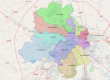
North Delhi is an administrative district of the National Capital Territory of Delhi in India. Alipur is the administrative headquarters of this district. North Delhi is bounded by the Yamuna River and the district of Central Delhi on the east and by the district of North West Delhi to the west.
North West Delhi is an administrative district of the National Capital Territory of Delhi in India.
West Delhi is one of the 11 administrative districts of the National Capital Territory of Delhi in India. Administratively, the district is divided into three subdivisions, Patel Nagar, Rajouri Garden and Punjabi Bagh.

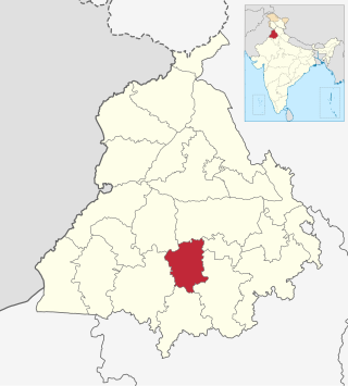
Fatehgarh Sahib district is one of the twenty-three districts of the state of Punjab, India, with its headquarters in the town of Fatehgarh Sahib.
Barnala is one of the districts of Indian state of Punjab. It was carved out of Sangrur district. It is a centrally located district bordered by Ludhiana district on the north, Moga district on northwest, Bathinda district on west and by Sangrur district on all other sides. As per census 2011, Population of District Barnala is 5,96,294. Barnala has sufficient number of Colleges to provide sufficient education in the field of Engineering, Arts, Medical and Commerce. Also Barnala is well known for its Industries. Two main Industries Trident Group which is mainly known for its world class towels is established in this District. Second a large Industry producing combines, Standard Combines is also established here.