Related Research Articles

The Partition of India in 1947 was the change of political borders and the division of other assets that accompanied the dissolution of the British Raj in the Indian subcontinent and the creation of two independent dominions in South Asia: India and Pakistan. The Dominion of India is today the Republic of India, and the Dominion of Pakistan—which at the time comprised two regions lying on either side of India—is now the Islamic Republic of Pakistan and the People's Republic of Bangladesh. The partition was outlined in the Indian Independence Act 1947. The change of political borders notably included the division of two provinces of British India, Bengal and Punjab. The majority Muslim districts in these provinces were awarded to Pakistan and the majority non-Muslim to India. The other assets that were divided included the British Indian Army, the Royal Indian Navy, the Royal Indian Air Force, the Indian Civil Service, the railways, and the central treasury. Provisions for self-governing independent Pakistan and India legally came into existence at midnight on 14 and 15 August 1947 respectively.

Qadian is a city and a municipal council in Gurdaspur district, north-east of Amritsar, situated 18 kilometres (11 mi) north-east of Batala city in the state of Punjab, India. Qadian is the birthplace of Mirza Ghulam Ahmad, the founder of the Ahmadiyya movement within Islam. It remained the headquarters of the Ahmadiyya movement until the Partition of India in 1947.

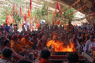
Hinduism is the second largest religious affiliation in Pakistan after Islam. Though Hinduism was one of the dominant faiths in the region a few centuries ago, Hindus accounted for just 2.17% of Pakistan's population in the 2023 Pakistani census. The Umerkot district has the highest percentage of Hindu residents in the country at 54.6%, while Tharparkar district has the most Hindus in absolute numbers at 811,507.

Dantewada District, also known as Dantewara District or Dakshin Bastar District, is a district in the Indian state of Chhattisgarh. Dantewada is the district headquarters. The district is part of Bastar Division. Until 1998, Dantewada District was a tehsil of the larger Bastar District.

Dakshin Dinajpur, also known as South Dinajpur, is a district in the Indian state of West Bengal, India. It was created on 1 April 1992 by the division of the erstwhile West Dinajpur District.The Headquarter (sadar) of the district is at Balurghat. It comprises two subdivisions: Balurghat and Gangarampur. According to the 2011 census, it is the third least populous district of West Bengal.
Jagraon is a city and a municipal council, a rural police district and a sub-division of the Ludhiana district in the Indian state of Punjab. Jagraon is more than three centuries old. Jagraon is at almost the geographical center of the state, 16 kilometres (9.9 mi) from the Satluj River. It is 37 km (23 mi) from its district headquarters Ludhiana, 29 km (18 mi) from Moga, 31 km (19 mi) from Nakodar and 54 miles from Barnala.

Nuh district is one of the 22 districts of the northern Indian state of Haryana. The district is known for having the largest Muslim population in Haryana. It lies within the National Capital Region as well as the historical Mewat region and Braj region of India.

Fatehpur is a town in Barabanki district in the state of Uttar Pradesh in India. It is also a Nagar panchayat, Police station and Tehsil. It is the second biggest urban area of the district after Barabanki city. It is about 35 km north-east of Lucknow, the state capital.
Sunam is a town and a tehsil, near city of Sangrur in Sangrur district in the Indian state of Punjab. The Railway Station of Sunam was renamed as Sunam Udham Singh Wala.
Belthangady is a town panchayat and the headquarters of Belthangady taluk of the Dakshina Kannada district of Karnataka state in India.
Banki is a town, a nagar panchayat and a block panchayat in Barabanki district in the state of Uttar Pradesh, India.
Vellamunda is a grama panchayat in the Wayanad district of the state of Kerala, India, situated approximately 15 km away from Mananthavady, the nearest town. Vellamunda Panchayath Office is situated at Ettenalu .Vellamunda can accessed by Padinjarathara or Mananthavady
Kirnahar is a village in Nanoor CD block in Bolpur subdivision of Birbhum district in the Indian state of West Bengal.

Presidency division is an administrative division within the Indian state of West Bengal. The headquarters and the largest city of the Presidency division is Kolkata, the state capital. Presidency division is bounded by Medinipur division to South-West, Burdwan division to North-West and Malda division to North. The whole east side of the division is covered by India–Bangladesh border.

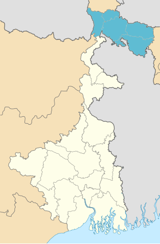
Jalpaiguri Division is one of the 5 divisions in the Indian state of West Bengal. It is the northernmost division of West Bengal. It is surrounded by Nepal on the western side, Bihar on South-Western side, Bhutan on the Northern side and Bangladesh on the southern side.

Kushmandi is a community development block that forms an administrative division in Gangarampur subdivision of Dakshin Dinajpur district in the Indian state of West Bengal.
Kambagi is a panchayat village in the southern state of Karnataka, India. Administratively it is under Vijayapur Taluk of Vijayapur District, Karnataka. It is nearly 40 kilometres (25 mi) from district headquarters, the city of Vijayapur, Karnataka. Kambagi has Government Primary HealthCare Center, Post Office, Bank of India and Gram Panchayat offices.
Burj Bhalaike, sometimes spelled Buraj Bhalaike, or Burj Bhalai, is a village in the Sardulgarh tehsil of Mansa district in Punjab, India.

Medinipur Division is one of the 5 divisions in the Indian state of West Bengal. It is the westernmost division of West Bengal. Earlier it was a part of Burdwan division and was curved out from it in 2016. The port city of Haldia is located in this division.
References
- ↑ "Chachowal elects Sarpanch". The Tribune . 19 June 2003. Retrieved 11 August 2009.
- ↑ "List of Census Villages, Reports of National Panchayat Directory". Ministry of Panchayati Raj, Govt. of India. 12 August 2009. Archived from the original on 3 March 2016. Retrieved 11 August 2009.
- ↑ "NAME OF HABITATIONS IN YEARLY STATUS REPORT". Ministry of Rural Development, Govt of India. Archived from the original on 21 July 2011. Retrieved 11 August 2009.
31°13′41″N75°39′14″E / 31.228°N 75.654°E