Related Research Articles

Amador County, is a county in the U.S. state of California, in the Sierra Nevada. As of the 2010 census, the population was 38,091. The county seat is Jackson. Amador County, located within California's Gold Country, is known as "The Heart of the Mother Lode". There is a substantial viticultural industry in the county.

Mokelumne Hill is a census-designated place (CDP) in Calaveras County, California, United States. The population was 646 at the 2010 census, down from 774 at the 2000 census. It is commonly referred to as "Moke Hill" by locals. The town takes its name from the neighboring Mokelumne River, which in turn is Miwok for the "people of Mokel," the likely name of a Native American village in the area.

The Cosumnes River is a river in northern California in the United States. It rises on the western slope of the Sierra Nevada and flows approximately 52.5 miles (84.5 km) into the Central Valley, emptying into the Mokelumne River in the Sacramento-San Joaquin Delta.

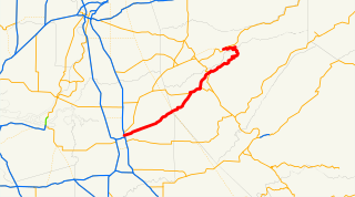
State Route 49 is a north–south state highway in the U.S. state of California that passes through many historic mining communities of the 1849 California gold rush. Highway 49 is numbered after the "49ers", the waves of immigrants who swept into the area looking for gold, and it is known as the Golden Chain Highway. This roadway begins at Oakhurst, Madera County, in the Sierra Nevada, where it diverges from State Route 41. It continues in a generally northwest direction, weaving through the communities of Goldside and Ahwahnee, before crossing into Mariposa County. State Route 49 then continues northward through the counties of Tuolumne, Calaveras, Amador, El Dorado, Placer, Nevada, Yuba, Sierra, and Plumas, where it reaches its northern terminus at State Route 70, in Vinton.

Keyesville is an unincorporated community in Kern County, California. It is located 2 miles (3.2 km) west of Lake Isabella and the Kern River Valley, at an elevation of 2,848 feet (868 m). Keyesville, founded in 1854 is named for Richard M. Keyes, whose discovery of gold in 1853 started the Kern River Gold Rush.

The Mokelumne River is a 95-mile (153 km)-long river in northern California in the United States. The river flows west from a rugged portion of the central Sierra Nevada into the Central Valley and ultimately the Sacramento–San Joaquin River Delta, where it empties into the San Joaquin River-Stockton Deepwater Shipping Channel. Together with its main tributary, the Cosumnes River, the Mokelumne drains 2,143 square miles (5,550 km2) in parts of five California counties. Measured to its farthest source at the head of the North Fork, the river stretches for 157 miles (253 km).
Lancha Plana was a small settlement in Amador County, California, formed as a result of a flatboat ferry crossing across the Mokelumne River. It was founded by Mexican settlers in 1848. It lay on the north bank of the Mokelumne River, 9 miles (14 km) south-southeast of Ione, at an elevation of 220 feet. The remnants of the town were submerged as a result of the damming of the river to form the Camanche Reservoir. Lancha Plana Bridge crosses the lake now about where the town once stood.

Sandy Gulch is a small community in Calaveras County, California, just southwest of West Point on State Route 26. It lies at an elevation of 2592 feet above sea level and is located at 38°22′49″N120°31′58″W. The community is in ZIP code 95248 and area code 209.
Camanche is a former settlement in Calaveras County, California. Located at an elevation of 220 feet, the town was once called Limerick before it was renamed to Camanche in 1849.
State Route 26 is a state highway in the U.S. state of California, running from State Route 99 in Stockton in San Joaquin County to State Route 88 near Pioneer in Amador County. The highway is routed to serve Mokelumne Hill and West Point in Calaveras County.

Lizzie Edith Irvine was an American photographer who documented the 1906 San Francisco earthquake.

Edmond Edward Wysinger (1816–1891) was an African American pioneer in California, arriving around October 1849 at the beginning of the California Gold Rush.

Timbuctoo is an unincorporated community in Yuba County, California. It lies northwest of Smartsville, at an elevation of 397 feet.

The Mokelumne Wilderness is a 105,165-acre federally designated wilderness area located 70 miles (110 km) east of Sacramento, California. It is within the boundaries of three national forests: Stanislaus, Eldorado and Toiyabe. First protected under the Wilderness Act of 1964, the Mokelumne’s borders were expanded under the California Wilderness Act of 1984 with the addition of 55,000 acres. The wilderness takes its name from the Mokelumne River, which was named after a Mi-wok Indian village located on the riverbank in California's Central Valley.

The Cuyamaca Mountains, locally the Cuyamacas, are a mountain range of the Peninsular Ranges System, in San Diego County, southern California. The mountain range runs roughly northwest to southeast. The Laguna Mountains are directly adjacent to the east, with Palomar Mountain and Hot Springs Mountain more distant to the north.
China City is a former settlement and mining camp in Amador County, California. It was 1.5 miles (2.4 km) east of Electra on the north bank of the Mokelumne River.

Bouldin Island is an island in the Sacramento-San Joaquin River Delta in San Joaquin County, California, 20 kilometers (12 mi) northwest of Stockton on the Stockton Deepwater Shipping Channel.
Poverty Bar is a former settlement in Calaveras County, California now covered by the waters of Camanche Reservoir. Poverty Bar is located at latitude - longitude coordinates of N 38.22547 and W -120.90938. Poverty Bar is shown in the center of the topographic (topo) map, which is sourced from the United States Geographical Survey map USGS WALLACE quad. The nearest major town is Campo Seco, California.
Middle Bar is a former mining town on the Mokelumne River in Amador County, California. It is a California Historical Landmark.

Horseshoe Bend is a mining ghost town of the California Gold Rush, formerly on the Merced River in Mariposa County, California
References
- 1 2 3 Durham, David L. (1998). California's Geographic Names: A Gazetteer of Historic and Modern Names of the State. Clovis, Calif.: Word Dancer Press. p. 511. ISBN 1-884995-14-4.
Municipalities and communities of Amador County, California, United States | ||
|---|---|---|
| Cities |  | |
| CDPs | ||
| Unincorporated communities | ||
| Ghost towns |
| |
| Footnotes | ‡This CDP also has portions in an adjacent county or counties | |
| | This Amador County, California-related article is a stub. You can help Wikipedia by expanding it. |