"},"blank1_name":{"wt":""},"blank1_info":{"wt":""},"website":{"wt":""},"footnotes":{"wt":""},"pop_est_as_of":{"wt":""},"pop_est_footnotes":{"wt":""},"population_est":{"wt":""}},"i":0}}]}" id="mwBQ">Census-designated place in Iowa, United States
Chapin, Iowa | |
---|---|
Coordinates: 42°50′01″N93°13′20″W / 42.83361°N 93.22222°W | |
Country | United States |
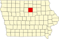
State | Iowa |
County | Franklin |
Area | |
• Total | 0.10 sq mi (0.26 km2) |
• Land | 0.10 sq mi (0.26 km2) |
• Water | 0.00 sq mi (0.00 km2) |
Elevation | 1,155 ft (352 m) |
Population (2020) | |
• Total | 71 |
• Density | 717.17/sq mi (278.15/km2) |
Time zone | UTC-6 (Central (CST)) |
• Summer (DST) | UTC-5 (CDT) |
Area code | 641 |
GNIS feature ID | 455347 [2] |
Chapin is an unincorporated community and census-designated place in northern Franklin County, Iowa, United States. It lies along local roads just off U.S. Route 65, north of the city of Hampton, the county seat of Franklin County. [3] Its elevation is 1,155 feet (352 m), and it is located at 42°50′1″N93°13′20″W / 42.83361°N 93.22222°W (42.8335814, -93.2221464). [2] Although Chapin is unincorporated, it has a post office with the ZIP code of 50427, [4] which opened on 29 February 1860. [5] As of the 2020 census, its population was 71.
Chapin was platted in 1858 by Josiah Bushnell Grinnell, who had previously founded Grinnell, Iowa. He gave this new town the name Chapin, the maiden name of his wife. [6] The population was 150 in 1940. [7]
Census | Pop. | Note | %± |
---|---|---|---|
2010 | 87 | — | |
2020 | 71 | −18.4% | |
U.S. Decennial Census [8] |
As of the census of 2020, [9] there were 71 people, 38 households, and 18 families residing in the community. The population density was 720.4 inhabitants per square mile (278.2/km2). There were 40 housing units at an average density of 405.9 per square mile (156.7/km2). The racial makeup of the community was 85.9% White, 0.0% Black or African American, 0.0% Native American, 0.0% Asian, 0.0% Pacific Islander, 1.4% from other races and 12.7% from two or more races. Hispanic or Latino persons of any race comprised 5.6% of the population.
Of the 38 households, 10.5% of which had children under the age of 18 living with them, 44.7% were married couples living together, 5.3% were cohabitating couples, 34.2% had a female householder with no spouse or partner present and 15.8% had a male householder with no spouse or partner present. 52.6% of all households were non-families. 50.0% of all households were made up of individuals, 28.9% had someone living alone who was 65 years old or older.
The median age in the community was 55.3 years. 14.1% of the residents were under the age of 20; 2.8% were between the ages of 20 and 24; 14.1% were from 25 and 44; 36.6% were from 45 and 64; and 32.4% were 65 years of age or older. The gender makeup of the community was 73.2% male and 26.8% female.
Chapin is part of the West Fork Community School District, formed in 2011 by the merger of the Sheffield–Chapin–Meservey–Thornton (SCMT) Community School District and the Rockwell–Swaledale Community School District. SCMT was formed in 2007 by the merger of the Sheffield–Chapin Community School District and the Meservey–Thornton Community School District. [10] Sheffield–Chapin, in turn, formed in 1960 from the merger of the Sheffield Community School District and the Chapin Community School District. [11]
Wright County is a county in the U.S. state of Iowa. As of the 2020 census, the population was 12,943. The county seat is Clarion. The county organization became effective in January 1851, and is believed to be named either after Silas Wright, a governor of New York, or Joseph Albert Wright, a governor of Indiana.
Hancock County is a county in the U.S. state of Iowa. As of the 2020 census, the population was 10,795. The county seat is Garner. The county was founded on January 15, 1851, and named in honor of John Hancock, a leader of the Continental Congress during the American Revolution.
Franklin County is a county located in the U.S. state of Iowa. As of the 2020 census, the population was 10,019. The county seat is Hampton. The county was formed on January 15, 1851 and named after Benjamin Franklin.
Dougherty is a city in Cerro Gordo County, Iowa, United States. The population was 62 at the 2020 census. It is part of the Mason City Micropolitan Statistical Area.
Meservey is a city in Cerro Gordo County, Iowa, United States. The population was 222 at the time of the 2020 census. It is part of the Mason City Micropolitan Statistical Area.
Rockwell is a city in Cerro Gordo County, Iowa, United States. The population was 1,071 at the time of the 2020 census. In 2020, it was speculated that the city is part of the Mason City Micropolitan Statistical Area.
Swaledale is a city in Cerro Gordo County, Iowa, United States. The population was 144 at the time of the 2020 census. It is part of the Mason City Micropolitan Statistical Area.
Thornton is a city in Cerro Gordo County, Iowa, United States. The population was 400 at the time of the 2020 census. It is part of the Mason City Micropolitan Statistical Area.
Geneva is a city in Franklin County, Iowa, United States. The population was 136 at the time of the 2020 census.
Sheffield is a city in Franklin County, Iowa, United States. The population was 1,130 at the time of the 2020 census.
Rowan is a city in Wright County, Iowa, United States. The population was 123 at the time of the 2020 census.
South Amana is an unincorporated community and census-designated place (CDP) in northern Iowa County, Iowa, United States, and is part of the "seven villages" of the Amana Colonies. As of the 2020 census, it had a population of 165.
Moscow is an unincorporated community and census-designated place (CDP) in Muscatine County, Iowa, United States. As of the 2020 census, the population was 290. It has a post office, with the ZIP code of 52760, which opened on May 1, 1837. The community is part of the Muscatine Micropolitan Statistical Area.
Argyle is an unincorporated community in southwestern Lee County, Iowa, United States. As of the 2020 census, its population was 91.
Avery Township is one of sixteen townships in Hancock County, Iowa, United States. As of the 2000 census, its population was 387.
The West Fork Community School District is a consolidated rural public school district in Iowa, with campuses in Rockwell and Sheffield. It resides in sections of Cerro Gordo and Franklin counties, with smaller portions in Hancock and Wright counties. The district is for students residing in the communities of Rockwell, Sheffield, Swaledale, Meservey, Thornton, Dougherty, and Chapin.
Rockwell–Swaledale Community School District was a school district headquartered in Rockwell, Iowa, USA. Located in Cerro Gordo County, it served Rockwell and Swaledale.
The Sheffield–Chapin–Meservey–Thornton (SCMT) Community School District was a school district headquartered in Sheffield, Iowa, serving Sheffield, Chapin, Meservey, and Thornton.
Sheffield–Chapin Community School District was a school district headquartered in Sheffield, Iowa, serving Sheffield and Chapin.
Meservey–Thornton Community School District was a school district headquartered in Thornton, Iowa, serving Thornton and Meservey.