Kallur is a census town in Khammam district in the Indian state of Telangana.

Manuguru is a census town and mandal in Bhadradri Kothagudem district in the Indian state of Telangana. It falls under the Mahaboobabad Parliamentary constituency and the Pinapaka Assembly constituency. Manuguru is an urban area situated on the banks of the Godavari River. The town has the Singareni coal mines, that provide many jobs, and a power plant.
Nalpur is a census town in Sankrail CD Block of Howrah Sadar subdivision in Howrah district in the Indian state of West Bengal. It is a part of Kolkata Urban Agglomeration.
Bhanpuri is a census town in Raipur District in the state of Chhattisgarh, India.
Chandla is a town and a nagar parishad,Chandla Assembly constituency in Chhatarpur district in the state of Madhya Pradesh, India.
Chinnasekkadu is a neighbourhood of Chennai in Chennai district in the state of Tamil Nadu, India. Chinnasekkadu used to be a town panchayat in Thiruvallur district. In 2011, Chinnasekkadu town panchayat was merged with Chennai Corporation. Chinnasekkadu comes under ward 29 in Zone 3(Madhavaram) of Chennai Corporation.
Dhampur is a city and a municipal board in Bijnor district in the state of Uttar Pradesh, India. It is located at 29.51°N 78.50°E, and lies in Northern India.
Gogapur is a census town in tehsil Mehidpur City and Ujjain district in the Indian state of Madhya Pradesh.This town is commonly known as Mehidpur Road and Mehidpur Mandi.
Hirapur is a census town in Balaghat district in the Indian state of Madhya Pradesh.
Marandahalli is a panchayat town Dharmapuri district in the Indian state of Tamil Nadu. Located in the northern part of the district.
Mohgaon is a town and a nagar parishad in Pandhurna District in the Indian state of Madhya Pradesh.
Naravarikuppam is a town in Thiruvallur district in the Indian state of Tamil Nadu.
Nyotini is a town and nagar panchayat in Hasanganj tehsil of Unnao district, Uttar Pradesh, India. Located 3 km southeast of Hasanganj on the right bank of the Sai river, Nyotini was historically one of the main centres of Muslim settlement in the district and it has several mosques and shrines. As of 2011, its population is 7,577, in 1,212 households.
Panara is a census town in Chhindwara district in the Indian state of Madhya Pradesh.
Ukwa is a census town in Balaghat district in the Indian state of Madhya Pradesh.
Uppiliapuram is a panchayat town in Tiruchirappalli district in the Indian state of Tamil Nadu.
Santoshpur is a census town in Uluberia II CD Block of Uluberia subdivision in Howrah district in the Indian state of West Bengal. It is a part of Kolkata Urban Agglomeration.
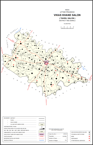
Salon is a town and nagar panchayat in Raebareli district in the Indian state of Uttar Pradesh. It serves as the headquarters of a tehsil as well as a community development block. Originally it was also the headquarters of the entire district, but they were moved after the Indian Rebellion of 1857. It is located a bit to the south of the Sai river, at the junction of the Raebareli-Pratapgarh and Jais-Khaga roads. Other roads lead to Dalmau, Manikpur, and Kunda. To the east is a large jhil.
Ratangarh is a town and a nagar parishad in Neemuch district in the Indian state of Madhya Pradesh.

Dewa Sharif or Dewa is a town and a nagar panchayat in Barabanki district in the state of Uttar Pradesh, India. It is famous for the shrine of Haji Waris Ali Shah. This town is also known by the name of Dewa Sharif in respect for the shrine. It is about 26 km north-east of the capital Lucknow.


 India
India