This article needs additional citations for verification .(August 2024) |
Chemora District | |
|---|---|
 | |
| Country | |
| Province | Batna Province |
| Time zone | UTC+1 (CET) |
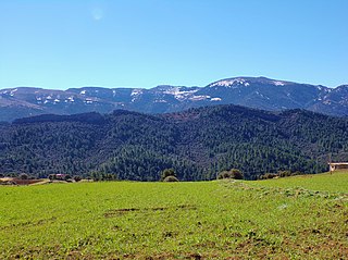
Chemora District is a district [ citation needed ] of Batna Province, Algeria. [1]
This article needs additional citations for verification .(August 2024) |
Chemora District | |
|---|---|
 | |
| Country | |
| Province | Batna Province |
| Time zone | UTC+1 (CET) |
Chemora District is a district [ citation needed ] of Batna Province, Algeria. [1]
The district is further divided into two municipalities.

USS Bogue (AVG/ACV/CVE/CVHE-9) was the lead ship in the Bogue class of escort carriers in the United States Navy during World War II. The ship was named for Bogue Sound in North Carolina.
This is a list of the extreme points of the United Kingdom: the points that are farther north, south, east or west than any other location. Traditionally the extent of the island of Great Britain has stretched "from Land's End to John o' Groats".

Aurès is a natural region located in the mountainous area of the Aurès range in eastern Algeria. The region includes the Algerian provinces of Batna, Tebessa, Constantine, Khenchela, Oum El Bouaghi, Souk Ahras and Biskra.

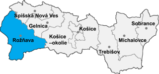
Drnava is a village and municipality in the Rožňava District in the Košice Region of eastern Slovakia.

Dogu'a Tembien is a woreda in Tigray Region, Ethiopia. It is named in part after the former province of Tembien. Nowadays, the mountainous district is part of the Southeastern Tigray Zone. The administrative centre of this woreda is Hagere Selam.
Khogyani is located 17 km northwest of Ghazni. It was the district center of the big Jaghatu district before the year 2005. Now it is the center of Khogyani District.

Chemora is a town in north-eastern Algeria.

The canton of Guillestre is an administrative division in the southeastern France. At the French canton reorganisation which came into effect in March 2015, the canton was expanded from 9 to 15 communes (two of which were merged into the new commune Abriès-Ristolas:
Zilban is a village in the Zaqatala Rayon of Azerbaijan. The village forms part of the municipality of Car.
Mathairaj is a village development committee in Baitadi District in the Mahakali Zone of western Nepal. At the time of the 2011 Nepal census it had a population of 3,004 and had 537 houses in the village.
El Ghabra is a town and commune in Mauritania.
Meossaare is a village in Türi Parish, Järva County in central Estonia.
Vaidavere is a village in Jõgeva Parish, Jõgeva County in eastern Estonia.
Petrovsky, Petrovskaya, or Petrovskoye is the name of various inhabited localities in Russia.

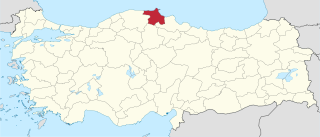
Sinop is an electoral district of the Grand National Assembly of Turkey. It elects two members of parliament (deputies) to represent the province of the same name for a four-year term by the D'Hondt method, a party-list proportional representation system.
Krasnaya Zarya is the name of several rural localities in Russia.
Kirovo is the name of several rural localities in Russia:
Hantutin is a Syrian village located in Maarrat al-Nu'man Nahiyah in Maarrat al-Nu'man District, Idlib. According to the Syria Central Bureau of Statistics (CBS), Hantutin had a population of 1420 in the 2004 census.
Hraki is a Syrian village located in Maarrat al-Nu'man Nahiyah in Maarrat al-Nu'man District, Idlib. According to the Syria Central Bureau of Statistics (CBS), Hraki had a population of 1467 in the 2004 census.
Qatra, Idlib is a Syrian village located in Sinjar Nahiyah in Maarrat al-Nu'man District, Idlib. According to the Syria Central Bureau of Statistics (CBS), Qatra, Idlib had a population of 357 in 2004.