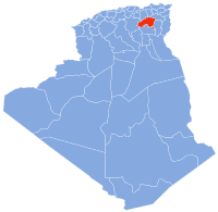
Castine is a village in Darke County, Ohio, United States. The population was 110 at the 2020 census.
Longkesh is a small village in County Antrim, Northern Ireland, near Lisburn. In the 2001 Census it had a population of 201 people. It is situated in the Lisburn City Council area.
Bearwallow Creek is a 4.3-mile-long (6.9 km) tributary stream of Tearcoat Creek, itself a tributary of the North River, making it a part of the Potomac River and Chesapeake Bay watersheds. Bearwallow Creek is located in Hampshire County, West Virginia. It rises on Chestnut Oak Ridge, from which it flows southwest along the ridge's eastern flanks and then begins its course southeast along Bear Wallow Hollow Road and U.S. Route 50 until its confluence with Tearcoat Creek at Pleasant Dale.

The Qadis District is located in the southern part of Badghis province, Afghanistan, between the districts Jawand in the east, Qala i Naw in the west, Muqur and Bala Murghab in the north. In the south is the Herat province. The capital is Qadis.

Dadal is a sum (district) of Khentii Province in eastern Mongolia. Dadal airfield, unpaved at Lat: 49.0124N, 111.509E, elevation 1024 m.
Bearpen Mountain is a mountain located in the Catskill Mountains of New York. The mountain's highest peak is in Greene County, but its northwest subpeak at 42°16.42′N74°29.05′W is the highest point in Delaware County at 3,520 ft. Bearpen Mountain is flanked to the north by Roundtop, and to the southeast by Vly Mountain.
Koski Duże is a village in the administrative district of Gmina Perlejewo, within Siemiatycze County, Podlaskie Voivodeship, in north-eastern Poland. It lies approximately 6 kilometres (4 mi) south-east of Perlejewo, 20 km (12 mi) north-west of Siemiatycze, and 75 km (47 mi) south-west of the regional capital Białystok.
Koski-Wypychy is a village in the administrative district of Gmina Perlejewo, within Siemiatycze County, Podlaskie Voivodeship, in north-eastern Poland.
Krasewicze-Jagiełki is a village in the administrative district of Gmina Siemiatycze, within Siemiatycze County, Podlaskie Voivodeship, in north-eastern Poland. It lies approximately 8 kilometres (5 mi) north-west of Siemiatycze and 75 km (47 mi) south of the regional capital Białystok.
Przyszów is a village in the administrative district of Gmina Bojanów, within Stalowa Wola County, Subcarpathian Voivodeship, in south-eastern Poland. It lies approximately 10 kilometres (6 mi) north of Bojanów, 12 km (7 mi) south of Stalowa Wola, and 50 km (31 mi) north of the regional capital Rzeszów.
Sava, Mauritania is a village and rural commune in Mauritania.
Ržanica is a village in the municipality of Aleksandrovac, Serbia. According to the 2002 census, the village has a population of 317 people.

Mala Kamenica is a village in the municipality of Negotin, Serbia. According to the 2002 census, the village has a population of 392 people.

Kärevere is a village in Tartu Parish, Tartu County in eastern Estonia. Prior to the 2017 administrative reform in Estonia of local governments, it was located in Laeva Parish.
Aïn Rahma is a town and commune in Relizane Province, Algeria.
Trubarevo is a village in the municipality of Ćićevac, Serbia. According to the 2002 census, the village has a population of 152 people.
Belasica is a village in the municipality of Kruševac, Serbia. According to the 2002 census, the village has a population of 402 people.
Zebica is a village in the municipality of Kruševac, Serbia. According to the 2002 census, the village has a population of 206 people.
Oriflamme Canyon is a steep mountain canyon, in San Diego County, California that descends from its head in the Laguna Mountains, at 32°56′41″N116°29′45″W, in an arc northwestward then northeastward to join Rodriguez Canyon at the northwest end of Mason Valley, where Vallecito Wash has its source.


