Ben Foudhala El Hakania

Last updated
Ben Foudhala El Hakania
بنى فضالة الحقانية
Dz - 05-32 Ben Foudhala El Hakania - Wilaya de Batna map.svg
Country Algeria
Province Batna
District Aïn Touta [1]
Area
  Total154 km2 (59 sq mi)
Population
 (2008 [2] )
  Total1,511
Time zone UTC+1 (West Africa Time)

Ben Foudhala El Hakania is a town in north-eastern Algeria.

Localities of the commune

The commune of Aïn Touta is composed of 15 localities: [3]

Related Research Articles

Aflou Commune and town in Laghouat Province, Algeria

Aflou is a town and commune in Laghouat Province, Algeria. It is located in the Amour Range of the Saharan Atlas, at an elevation of 1,426 m (4,678 ft), which makes it one of the highest towns in Algeria. Aflou is the capital of Aflou District. Its population in 1998 was 48,000.

Aïn Djasser Place in Batna, Algeria

Aïn Djasser is a town in north-eastern Algeria.

Aïn Touta Place in Batna, Algeria

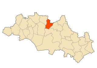
Aïn Touta is a town in eastern Algeria. It is located 35 km southwest of Batna and 82 km north of Biskra. It has an area of about five square kilometers.

El Hassi, Batna Place in Batna, Algeria

El Hassi is a town in north-eastern Algeria.

Maâfa Place in Batna, Algeria

Maafa, Algeria is a town in north-eastern Algeria.

Ouled Aouf Place in Batna, Algeria

Ouled Aouf is a town in north-eastern Algeria.

Aïn Djasser District District in Batna Province, Algeria

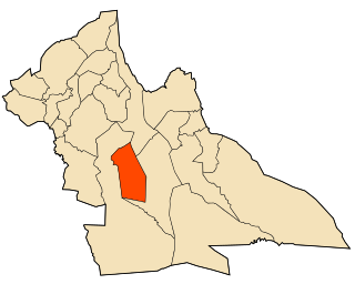
Aïn Djasser District is a district of Batna Province, Algeria.

Aïn Touta District District in Batna Province, Algeria

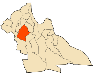
Aïn Touta District is a district of Batna Province, Algeria.

Ouled Ben Abdelkader District District in Chlef Province, Algeria

Ouled Ben Abdelkader District is a district of Chlef Province, Algeria.

El Karimia District District in Chlef Province, Algeria

El Karimia District is a district of Chlef Province, Algeria.

Reguiba District District in El Oued Province, Algeria

Reguiba District is a district of El Oued Province, Algeria. At the 2008 census, it had a population of 45,539.

El Ghicha District District in Laghouat Province, Algeria

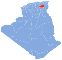
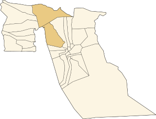
El Ghicha District is a district of Laghouat Province, Algeria.

Aïn Babouche District District in Oum El Bouaghi Province, Algeria

Aïn Babouche District is a district of Oum El Bouaghi Province, Algeria.

Sidi Akkacha Commune and town in Chlef Province, Algeria

Sidi Akkacha is a town and commune in Chlef Province, Algeria. According to the 1998 census, it had a population of 23,374.

El Assafia Commune and town in Laghouat Province, Algeria

El Assafia is a town and commune in Laghouat Province, Algeria. According to the 1998 census, it has a population of 4,389.

El Ghicha Commune and town in Laghouat Province, Algeria

El Ghicha is a town and commune in Laghouat Province, Algeria. According to the 1998 census, it has a population of 5,719.

El Houaita Commune and town in Laghouat Province, Algeria

El Houaita is a town and commune in Laghouat Province, Algeria. According to the 1998 census it has a population of 1,290.

Ksar El Hirane Commune and town in Laghouat Province, Algeria

Ksar El Hirane is a town and commune in Laghouat Province, Algeria. According to the 1998 census it has a population of 14,910.

Aïn Babouche Commune and town in Oum El Bouaghi Province, Algeria

Aïn Babouche is a town and commune in Oum El Bouaghi Province, Algeria. According to the 1998 census it has a population of 14,597.

Aïn Diss Commune and town in Oum El Bouaghi Province, Algeria

Aïn Diss is a town and commune in Oum El Bouaghi Province, Algeria. According to the 1998 census it has a population of 2741.

References

  1. "Décret executif n° 91-306 du 24 août 1991 fixant la liste des communes animées par chaque chef de daïra. 05 - Wilaya de Batna" [List of municipalities animated by each District chief: 05 - Batna Province](PDF) (in French). Journal officiel de la République Algérienne. 4 September 1991. p. 1295. Archived (PDF) from the original on 2019-11-06. Retrieved 2019-11-09.
  2. "Wilaya de Batna: répartition de la population résidente des ménages ordinaires et collectifs, selon la commune de résidence et la dispersion" (PDF) (in French). Archived (PDF) from the original on 2011-11-13. Retrieved 2019-11-09.. Data from the 2008 General Population and Housing Census on the site of the NOS Algeria.
  3. "Décret n° 84-365, fixant la composition, la consistance et les limites territoriale des communes. Wilaya de Batna" (PDF). Journal officiel de la République Algérienne (67): 1483. 19 December 1984. Retrieved 3 October 2019.

Coordinates: 35°21′09″N6°01′04″E / 35.35250°N 6.01778°E / 35.35250; 6.01778