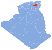
Batna Province is a province of Algeria, in the region of Aurès. The capital is Batna. Localities in this province include N'Gaous, Merouana and Timgad. Belezma National Park is in the Belezma Range area of the province.

Annaba, formerly known as Bon, Bona and Bône, is a seaport city in the northeastern corner of Algeria, close to the border with Tunisia. Annaba is near the small Seybouse River and is in the Annaba Province. With a population of about 464,740 (2019) and 1,000,000 for the metropolitan area, Annaba is the third-largest city and the leading industrial center in Algeria.

Bordj Bou ArréridjProvince is a province (wilaya) in northern Algeria around 200 km from the capital Algiers. It is considered as a crossroads between the east and west, the north and south.

Guelma Province is a province (wilaya) in eastern Algeria. Its namesake is its seat and most populous municipality: Guelma.

Souk Ahras is a province (wilaya) in the Aures region in Algeria, named after its capital, Souk Ahras. It stands on the border between Algeria and Tunisia. In 2008, Souk Ahras had a population of 440,299 people.

Bouïra is the capital of Bouïra Province, Algeria. The city is also called "Garanda" by the locals.

Oulad Rechache is a district in eastern Khenchela, Algeria. It is one of the oldest areas in this state in the Middle Algeria that emerged as a district in 1990. It is adjacent to the state capital, and includes two municipalities. This district is located in a border area between Khanshalah and Tebessa and was important in fight against France during the Algerian Revolution. It is one of the most important areas to maintain the Tamazight language comparing to the state capital, where use of Chaouïa is widely relevant in all aspects of daily life. [[

Aïn Touta is a town in eastern Algeria. It is located 35 km southwest of Batna and 82 km north of Biskra. It has an area of about five square kilometers.

Merouana is a city in Batna Province, Algeria. It is situated around 40 km from Batna City, and is inhabited by the Chaoui Berbers. Merouana is one of the oldest local daïras (districts). It is the capital of the Belzma Plain and Belzma National Park.

Ras El Aioun is a town in northeastern Algeria, within the Ras El Aioun District.

Ten Hamadi or Tenhemad is a village and rural commune in southern Mauritania, in the Aïoun El Atrouss department of the Hodh El Gharbi region. In 2000, the commune had a population of 2,264, of which 155 lived in the village of Ten Hamadi itself, approximately 17 kilometres (11 mi) southwest of the main town and departmental capital of Aïoun El Atrouss. The population estimate in 2007 was 3,686, spread over 16 villages.
Settat is a province of Morocco in the Casablanca-Settat Region. The province had a population of 956,904 people in 2004.
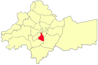
Ras El Oued District is a district in Bordj Bou Arréridj Province, Algeria.
Aïn El Berd is a commune (baladiyah) in the Aïn El Berd district (daïra) in the Sidi Bel Abbès province (wilayah) of Algeria. It is situated in the northwestern part of the country, in the Hauts Plateaux region, and has a typical Mediterranean climate. Established as an official commune on April 15, 1886, Aïn El Berd is known for its beautiful countryside views and sites, as well as for its vineyards, olive trees, and wheat products. During the French colonial era, the surrounding areas, then called Saint-Marc and Saint-Henri, gave wines of good quality, and in 1889 and 1900 won silver and gold medals, respectively.

Aïn Arnat is a town and commune in Sétif Province in north-eastern Algeria.

French Morocco had from 1912 to 1935 one of the largest 600 mm gauge network in Africa with a total length of more than 1,700 kilometres (1,100 mi). After the treaty of Algeciras where the representatives of Great Powers agreed not to build any 1,435 mm standard-gauge railway in Morocco until the standard-gauge Tangier–Fes railway being completed, the French begun to build military 600 mm gauge lines in their part of Morocco French Morocco.

Ain el Madiour is one of the communes on the outskirts of Taroudannt city in the Souss-Massa region in Morocco. It is located at an altitude of 214 meters above sea level and within 569 kilometers south-west of the Moroccan capital Rabat. It is characterized by abundant citrus groves and other plantations, as well as being a strategic location on the highway that links Taroudannt, the western and southern parts and the region's capital city, Agadir. Ain el Madiour is the administrative headquarters of the Greater Machraa El Ain's commune.

Oriental is one of the sixteen former regions of Morocco. It covers an area of 82,900 km2 and has a population of 1,918,094. The capital and largest city is Oujda, and the second largest city is Nador.

Aïn-Sbir is a location in Algeria. Aïn Sbir is the location of a spring in Algeria and is nearby to mount Djebel Sekoum, Koudiat Kaïda and mount Oulad Selem. Aïn Sbir is also close to Marabout Sidi Rakhal shirne, Chaba Tebb el Mra and Chaba Khouari. The nearest town is Ali Mendjeli.
Ras al-Ein is one of the 22 administrative sub-districts of the city of Amman, Jordan, as governed by the Greater Amman Municipality.