Related Research Articles

Dartmouth Dam is a large rock-fill embankment dam with an uncontrolled chute spillway across the Mitta Mitta, Gibbo, and Dart rivers, the Morass Creek and a number of small tributaries. The dam is located near Mount Bogong in the north-east of the Australian state of Victoria. The dam's purpose includes irrigation, the generation of hydro-electric power, water supply and conservation. The impounded reservoir is called Dartmouth Reservoir, sometimes called Lake Dartmouth. The Dartmouth Power Station, a hydro-electric power station that generates power to the national grid, is located near the dam wall.

The Dakelh or Carrier are the indigenous people of a large portion of the Central Interior of British Columbia, Canada.

Kitimat is a district municipality in the North Coast region of British Columbia, Canada. It is a member municipality of the Regional District of Kitimat–Stikine regional government. The Kitimat Valley is part of the most populous urban district in northwest British Columbia, which includes Terrace to the north along the Skeena River Valley. The city was planned and built by the Aluminum Company of Canada (Alcan) during the 1950s. Its post office was approved on June 6, 1952.

The Nechako River arises on the Nechako Plateau east of the Kitimat Ranges of the Coast Mountains of British Columbia, Canada, and flows north toward Fort Fraser, then east to Prince George where it enters the Fraser River. "Nechako" is an anglicization of netʃa koh, its name in the indigenous Carrier language which means "big river".

Copeton Dam is a major clay core and rock fill embankment dam with nine radial gates and a gated concrete chute spillway across the Gwydir River upstream of Bingara in the New England region of New South Wales, Australia. The dam's purpose includes environmental flows, hydro-electric power generation, irrigation, and water supply. The impounded reservoir is called Lake Copeton.

The Blowering Dam is a major ungated rock fill with clay core embankment dam with concrete chute spillway impounding a reservoir under the same name. It is located on the Tumut River upstream of Tumut in the Snowy Mountains region of New South Wales, Australia. Purposes for the dam include flood mitigation, hydro-power, irrigation, water supply and conservation. The dam is part of the Snowy Mountains Scheme, a vast hydroelectricity and irrigation complex constructed in south-east Australia between 1949 and 1974 and now run by Snowy Hydro.
Jindabyne Dam is a major ungated rockfill embankment dam across the Snowy River in the Snowy Mountains of New South Wales, Australia. The dam's main purpose is for the generation of hydro-power and is one of the sixteen major dams that comprise the Snowy Mountains Scheme, a vast hydroelectricity and irrigation complex constructed in south-east Australia between 1949 and 1974 and now run by Snowy Hydro.

The Grant Devine Dam, formally Alameda Dam, is an embankment dam located near Alameda, and Oxbow, Saskatchewan, Canada. It was constructed in 1994 to control flows on the Moose Mountain Creek, and Souris River. It provides flood protection and irrigation for this area of Saskatchewan, along with protection for Minot, North Dakota. The Grant Devine Reservoir provides opportunities for recreational use such as boating and fishing. At the full supply level of 562 metres (1,844 ft), the reservoir holds 105,000,000 cubic metres (3.7×10⁹ cu ft) of water. The project is owned and operated by the Saskatchewan Water Security Agency (formerly Saskatchewan Watershed Authority).
Kemano was a settlement situated 75 km (47 mi) southeast of Kitimat in the province of British Columbia in Canada. It was built to service a hydroelectric power station, built to provide energy for Alcan to smelt aluminum from its ore. The Kemano Generating Station is built 427 m (1,400 ft) inside the base of Mt Dubose in a blasted cavern. It produces 896 MW of power from its eight generators, each of which has a capacity of 112MW.
The Nechako Country, also referred to as the Nechako District or simply "the Nechako" is one of the historical geographic regions of the Canadian province of British Columbia, located southwest of the city of Prince George and south of Hwy 16 on the inland side of the Hazelton Mountains, and comprising the basin of the Nechako River and its tributaries. "Nechako" is an anglicization of netʃa koh, its name in the indigenous Carrier language which means "big river".
The Kenney Dam is a rock-fill embankment dam on the Nechako River in northwestern British Columbia, built in the early 1950s. The impoundment of water behind the dam forms the Nechako Reservoir, which is also commonly known as the Ootsa Lake Reservoir. The dam was constructed to power an aluminum smelter in Kitimat, British Columbia by Alcan, although in the late 1980s the company increased their economic activity by selling excess electricity across North America. The development of the dam caused various environmental problems along with the displacement of the Cheslatta T'En First Nation, whose traditional land was flooded.
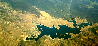
The Nechako Reservoir, sometimes called the Ootsa Lake Reservoir, is a hydroelectric reservoir in British Columbia, Canada that was formed by the Kenney Dam making a diversion of the Nechako River through a 16-km intake tunnel in the Kitimat Ranges of the Coast Mountains to the 890 MW Kemano Generating Station at sea level at Kemano to service the then-new Alcan aluminum smelter at Kitimat. When it was constructed on the Nechako River in 1952, it resulted in the relocation of over 75 families. It was one of the biggest reservoirs built in Canada until the completion of the Columbia Treaty Dams and the W.A.C. Bennett Dam that created Lake Williston. The water level may swing 10 feet between 2790 and 2800 feet.

The Sterkfontein Dam, located just outside the town of Harrismith, in the Free State, province of South Africa, is part of the Tugela-Vaal Water Project and the Drakensberg Pumped Storage Scheme, and located on the Nuwejaarspruit, a tributary of the Wilge River in the upper catchment area of the Vaal River. It is the second highest dam wall in South Africa and its highest earth fill dam.

The Kitimat River is a river in the Canadian province of British Columbia. It originates in the Kitimat Ranges, near the sources of the Dala River, Kemano River, Atna River, and Clore River. It flows in a curve north, then west, then south, emptying into Kitimat Arm at the head of Douglas Channel, at the town of Kitimat.
Knewstubb Lake is an arm or stretch of the Ootsa Lake Reservoir in the Nechako Country of the western Central Interior of British Columbia, Canada. It forms part of the south arm of the reservoir, which includes adjoining stretches such as Eutsuk Lake and Natalkuz Lake, which are "upstream" to the southwest. Ootsa Lake was formed by the damming and diversion of the flow of the Nechako River, the bulk of which is now drained beneath the spine of the Coast Mountains to the west to the Kemano Powerhouse, which is the power supply for the aluminum smelter at Kitimat, to the southeast of Terrace.

Toonumbar Dam is a minor ungated rock fill with clay core embankment dam with a concrete chute spillway across the Iron Pot Creek north-west of Casino in the Northern Rivers region of New South Wales, Australia. The dam's purpose includes hydro-power, irrigation, water supply, and conservation. The impounded reservoir is called Lake Toonumbar.
The Cheslatta Carrier Nation or Cheslatta T'En, of the Dakelh or Carrier people (Ta-cullies, meaning "people who go upon water", whose traditional lands where originally where the Kitimat Kemano Project I was built, form a large portion of the Central Interior of present-day British Columbia, Canada, is a First Nation of the Nechako River at the headwaters of the Fraser River.

Zengwen Dam, also spelled Tsengwen Dam, is a major earthen dam in Dapu Township, Chiayi County, Taiwan on the Zengwen River. It is the third tallest dam in Taiwan, and forms Zengwen Reservoir (曾文水庫), the biggest reservoir in Taiwan by volume. The dam stores water for irrigation of the Chianan Plain, Taiwan's most productive agricultural region, and provides flood control along the Zengwen River which flows through Tainan City. The dam supports a 50 megawatt hydroelectric power station.
Cheslatta Lake is a large freshwater lake located between François Lake and the western end of the Nechako Reservoir, Range 4 Coast Land District. It is in the Regional District of Bulkley-Nechako, British Columbia.
The Kemano Generating Station is situated 75 km (47 mi) southeast of Kitimat in the province of British Columbia, Canada. It was completed in 1954, providing hydroelectricity for Alcan's Kitimat Aluminum smelter. The powerhouse is built in a cavern created 427 m (1,400 ft) inside the base of Mt Dubose. It produces 896 MW of power from its eight generator units, each of which has a capacity of 112 MW. It was the largest producer in the province when it was built, and is now the fifth largest electrical plant in British Columbia.
References
- 1 2 Akrigg, G. P. V.; Akrigg, Helen B. (1997). British Columbia Place Names . UBC Press. p. 45. ISBN 978-0-7748-0637-4 . Retrieved 5 August 2013.
- 1 2 "Skins Lake". BC Geographical Names .
- 1 2 Elevation derived from ASTER Global Digital Elevation Model, using GeoLocator, and BCGNIS coordinates.
- ↑ "Cheslatta River". BC Geographical Names .
- 1 2 "Archived Hydrometric Data Search". Water Survey of Canada. Archived from the original on 24 December 2010. Retrieved 4 August 2013. Search for Station 08JA017 Nechako River below Cheslatta Falls. Note the Nechako River receives its entire flow from the Cheslatta River below Cheslatta Falls. Also note this gage began operating in 1981, long after Kenney Dam was built.
- ↑ "Cheslatta Falls". BC Geographical Names .
- 1 2 3 4 Wood, June (2007). Nechako Country: In the Footsteps of Bert Irvine. Heritage House Publishing Co. pp. 89–90. ISBN 978-1-894974-27-1 . Retrieved 5 August 2013.
- ↑ "Archived Hydrometric Data Search". Water Survey of Canada. Archived from the original on 24 December 2010. Retrieved 4 August 2013. Search for Station 08JA013 Skins Lake Spillway, Nechako Reservoir
- 1 2 3 Wood, June (2013). Home to the Nechako: The River and the Land. Heritage House Publishing Co. pp. 13, 40–47. ISBN 978-1-927527-13-9 . Retrieved 5 August 2013.
- 1 2 Beck, Janice (2010). Three Towns: A History of Kitimat. Trafford Publishing. pp. 55–59. ISBN 978-1-4269-8092-3 . Retrieved 5 August 2013.
- ↑ "About Rio Tinto Alcan in BC". Rio Tinto Alcan. Retrieved 4 August 2013.
- 1 2 3 "3.4 The Cheslatta T'en and the Kemano Hydro Project". Report of the Royal Commission on Aboriginal Peoples. Royal Commission on Aboriginal Peoples, Aboriginal Affairs and Northern Development Canada. 1996. Archived from the original on 25 November 2003. Retrieved 10 August 2013.
- 1 2 "Nechako River Geomorphic Assessment, Phase I" (PDF). BC Ministry of Water, Land and Air Protection. pp. 3, 10. Archived from the original (PDF) on 3 March 2016. Retrieved 4 August 2013.
- ↑ Mate, DJ; Levson, VM (2001). "Quaternary stratigraphy and history of the Ootsa Lake - Cheslatta River area, Nechako Plateau, central British Columbia". Canadian Journal of Earth Sciences. 38 (4): 751–765. doi:10.1139/e00-112. ISSN 0008-4077.