
The Chongwe River is a river in Zambia. [1] The river begins to the north east of the capital Lusaka, and alongside the larger Kafue River, drains into the Zambezi River. [2]
The Chongwe River is a river in Zambia. [1] The river begins to the north east of the capital Lusaka, and alongside the larger Kafue River, drains into the Zambezi River. [2]

Zambia, officially the Republic of Zambia, is a landlocked country at the crossroads of Central, Southern and East Africa, although it is typically referred to as being in Southern Africa at its most central point. Its neighbours are the Democratic Republic of the Congo to the north, Tanzania to the northeast, Malawi to the east, Mozambique to the southeast, Zimbabwe and Botswana to the south, Namibia to the southwest, and Angola to the west. The capital city of Zambia is Lusaka, located in the south-central part of Zambia. The nation's population of around 19.5 million is concentrated mainly around Lusaka in the south and the Copperbelt Province to the north, the core economic hubs of the country.

Western Province is one of the 10 provinces in Zambia and encompasses most of the area formerly known as Barotseland. The capital is Mongu, and together with the neighbouring town of Limulunga, Mongu is treated as the capital of Barotseland.

Livingstone is a city in Zambia. Until 1935, it served as the capital city of Zambia. Lying 10 km (6.2 mi) to the north of the Zambezi River, it is a tourism attraction center for the Victoria Falls and a border town with road and rail connections to Zimbabwe on the other side of the Victoria Falls. A historic British colonial city, its present population was enumerated at 134,349 inhabitants at the 2010 census. It is named after David Livingstone, the Scottish explorer and missionary who was the first European to explore the area.

The Great East Road is a major road in Zambia and the main route linking its Eastern Province with the rest of the country. It is also the major link between Zambia and Malawi and between Zambia and northern Mozambique. However, the route does not carry as much traffic as many of the other regional arterial roads and between the main cities it serves, Lusaka and Chipata, it passes through rural and wilderness areas. In Lusaka the road forms the main arterial road for the eastern suburbs. The entire route from Lusaka to Chipata and the Malawi Border Post is designated the T4 Road on Zambia's road network.

Lusaka Province is one of the ten provinces of Zambia. Its capital is Lusaka, which is also the national capital. It is the smallest province in Zambia, with an area of 21,896 km2. Lusaka is also Zambia's most populated and most densely populated province, with a population of 2,191,225 and density of 100 persons per km2 as of 2010. It is the most urban province, with the most doctors and fewest malaria-related incidents. The province is bordered by Zimbabwe and Mozambique, and separated by the Lower Zambezi National Park.

Southern Province is one of Zambia's ten provinces, and home to Zambia's premier tourist attraction, Mosi-oa-Tunya, shared with Zimbabwe. The centre of the province, the Southern Plateau, has the largest area of commercial farmland of any Zambian province, and produces most of the maize crop.

The ten provinces of Zambia are divided into a total of 116 districts as of 2018.

Kenneth Kaunda International Airport is an international airport located in Chongwe District, off the Great East Road, approximately 27 kilometres (17 mi) northeast of the city centre of Lusaka, the capital and largest city of Zambia. The airport has a capacity of 6 million and is the largest in Zambia, serving as a hub for its region. The airport serves as a hub for Zambia Airways, Proflight Zambia, Royal Zambian Airlines, and Mahogany Air.

Lusaka is the capital and largest city of Zambia. It is one of the fastest-developing cities in southern Africa. Lusaka is in the southern part of the central plateau at an elevation of about 1,279 metres (4,196 ft). As of 2019, the city's population was about 3.3 million, while the urban population is estimated at 2.5 million in 2018. Lusaka is the centre of both commerce and government in Zambia and connects to the country's four main highways heading north, south, east and west. English is the official language of the city administration, while Bemba, Tonga, Lenje, Soli, Lozi and Nyanja are the commonly spoken street languages.

Chongwe District is a district of Zambia, located in Lusaka Province. The capital lies at Chongwe. As of the 2000 Zambian Census, the district had a population of 137,461 people.

Luangwa District is a district of Zambia, located in Lusaka Province. As of the 2020 Zambian Census, the district had a population of 31,007 people.

Rufunsa District is a district in Zambia, located in Lusaka Province. The district capital is Rufunsa. The district was established by President Michael Sata in 2012 by splitting Chongwe District. It is estimated to have a population of about 45,000.
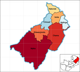
Muchinga Province is one of the ten provinces of Zambia. It is located in the northeast of the country and borders with Tanzania in the north, Malawi in the east, Eastern Province in the south, Central Province in the southwest, Luapula Province in the west, and Northern Province in the northwest. The administrative center of the province is Chinsali.

Esther Nyawa Lungu is a Zambian public figure who has held the position of the First Lady of Zambia from 25 January 2015 to 24 August 2021. She is the wife of the former Zambian president Edgar Lungu, with whom she has six children. Her parents were originally from the country's Eastern Province. She was raised Catholic, but she and her husband are now practicing Baptists.

Sylvia Masebo is a Zambian entrepreneur, politician and National Assembly of Zambia representative for Chongwe constituency with the United Party for National Development (UPND). Sylvia Masebo holds a degree in Banking and Finance. She first stood on the ticket of Zambian Republican Party (ZRP) in 2001, then the Movement for Multi-Party Democracy (MMD) in 2003, then the Patriotic Front (PF) in 2011 and then the UPND in 2021.

Sioma District is a district of Zambia, located in Western Province on the west bank of the Zambezi River. The capital lies at Sioma.

The T2 is a trunk road in Zambia. The road runs from the Tunduma border with Tanzania via Mpika, Kabwe and Lusaka to the Chirundu border with Zimbabwe. The road is the longest route of the country, as it is approximately 1,155 kilometres (718 mi). The route from Mpika to Kafue is a toll road. The route from Tanzania to Lusaka is Zambia's Great North Road.
The M10 Road is a Road in Zambia. It goes from Livingstone, through Sesheke, to Mongu. The Road is approximately 508 kilometres and follows the Zambezi River for its entire length.
Coordinates: 15°42′57″S29°20′22″E / 15.71583°S 29.33944°E