Claudelands

Last updated

Claudelands
Claudelands2.jpg
Claudelands, from Hamilton Central
Claudelands
Coordinates: 37°46′47″S175°16′55″E / 37.77973°S 175.28189°E / -37.77973; 175.28189
CountryNew Zealand
City Hamilton, New Zealand
Local authority Hamilton City Council
Electoral wardEast Ward
Established1912
Area
[1]
  Land282 ha (697 acres)
Population
 (June 2022) [2]
  Total7,030
River Road Fairfield Enderley
Hamilton Central
Pfeil oben.svg
Pfeil links.svgClaudelandsPfeil rechts.svg
Pfeil unten.svg
Hillcrest
Hamilton East

Claudelands is a suburb directly to the east of central Hamilton, New Zealand, across the Waikato River. It is linked to the central city by the Claudelands road bridge and the East Coast Main Trunk Railway bridge.

Contents

History

Miropiko , at River Road, in the north-west of Claudelands, [3] was occupied by Ngāti Wairere, Ngāti Hānui and Ngāti Koura. Following the 1864 invasion of the Waikato they moved to Gordonton [4] and the land was confiscated and sold by the government. [5]

Alfred William East, a captain with the 4th Waikato Regiment, was one of the original owners of Claudelands. East Street in the suburb is named for him. [6] [7] Francis Richard Claude was an early wealthy settler from South America who bought 400 ha (990 acres) [8] of parcels of mainly swampy land from the original soldier-settlers who were disgruntled with their land allocation. Claude subdivided most of it in 1878. An area of kahikatea forest was then cleared to create the racecourse. It was sold to the South Auckland Racing Club and then the Waikato A&P Association, who had their first show on 27 October 1892. Racing moved to Te Rapa Racecourse in 1925. [8]

The only piece of land in near original state is the 5 ha (12 acres) kahikatea forest, named Claudelands Bush, adjacent to Claudelands show grounds. Originally the ground in this area was swampy but artificial drainage has dried the soil. The roots of the trees are protected by an elevated walkway which is open to the public. The A&P Association gave it to the city council in 1928. [9]

Claudelands is one of Hamilton's oldest suburbs, with a large number of bay villas and bungalows dating from the late 19th and early 20th centuries. Although later development led to the construction of a large number of two-storey blocks of flats, the unique character of the area was deemed worthy of preservation by the Hamilton City Council. To this end, strict rules governing alteration, demolition and new development were introduced. [10]

Features of Claudelands

Claudelands is home to the Claudelands Showgrounds - original site of major agricultural shows and events in Hamilton, and a trotting and dog racing track. Since passing into council ownership, a large part of it (including the race track) has been converted into a large open park. The upgraded Claudelands Arena was opened in 2011. The Claudelands Event Centre hosted a mayoral debate in 2019. [11]

Claudelands is also home of one of Hamilton's oldest and most notable association football clubs, Claudelands Rovers.

Claudelands railway station

Claudelands had a railway station from 1884 to 1991. The station was between Brooklyn Rd and Claudelands Rd, [12] 1.23 km (0.76 mi) east of the old Hamilton station (1879-1969) and 3.94 km (2.45 mi) west of Ruakura [13] (1/10/1884-1/1/1967). [14]

In 2020 double tracking and potentially reopening the station for events, were put forward as a COVID-19 recovery scheme, as part of a $150m scheme to relay tracks to Cambridge. [15]

Demographics

Claudelands covers 2.82 km2 (1.09 sq mi) [1] and had an estimated population of 7,030 as of June 2022, [2] with a population density of 2,493 people per km2.

Historical population
YearPop.±% p.a.
20065,994    
20136,321+0.76%
20186,732+1.27%
Source: [16]

Claudelands had a population of 6,732 at the 2018 New Zealand census, an increase of 411 people (6.5%) since the 2013 census, and an increase of 738 people (12.3%) since the 2006 census. There were 2,478 households, comprising 3,405 males and 3,324 females, giving a sex ratio of 1.02 males per female, with 1,134 people (16.8%) aged under 15 years, 1,839 (27.3%) aged 15 to 29, 2,772 (41.2%) aged 30 to 64, and 987 (14.7%) aged 65 or older.

Ethnicities were 63.1% European/Pākehā, 20.5% Māori, 5.5% Pacific peoples, 20.5% Asian, and 4.5% other ethnicities. People may identify with more than one ethnicity.

The percentage of people born overseas was 30.9, compared with 27.1% nationally.

Although some people chose not to answer the census's question about religious affiliation, 41.5% had no religion, 36.3% were Christian, 1.7% had Māori religious beliefs, 6.4% were Hindu, 3.5% were Muslim, 1.0% were Buddhist and 4.2% had other religions.

Of those at least 15 years old, 1,659 (29.6%) people had a bachelor's or higher degree, and 762 (13.6%) people had no formal qualifications. 807 people (14.4%) earned over $70,000 compared to 17.2% nationally. The employment status of those at least 15 was that 2,643 (47.2%) people were employed full-time, 813 (14.5%) were part-time, and 279 (5.0%) were unemployed. [16]

Individual statistical areas
NameArea
(km2)
PopulationDensity
(per km2)
HouseholdsMedian ageMedian
income
Claudelands1.383,0572,2151,22132.8 years$29,600 [17]
Peachgrove1.443,6752,5521,25735.3 years$25,500 [18]
New Zealand37.4 years$31,800

The Index of Socioeconomic Deprivation, ranked 1-10 from lowest to most deprived areas, lists both Claudelands and Peachgrove at 8/10 (high deprivation) in 2013. [19]

Education

Peachgrove Intermediate is a state school for years 7 and 8 with a roll of 482. [20] The school opened in 1957. [21]

Patricia Avenue School is a state special school with a roll of 213. [22] It caters for students aged between 5 and 21 with intellectual disability. [23]

Southwell School is a private Anglican preparatory school (Year 1-8). It has a roll of 641. [24] The school was founded in 1911 and moved to its present site in 1921. [25]

All these schools are coeducational. Rolls are as of April 2023. [26]

See also

Related Research Articles

<span class="mw-page-title-main">Hamilton, New Zealand</span> City in North Island, New Zealand

Hamilton is an inland city in the North Island of New Zealand. Located on the banks of the Waikato River, it is the seat and most populous city of the Waikato region. With a territorial population of 179,900, it is the country's fourth most-populous city. Encompassing a land area of about 110 km2 (42 sq mi), Hamilton is part of the wider Hamilton Urban Area, which also encompasses the nearby towns of Ngāruawāhia, Te Awamutu and Cambridge. In 2020, Hamilton was awarded the title of most beautiful large city in New Zealand.

<span class="mw-page-title-main">South Waikato District</span> Territorial authority district in Waikato, New Zealand

South Waikato District is a local government district in the Waikato Region of the North Island of New Zealand. It is located between the cities of Hamilton to the north, Rotorua to the east, Taupo to the south and Ruapehu District to the west.

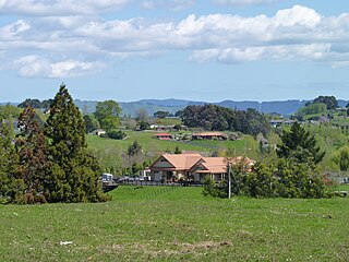
Ruakura is a semi-rural suburb of Hamilton City, in the Waikato region of New Zealand. The University of Waikato is nearby.

<span class="mw-page-title-main">Kawhia Harbour</span> Harbour and settlement in Waikato, New Zealand

Kawhia Harbour is one of three large natural inlets in the Tasman Sea coast of the Waikato region of New Zealand's North Island. It is located to the south of Raglan Harbour, Ruapuke and Aotea Harbour, 40 kilometres southwest of Hamilton. Kawhia is part of the Ōtorohanga District and is in the King Country. It has a high-tide area of 68 km2 (26 sq mi) and a low-tide area of 18 km2 (6.9 sq mi). Te Motu Island is located in the harbour.

<span class="mw-page-title-main">Frankton, Hamilton</span> Suburb of Hamilton, New Zealand

Frankton is a central suburb of the city of Hamilton, New Zealand. It is the site of the city's passenger railway station, a major industrial-commercial stretch of State Highway 1, and a commercial shopping area. Frankton Borough Council was formed in 1913, but merged with Hamilton in 1917, after a poll in 1916.

<span class="mw-page-title-main">Hamilton East, New Zealand</span> Suburb of Hamilton, New Zealand

Hamilton East is a suburb in central Hamilton in New Zealand. The suburb's primary commercial and retail precinct is located along Grey Street. Hamilton East is characterised by villas and bungalows built early in the 20th century.

<span class="mw-page-title-main">Hillcrest, Hamilton</span> Suburb of Hamilton, New Zealand

Hillcrest is a suburb in southeastern Hamilton in New Zealand. The suburb is home to the University of Waikato and consequently has a large student population. It is located on the east side of the Hamilton Town Belt, a series of public parks that run from the Hamilton Gardens to Ruakura in its eastern section.

<span class="mw-page-title-main">Forest Lake, New Zealand</span> Suburb of Hamilton, New Zealand

Forest Lake is a suburb of Hamilton in New Zealand and was added to from around the 1930s. It is centred around Forest Lake Road, which is used by around 10,000 vehicles a day.

<span class="mw-page-title-main">Rototuna</span> Suburb of Hamilton, New Zealand

Rototuna is a suburb in northern Hamilton, New Zealand, east of Flagstaff. It is one of the newest and fastest-growing suburbs in Hamilton, along with neighbouring Huntington and Flagstaff.

<span class="mw-page-title-main">Riverlea, New Zealand</span> Suburb of Hamilton, New Zealand

Riverlea is a suburb in south-eastern Hamilton in New Zealand. It is located south of Hillcrest. The suburb is primarily residential, with a small section of light industrial land along Riverlea Road.

<span class="mw-page-title-main">Enderley</span> Suburb of Hamilton, New Zealand

Enderley is a suburb of Hamilton, New Zealand. It became a part of Hamilton in the 5th boundary extension in 1949. It is the highest ranking suburb for socio-economic deprivation in eastern Hamilton.

<span class="mw-page-title-main">Crawshaw, New Zealand</span> Suburb of Hamilton, New Zealand

Crawshaw is a compact suburb, close to Te Rapa railway depot, in western Hamilton in New Zealand, and extended in the 2018 census to cover 0.86 km2. Although sometimes referred to as a suburb in its own right, it is often described as being part of Nawton.

<span class="mw-page-title-main">Pukete</span> Suburb of Hamilton, New Zealand

Pukete is a 1970s riverside suburb in northwestern Hamilton in New Zealand.

<span class="mw-page-title-main">Rotokauri</span> Suburb of Hamilton, New Zealand

Rotokauri is a semi-rural suburb split between western Hamilton and Waikato District in New Zealand. It is one of the future urban zones of Hamilton, along with Peacocke. The northeastern parts of Rotokauri, within Hamilton, are sometimes called Burbush and Baverstock. Part of Rotokauri was taken into Hamilton with the 10th city extension in November 1989. Until then it had been in the Waipa County Council area.

<span class="mw-page-title-main">Fairview Downs</span> Suburb of Hamilton, New Zealand

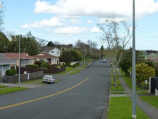
Fairview Downs is a suburb in eastern Hamilton in New Zealand.

<span class="mw-page-title-main">Peacocke, New Zealand</span> Suburb of Hamilton, New Zealand

Peacocke is a semi-rural suburb in southern Hamilton in New Zealand. Peacocke was brought into the city boundaries in 1989. It is one of the future urban zones of Hamilton, along with Rotokauri.

<span class="mw-page-title-main">Whitiora</span> Suburb of Hamilton, New Zealand

Whitiora is a suburb in central Hamilton in New Zealand. The suburb is home to Waikato Stadium, formerly Rugby Park. It is a major sporting and cultural events venue in Hamilton with a total capacity of 25,800. The stadium is a multi-purpose facility, though used mainly for rugby union. Many of Hamilton's hotels are in Whitiora, along the main road from the north.

<span class="mw-page-title-main">Whatawhata</span> Town in Waikato, New Zealand

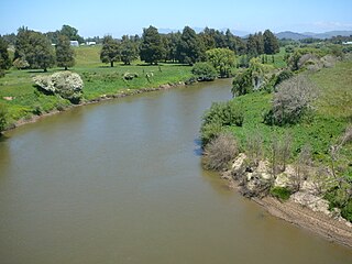
Whatawhata, previously also spelt Whata Whata, is a small town in the Waikato region on the east bank of the Waipā River, at the junction of State Highways 23 and 39, 12 km (7.5 mi) from Hamilton. Te Araroa tramping route passes through Whatawhata.

Matangi is a settlement in the Waikato District on the eastern border of Hamilton. It is surrounded by many lifestyle blocks, but the village centre has Matangi School, a garage, Four Square, takeaway and café, Matangi Hall, St David’s church and Matangi recreation reserve.

<span class="mw-page-title-main">River Road, Hamilton</span> Suburb of Hamilton, New Zealand

River Road is a residential suburb of Hamilton, sited on the eastern bank of the Waikato River. The namesake road runs from Claudelands Bridge north to Pukete Bridge and beyond, to Ngāruawāhia, but the main part of the suburb is between Boundary Road and Donny Park. Properties close to the river are much more expensive than those further away. Most of River Road was shown on an 1865 map, though it was some years later before it was built and, by 1866, only one bridge had been built.

References

  1. 1 2 "ArcGIS Web Application". statsnz.maps.arcgis.com. Retrieved 20 October 2022.
  2. 1 2 "Population estimate tables - NZ.Stat". Statistics New Zealand . Retrieved 25 October 2022.
  3. "Zoning Map 37A - Hamilton City Council". www.hamilton.govt.nz. Retrieved 29 October 2020.
  4. "MIROPIKO RESERVE MANAGEMENT PLAN" (PDF). Hamilton City Council. April 2001.
  5. "Confiscation map, 1869". teara.govt.nz. Retrieved 29 October 2020.
  6. "East Street". Kete Hamilton. Retrieved 16 December 2016.
  7. "East Street". Hamilton City Libraries. Retrieved 16 December 2016.
  8. 1 2 "Hamilton's Claudelands through the years". Stuff. Retrieved 2 May 2018.
  9. Patrick T. Whaley, Bruce D. Clarkson and Mark C. Smale (1997). "Claudelands Bush: Ecology of an Urban Kahikatea (Dacrycarpus Dacrydioides) Forest Remnant in Hamilton, New Zealand" (PDF).
  10. Taylor, Geoff (10 October 2009). "City plan aims to save old homes". Waikato Times . Fairfax New Zealand. Archived from the original on 12 August 2009. Retrieved 7 September 2010.
  11. Top four emerge from a crowded field during Hamilton mayoral debate
  12. Aerial photograph taken by Whites Aviation (4 April 1967). "Claudelands, Hamilton". Alexander Turnbull Library, Wellington.
  13. Yonge, John Roger; Company, Quail Map (1993). New Zealand Railway and Tramway Atlas. Quail Map Company. ISBN   9780900609923.
  14. Scoble, Juliet. "Names & Opening & Closing Dates of Railway Stations in New Zealand 1863 to 2010" (PDF). Rail Heritage Trust of New Zealand. Archived (PDF) from the original on 24 January 2018.
  15. "URBAN GROWTH PROGRAMME INITIATIVES" (PDF). Hamilton City Council. 3 April 2020.
  16. 1 2 "Statistical area 1 dataset for 2018 Census". Statistics New Zealand. March 2020. Claudelands (179300) and Peachgrove (179600).
  17. 2018 Census place summary: Claudelands
  18. 2018 Census place summary: Peachgrove
  19. "Index of Socioeconomic Deprivation for Areas within the Hamilton East Electorate". Parliament New Zealand. Retrieved 25 October 2020.
  20. Education Counts: Peachgrove Intermediate
  21. "Message from the Principal". Peachgrove Intermediate. Retrieved 25 October 2020.
  22. Education Counts: Patricia Avenue School
  23. "Welcome to the Patricia Avenue School website". Patricia Avenue School. Retrieved 25 October 2020.
  24. Education Counts: Southwell School
  25. "Our History". Southwell School. Retrieved 25 October 2020.
  26. "New Zealand Schools Directory". New Zealand Ministry of Education. Retrieved 12 December 2022.