Rototuna is a suburb in northern Hamilton, New Zealand, east of Flagstaff. It is one of the newest and fastest-growing suburbs in Hamilton, along with neighbouring Huntington and Flagstaff.

Western Heights is a suburb on the western boundary of the city of Hamilton in the Waikato region of the North Island of New Zealand.

Enderley is a suburb of Hamilton, New Zealand. It became a part of Hamilton in the 5th boundary extension in 1949. It is the highest ranking suburb for socio-economic deprivation in eastern Hamilton.

Crawshaw is a compact suburb, close to Te Rapa railway depot, in western Hamilton in New Zealand, and extended in the 2018 census to cover 0.86 km2. Although sometimes referred to as a suburb in its own right, it is often described as being part of Nawton.

Livingstone is a suburb in western Hamilton in New Zealand. J Livingstone, who the suburb is named after, owned and subdivided a large proportion of the area in 1916. The suburb became a part of Hamilton in 1962.

Pukete is a 1970s riverside suburb in northwestern Hamilton in New Zealand.
Stonebridge, also known as Stonebridge Estate, is a suburb close to the western boundary of Hamilton in New Zealand. It adjoins Dinsdale to the east and Western Heights to the north. The suburb was farmland until development began about 1996; a large farming operation still takes place in the land between sections today. The land is mainly rolling with a winding gully. Developers have modified the existing vegetation and landscape to create a series of ponds connected by a creek.
Thornton is a name sometimes used for part of a suburb in western Hamilton in New Zealand.
Fairview Downs is a suburb in eastern Hamilton in New Zealand.
Callum Brae is a suburb in north-eastern Hamilton in New Zealand.
Chedworth Park, also known simply as Chedworth, is a suburb in eastern Hamilton in New Zealand. It was defined as a suburb of Hamilton in 1974.

Harrowfield is a suburb in eastern Hamilton in New Zealand. It was built in about 1991.

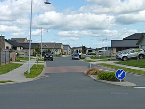
Magellan Rise is a new suburb in north-eastern Hamilton in New Zealand. In the 2018 census it is at the boundaries of Flagstaff North, East and South areas and is described by others as Flagstaff.

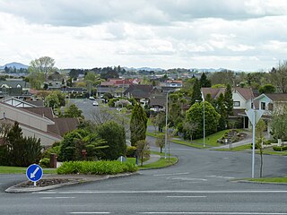
Somerset Heights is a suburb in north-eastern Hamilton in New Zealand, often known as Huntington, or Rototuna. The name Rototuna is also often used to include Grosvenor, Callum Brae, Huntington and St James. Somerset Heights forms part of Te Manatu census area.
St James Park is a name used for a suburb in north-eastern Hamilton in New Zealand by a 2010 map. It was developed by Chedworth/Grasshopper Joint Venture in 2001. In 2012 Hamilton Libraries described it as being in Huntington, as do some valuers and land agents. St James shopping area is in the centre of Rototuna, with a Countdown supermarket, a gym and a Palmers Garden Centre.

St Petersburg is a suburb in north-eastern Hamilton in New Zealand. In the 2013 census it was in meshblock 0951707, which was part of Sylvester area and had a population of 822 in 240 houses. In 2018 that meshblock was split into 4 meshblocks and is part of Flagstaff South. Others also describe it as part of Flagstaff.

Whitiora is a suburb in central Hamilton in New Zealand. The suburb is home to Waikato Stadium, formerly Rugby Park. It is a major sporting and cultural events venue in Hamilton with a total capacity of 25,800. The stadium is a multi-purpose facility, though used mainly for rugby union. Many of Hamilton's hotels are in Whitiora, along the main road from the north.
Hamilton City Council is the territorial authority for the New Zealand city of Hamilton.

Tararu is a former gold-mining village on the west coast of the Coromandel Peninsula of New Zealand. State Highway 25 runs through it; Te Puru being about 7 km (4.3 mi) to the north, and Thames about 2 km (1.2 mi) to the south.