
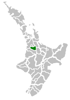
Hamilton is a city in the North Island of New Zealand. It is the seat and most populous city of the Waikato region, with a territorial population of 169,300, the country's fourth most-populous city. Encompassing a land area of about 110 km2 (42 sq mi) on the banks of the Waikato River, Hamilton is part of the wider Hamilton Urban Area, which also encompasses the nearby towns of Ngāruawāhia, Te Awamutu and Cambridge.
Waipa District is a municipality in the Waikato region of New Zealand that is administered by the Waipa District Council. Its most populous town is Cambridge. The seat of the council is at the second most populous town, Te Awamutu. The district is south and south-east of the city of Hamilton. It has five wards: Te Awamutu, Cambridge, Pirongia, Maungatautari and Kakepuku.
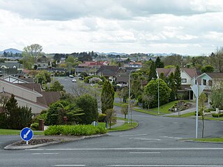
Ruakura is a semi-rural suburb of Hamilton City, in the Waikato region of New Zealand. The University of Waikato is nearby.

Hamilton East is a suburb in central Hamilton in New Zealand. The suburb's primary commercial and retail precinct is located along Grey Street. Hamilton East is characterised by villas and bungalows built early in the 20th century.

Flagstaff is a suburb in north-east Hamilton, New Zealand. It was originally called Dulverton on council plans, but it was officially named Flagstaff in 1986 when it was declared as a suburb. The area was heavily developed in the 1990s. The name "Flagstaff" comes from the flagstaff that was located on the hillock at the western end of Sylvester Road in the 1870s. A flag was raised by the local farmer when a steamer passed to alert the port authorities in the settlement 7 km further south. Flagstaff is connected to Pukete by a 5 m wide pedestrian bridge that connects with a series of walkways on both banks of the Waikato River. The suburb is served by a shopping centre with parks for 50 cars. It has 18 shops and a gym.

Crawshaw is a compact suburb, close to Te Rapa railway depot, in western Hamilton in New Zealand, and extended in the 2018 census to cover 0.86 km2. Although sometimes referred to as a suburb in its own right, it is often described as being part of Nawton.
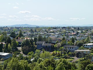
Dinsdale is the westernmost suburb of Hamilton in New Zealand. Originally called Frankton West, it was renamed in July 1961 after Thomas Dinsdale. Dinsdale grew rapidly in the 1960s. It is located around a low ridge with some views westward to open farm land. It has a large sports ground and shopping complex with a supermarket, shops and Dinsdale Library, one of the branches of the Hamilton City Libraries. The community church of West Hamilton is located in the suburb.

Livingstone is a suburb in western Hamilton in New Zealand. J Livingstone, who the suburb is named after, owned and subdivided a large proportion of the area in 1916. The suburb became a part of Hamilton in 1962.

Pukete is a 1970s riverside suburb in northwestern Hamilton in New Zealand.
Stonebridge, also known as Stonebridge Estate, is a suburb close to the western boundary of Hamilton in New Zealand. It adjoins Dinsdale to the east and Western Heights to the north. The suburb was farmland until development began about 1996; a large farming operation still takes place in the land between sections today. The land is mainly rolling with a winding gully. Developers have modified the existing vegetation and landscape to create a series of ponds connected by a creek.
Thornton is a name sometimes used for part of a suburb in western Hamilton in New Zealand.
Fairview Downs is a suburb in eastern Hamilton in New Zealand.

Ashmore is a name used for a suburb in north-eastern Hamilton in New Zealand by Hamilton City Council on its 2010 map and by the developer, CDL Land New Zealand Limited. It is more commonly described as being part of Rototuna North. It is in Rototuna Central census area.
Callum Brae is a suburb in north-eastern Hamilton in New Zealand.
Chedworth Park, also known simply as Chedworth, is a suburb in eastern Hamilton in New Zealand. It was defined as a suburb of Hamilton in 1974.

Harrowfield is a suburb in eastern Hamilton in New Zealand. It was built in about 1991.

Magellan Rise is a new suburb in north-eastern Hamilton in New Zealand. In the 2018 census it is at the boundaries of Flagstaff North, East and South areas and is described by others as Flagstaff.

Somerset Heights is a suburb in north-eastern Hamilton in New Zealand, often known as Huntington, or Rototuna. The name Rototuna is also often used to include Grosvenor, Callum Brae, Huntington and St James. Somerset Heights forms part of Te Manatu census area.
St James Park is a name used for a suburb in north-eastern Hamilton in New Zealand by a 2010 map. It was developed by Chedworth/Grasshopper Joint Venture in 2001. In 2012 Hamilton Libraries described it as being in Huntington, as do some valuers and land agents. St James shopping area is in the centre of Rototuna, with a Countdown supermarket, a gym and a Palmers Garden Centre.

St Petersburg is a suburb in north-eastern Hamilton in New Zealand. In the 2013 census it was in meshblock 0951707, which was part of Sylvester area and had a population of 822 in 240 houses. In 2018 that meshblock was split into 4 meshblocks and is part of Flagstaff South. Others also describe it as part of Flagstaff.
