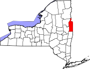
Cadyville is a hamlet in Clinton County, New York, United States. The community is located along the Saranac River and New York State Route 3 8.8 miles (14.2 km) west of Plattsburgh. Cadyville has a post office with ZIP code 12918, which opened on July 25, 1840.

Bakers Mills is a hamlet in Warren County, New York, United States. The community is located along New York State Route 8 28.5 miles (45.9 km) northwest of Glens Falls. Bakers Mills has a post office with ZIP code 12811.

Diamond Point is a hamlet in Warren County, New York, United States. The community is located along the western shore of Lake George and New York State Route 9N 3.9 miles (6.3 km) north-northeast of the village of Lake George. Diamond Point has a post office with ZIP code 12824, which opened on September 6, 1877.

Glenford is a hamlet in Ulster County, New York, United States. The community is located along New York State Route 28 8.5 miles (13.7 km) northwest of Kingston. Glenford has a post office with ZIP code 12433, which opened on September 14, 1886.

West Shokan is a hamlet in Ulster County, New York, United States. The community is located near New York State Route 28A and 15.2 miles (24.5 km) west of Kingston. West Shokan has a post office with ZIP code 12494.

Mongaup Valley is a hamlet in Sullivan County, New York, United States. The community is located along New York State Route 17B 5 miles (8.0 km) west of Monticello. Mongaup Valley has a post office with ZIP code 12762, which opened on June 22, 1848.

Sparrow Bush is a hamlet in Orange County, New York, United States. The community is located along New York State Route 42 and New York State Route 97 2.3 miles (3.7 km) northwest of Port Jervis. Sparrow Bush has a post office with ZIP code 12780.

Cossayuna is a hamlet in Washington County, New York, United States. The community is 7.4 miles (11.9 km) north-northeast of Greenwich. Cossayuna has a post office with ZIP code 12823.

Greenfield Center is a hamlet in Saratoga County, New York, United States. The community is located along New York State Route 9N 4.4 miles (7.1 km) northwest of Saratoga Springs. Greenfield Center has a post office with ZIP code 12833, which opened on February 16, 1831.

Middle Falls is a hamlet in Washington County, New York, United States. The community is located along New York State Route 29 1.5 miles (2.4 km) north-northwest of Greenwich. Middle Falls has a post office with ZIP code 12848, which opened on January 12, 1832.

Middle Granville is a hamlet in Washington County, New York, United States. The community is located at the intersection of New York State Route 22 and New York State Route 22A 2.1 miles (3.4 km) northwest of the village of Granville. Middle Granville has a post office with ZIP code 12849.

North Granville is a hamlet in Washington County, New York, United States. The community is located along New York State Route 22 5 miles (8.0 km) northwest of the village of Granville. North Granville has a post office with ZIP code 12854.

Putnam Station is a hamlet in Washington County, New York, United States. The community is located along southern Lake Champlain 12.4 miles (20.0 km) north of Whitehall. Putnam Station has a post office with ZIP code 12861, which opened on July 30, 1879.

Sabael is a hamlet in the town of Indian Lake, Hamilton County, New York, United States. The community is located along the western shore of Indian Lake and New York State Route 30 16.2 miles (26.1 km) north of Speculator. Sabael had a post office until March 9, 2013; it still has its own ZIP code, 12864.

Brainardsville is a hamlet in Franklin County, New York, United States. The community is located at the intersection of New York State Route 190 and New York State Route 374 5.3 miles (8.5 km) south-southeast of Chateaugay. Brainardsville has a post office with ZIP code 12915.

Childwold is a hamlet in St. Lawrence County, New York, United States. The community is located along New York State Route 3 10.8 miles (17.4 km) west-northwest of Tupper Lake. Childwold has a post office with ZIP code 12922.

Apulia Station is a hamlet in Onondaga County, New York, United States. The community is located along New York State Route 80 2.4 miles (3.9 km) northeast of Tully. Apulia Station has a post office with ZIP code 13020, which opened on August 17, 1861.

East Homer is a hamlet in Cortland County, New York, United States. The community is located along New York State Route 13 6 miles (9.7 km) northeast of Cortland. East Homer had a post office until June 17, 1995; it still has its own ZIP code, 13056.

Alder Creek is a hamlet in Oneida County, New York, United States. The community is located at the intersection of New York State Route 12 and New York State Route 28 6.9 miles (11.1 km) southeast of Boonville. Alder Creek has a post office with ZIP code 13301.

Limerick is a hamlet in Jefferson County, New York, United States. The community is located in the town of Brownville at the intersection of New York State Route 12E and New York State Route 180 1.5 miles (2.4 km) north of Dexter. Limerick had a post office until June 1, 1998; it still has its own ZIP code, 13657.


