Huletts Landing, New York

Last updated

Huletts Landing
USA New York location map.svg
Red pog.svg
Huletts Landing
Location within the state of New York
Coordinates: 43°38′21″N73°30′25″W / 43.63917°N 73.50694°W / 43.63917; -73.50694
Country United States
State New York
County Washington
Time zone UTC-5 (Eastern (EST))
  Summer (DST) UTC-4 (EDT)
ZIP code
12841 [1]
Area code 518

Huletts Landing is a hamlet in the town of Dresden in northern Washington County, New York, United States. [2] A lakeside community on the eastern shore of Lake George in the Adirondack Mountains, Huletts Landing is located entirely within the Adirondack Park. There is only one roadway access to the hamlet, County Route 6 and its suffixed routes, which head north–south. Huletts Landing is geographically located at 43°38′21″N73°30′25″W / 43.63917°N 73.50694°W / 43.63917; -73.50694 and has approximately two centuries of written history.

Contents

The hamlet derives its name from the Hulett family, which resided in the area for several generations after Revolutionary War soldier David Hulett moved near the lakeside and began farming. In 1874 his descendant Philander Hulett built a boat landing, a general store, and a post office. This opened the scenic corner of the lake to steamship traffic and tourism. This suffered a major setback in 1915 when the hamlet's largest hotel burned to its foundation, but tourism remained an important factor to the local economy. The town (Dresden) population, not Huletts Landing, is 695, according to 2007 U.S. Census Bureau estimates. [3]

Huletts seen from Burgess Island in the autumn LgFall2007 1.jpg
Huletts seen from Burgess Island in the autumn

History

The Hulett family appears to have been of French origin and came to North America to avoid religious persecution for their Huguenot beliefs. [4] David Hulett, the founder of Huletts Landing, was born in Killingly, Connecticut c. 17581762 and served as a private under General James Wadsworth during the American Revolution. For three years, the unit where Pvt. Hulett served fought mainly in upstate New York. [4] Oral history asserts that David Hulett fought heroically at the Battle of Saratoga, where he refused to leave the field despite an injury to his neck. [4] The Hulett family settled near Lake George c. 1804, possibly because of a land grant offered to veterans in lieu of wages for service. [4] Along with Bolton, New York and Putnam, New York, Hulett's Landing is one of three place names on Lake George relating with Wadsworth's Connecticut brigade. [4]

Hulett House hotel, 1907. Huletts Landing pre-fire.jpg
Hulett House hotel, 1907.

Until 1874 the Huletts Landing area was known as Bosom Bay. [4] Successive generations of the Hulett family lived by farming the area until Philander Hulett began to develop the area in the 1870s by building a steamship landing and submitting an application to build a post office. [5] The post office application is the earliest document to use the Huletts Landing name. [5] The existing Lake George Steamboat Company, which delivered mail as well as passengers, probably required either a post office or a tourism facility in order to justify adding a new stop to its schedule. [5] An influential travelogue by Rev. William Henry Harrison Murray was published in 1868 and praised the Adirondacks for the relaxing effects of its picturesque wilderness. [6] The first railroad service into the region was also built in the 1870s. [6] The application received approval and Philander Hulett built the post office shortly afterward, housed in the same building as the community's first store. [5] He served as postmaster until his death in 1883, but sold his property. [5]

A 1903 travel advertisement for Huletts Landing. Huletts Ad.jpg
A 1903 travel advertisement for Huletts Landing.

According to George T. Kapusinski in his history of the area:

Part of Philander Hulett’s property would be sold to businessman John W. Hall, but the bulk of the real estate would pass first to C.W. Wentz, an executive with the Delaware and Hudson Railroad, next to entrepreneur Henry W. Buckell, and finally by the early part of the 20th century to William H. Wyatt, an owner of hotels. All of these successive owners saw their first and primary role as marketing the property as a tourist attraction. [7]

The first Lakeside Inn was constructed for John W. Hall in 18771878 on a 1 acre (0.0040 km2) lot. [7] Although the only direct access to Huletts Landing was by ferry, a combination of train, coach, and ferry was normal for Adirondack vacationers of the period. [6] [7] Huletts Hotel grew from expansions on the original farmhouse until a fire destroyed it on 14 November 1915. [7] It was hastily rebuilt for the 1916 tourist season, but questions of arson arose, and led to trial. [8] Tourism has continued to be a mainstay of the community's economy. Adirondack Park was originally established in 1892. [6] In 1931, an eastward expansion brought Lake George and its communities within park boundaries. [6]

Geography

Sign depicting the entrance to Huletts Landing on CR 6 Sign entering Huletts Landing edited.jpg
Sign depicting the entrance to Huletts Landing on CR 6

Huletts Landing is located at coordinates 43°23′N73°18′W / 43.38°N 73.30°W / 43.38; -73.30 . It is located on the northern shore of Lake George, which is a 32-mile (51 km) lake in the Adirondacks. Huletts Landing is entirely situated within the Adirondack Park, which is the largest state park in the United States. [6] [9] Nearly two-thirds of the property within the park's formal range is privately owned with various land use restrictions. [6]

The climate of Huletts Landing is diverse. On average, the coolest month is January, while the warmest is July. The highest monthly precipitation in the area, on average, occurs in August. The lowest recorded temperature was −38 °F (−39 °C) in 1979, while the highest was 103 °F (39 °C) in 1953. [10]

Transportation

Huletts Landing is a remote hamlet, accessible by car only via Washington County Route 6, which branches off of nearby New York State Route 22. The main road is known as Huletts Landing Road, and spawns two suffixed routes which reach different parts of Huletts Landing. The first is County Route 6A, which is better known as Lands End Road, heads southward while the other, County Route 6B, which is better known as Bluff Head Road, brings the traveler northward, to locations such as Washington County Park and Huletts Landing Marina. [11] Huletts Landing County Park is also on CR 6B. [12]

The airport at Burlington, Vermont is approximately a one-hour drive from the eastern section of Adirondack Park, where Huletts Landing is located. [13] A smaller airport within Adirondack Park is Adirondack Regional Airport in Saranac Lake. [13]

Tourism

The area sees most of its tourism during the summer and the fall foliage season, virtually shutting down in winter. [13] Nearby attractions include lake cruises, canoeing, golf, and hiking. [13] Historic attractions of Huletts Landing also included hunting and local proprietors of the late nineteenth and early twentieth centuries provided weekly fireworks displays during tourist season. [4]

Related Research Articles

<span class="mw-page-title-main">Washington County, New York</span> County in New York

Washington County is a county in the U.S. state of New York. As of the 2020 census, the population was 61,302. The county seat is Fort Edward. The county was named for U.S. President George Washington.

<span class="mw-page-title-main">Warren County, New York</span> County in New York, United States

Warren County is a county in the U.S. state of New York. As of the 2020 census, the population was 65,737. The county seat is Queensbury. The county was established in 1813 and is named in honor of General Joseph Warren, an American Revolutionary War hero of the Battle of Bunker Hill.

<span class="mw-page-title-main">Summerhill, New York</span> Town in New York, United States

Summerhill is a town in Cayuga County, New York, United States. The population was 1,217 at the 2010 census. The town name is that of a location in Ireland. Summerhill is in the southeastern corner of the county and is northeast of Ithaca.

<span class="mw-page-title-main">Schroon, New York</span> Town in New York, United States

Schroon is a town in the Adirondack Park, in Essex County, New York, United States. The population was 1,880 at the 2020 census. The largest community in town is the hamlet of Schroon Lake, located at the northern end of the lake of the same name.

<span class="mw-page-title-main">Carlton, New York</span> Town in New York, United States

Carlton is a town in Orleans County, New York, United States. The population was 2,994 at the 2010 census. The name is derived from Carleton, a shipbuilding district near Ottawa, Ontario, Canada.

<span class="mw-page-title-main">Lake Luzerne, New York</span> Town in New York, United States

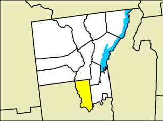
Lake Luzerne, formerly the Town of Fairfield and then Luzerne, is a town in southern Warren County, New York, United States. The town is located within the Adirondack Park. The town is part of the Glens Falls Metropolitan Statistical Area. Lake Luzerne is west of the city of Glens Falls. The town population was 3,079 at the 2020 census.

<span class="mw-page-title-main">Dresden, Washington County, New York</span> Town in New York, United States

Dresden is a town in northern Washington County, New York, United States. It is part of the Glens Falls Metropolitan Statistical Area. The town population was 677 at the 2000 census.

<span class="mw-page-title-main">North Pole, New York</span> Hamlet in the United States

North Pole is a small hamlet located in the town of Wilmington within Essex County, New York, United States, in the Adirondack Mountains.

<span class="mw-page-title-main">Bolton Landing, New York</span> Hamlet & CDP in New York, United States

Bolton Landing is a hamlet and census-designated places in the town of Bolton in Warren County, New York. It is located on Lake George in the Adirondack Mountains. It is a common tourist destination and the closest town to the State Park lands and islands of the Lake George Narrows. The hamlet's most notable structure is The Sagamore Hotel, a renovated Victorian-era hotel.

<span class="mw-page-title-main">New York State Route 9N</span> Highway in New York, USA

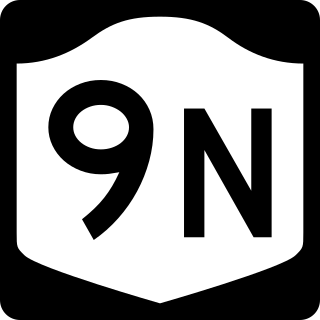
New York State Route 9N (NY 9N) is a north–south state highway in northeastern New York in the United States. It extends from an intersection with U.S. Route 9 (US 9), NY 29, and NY 50 in the city of Saratoga Springs to a junction with US 9 and NY 22 in the Clinton County hamlet of Keeseville. At 143.49 miles (230.92 km) in total length, NY 9N is the longest letter-suffixed route in the state. It is concurrent with its parent route for 1 mile (1.6 km) in the village of Lake George and for three blocks in the hamlet of Elizabethtown.

<span class="mw-page-title-main">State Route 74 (New York–Vermont)</span> Highway in Vermont and New York

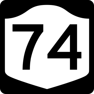
New York State Route 74 (NY 74) and Vermont Route 74 (VT 74) are state highways in the northeastern United States, connected by one of the last remaining cable ferries in North America. Together they extend for 34 miles (55 km) through Essex County, New York, and Addison County, Vermont. NY 74 begins at exit 28 off Interstate 87 (I-87) in the hamlet of Severance in the Adirondack Mountains region of the northern part of New York State. It extends 20.44 miles (32.89 km) to the western shore of Lake Champlain in Ticonderoga. There, the seasonal Fort Ticonderoga–Larrabees Point Ferry carries cars across the state border into Vermont, where VT 74 starts at the lake's eastern shore and terminates 13.26 miles (21.34 km) later at a junction with VT 30 in the town of Cornwall.

<span class="mw-page-title-main">New York State Route 309</span> State highway entirely in Fulton County, New York

New York State Route 309 (NY 309) is a 6.56-mile-long (10.56 km) state highway located entirely in Fulton County, New York, in the United States. The southern terminus of the route is at an intersection with NY 29A in Gloversville. The northern terminus of the route is at a junction with Lily Lake Road in the hamlet of Bleecker, where the highway continues north and west as County Route 112 (CR 112) to London Bridge Road at West Caroga Lake in the town of Caroga. Part of NY 309 and all of CR 112 is located within Adirondack Park. NY 309 was assigned to its current alignment as part of the 1930 renumbering of state highways in New York.

<span class="mw-page-title-main">New York State Route 29A</span> Highway in New York

New York State Route 29A (NY 29A) is a state highway in the western portion of the Capital District of New York in the United States. The western terminus of the route is at an intersection with NY 29 in the Herkimer County hamlet of Salisbury Center. Its eastern end is at another junction with NY 29 about 36 miles (58 km) to the east near the Fulton County hamlet of Vail Mills. NY 29A enters Gloversville via Rose Street and continues through downtown on Fulton Street.

<span class="mw-page-title-main">New York State Route 86</span> State highway in New York, US

New York State Route 86 (NY 86) is a 39.11-mile (62.94 km) long state highway located within Adirondack Park in northern New York, in the United States, linking Franklin County to Essex County. The western terminus of the route is at NY 30 in the hamlet of Paul Smiths. The eastern terminus is at NY 9N in Jay. Although largely a two-lane road, NY 86 is one of only two east–west highways in the High Peaks area of the Adirondack Park, providing a major link between hamlets and tourist destinations.

<span class="mw-page-title-main">New York State Route 191</span> Highway in New York

New York State Route 191 (NY 191) was a 6.24-mile (10.04 km) long state highway located north of Adirondack Park. The route was maintained and co-designated by the Clinton County highway department as County Route 23 (CR 23) and headed from an intersection with NY 22 in the hamlet of Sciota within the town of Chazy to a junction with U.S. Route 9 (US 9) in the hamlet of Chazy. The route met Interstate 87 west of Chazy hamlet.

<span class="mw-page-title-main">New York State Route 28N</span> Highway in New York

New York State Route 28N (NY 28N) is an east–west state highway in the North Country of New York in the United States. It extends for 50.95 miles (82.00 km) through the Adirondack Mountains from Blue Mountain Lake to North Creek. The route is a northerly alternate route to NY 28 between both locations; as such, it passes through several communities that NY 28 bypasses to the south. The westernmost 10 miles (16 km) of NY 28N overlap with NY 30 through the town of Long Lake. NY 28N and NY 30 split in the hamlet of Long Lake, from where NY 30 heads to the north and NY 28N proceeds eastward through mountainous regions of Adirondack Park.

<span class="mw-page-title-main">New York State Route 58</span> State highway in New York, US

New York State Route 58 (NY 58) is a north–south state highway located in St. Lawrence County, New York, in the United States. The highway runs in a northwest to southeast direction as it traverses the county. The southern terminus of the route is at a junction with NY 3 in the hamlet of Fine within the town of the same name. Its northern terminus is at an intersection with NY 37 near the St. Lawrence River in the hamlet of Morristown. Part of NY 58 passes through the Adirondack Mountains.

<span class="mw-page-title-main">New York State Route 99</span> Former state highway in New York

New York State Route 99 (NY 99) was a state highway in Franklin County. The western terminus of the route was at an intersection with NY 30 in Duane. Its eastern terminus was at a junction with NY 3 near the Franklin community of Merrillsville. The narrow, winding route passed through isolated and heavily wooded areas of Adirondack Park. NY 99 was known as the Port Kent–Hopkinton Turnpike and maintained by Franklin County as a county highway. The state highway had been co-designated, and is signed today solely as County Route 26 (CR 26).

Black Mountain is a mountain located in Washington County, New York, of which its peak is the highest point. Isolated from the rest of the Adirondack Mountains by Lake George, Black Mtn. has the seventh highest topographic prominence of all the mountains in New York. Black Mountain also has the highest elevation of any of the peaks which surround Lake George and offers unobstructed views of the lake from its summit.

<span class="mw-page-title-main">New York State Route 373</span> State highway in Essex County, New York, US

New York State Route 373 (NY 373) is a short state highway in Essex County, New York, within Adirondack Park. It begins at U.S. Route 9 (US 9) and proceeds eastward, ending at a ferry landing on Lake Champlain. It intersects two county routes, several local roads, and a reference route—NY 912T—which connects it with US 9. NY 373 is the only connector between US 9 and the hamlet of Port Kent and the ferry that serves it.

References

  1. "Huletts Landing ZIP Code". zipdatamaps.com. 2022. Retrieved November 11, 2022.
  2. "Washington County, New York map" (Map). I Love New York. Washington County, New York. 2008.
  3. Dresden town, New York population (Map). U.S. Census Bureau. 2007. Archived from the original on February 10, 2020. Retrieved September 24, 2008.
  4. 1 2 3 4 5 6 7 George T. Kapusinski (2008). Huletts Landing on Lake George. Arcadia Publishing. pp. 9–14. ISBN   978-0-7385-5747-2 . Retrieved September 20, 2008.
  5. 1 2 3 4 5 George T. Kapusinski (2008). Huletts Landing on Lake George. Arcadia Publishing. pp. 15–20. ISBN   9780738557472 . Retrieved September 20, 2008.
  6. 1 2 3 4 5 6 7 Harvey H. Kaiser (2003). Great Camps of the Adirondacks. David R. Godine Publisher. pp. 9–14, 25. ISBN   9781567920734 . Retrieved September 25, 2008.
  7. 1 2 3 4 George T. Kapusinski (2008). Huletts Landing on Lake George. Arcadia Publishing. pp. 21–31. ISBN   9780738557472 . Retrieved September 20, 2008.
  8. George T. Kapusinski (2008). Huletts Landing on Lake George. Arcadia Publishing. pp. 35–36. ISBN   9780738557472 . Retrieved September 20, 2008.
  9. Overview map of Huletts Landing, New York (Map). Cartography by NAVTEQ Incorporated. Google Maps. 2008. Retrieved September 23, 2008.
  10. "Average Weather for Huletts Landing, New York". The Weather Channel. 2008. Retrieved November 1, 2008.
  11. Overview map of Huletts Landing, New York (Map). Cartography by NAVTEQ Incorporated. Yahoo Maps. 2008. Retrieved September 20, 2008.
  12. "Data Book" (PDF). Washington County, New York. 2008. Archived from the original (PDF) on August 16, 2010. Retrieved September 20, 2008.
  13. 1 2 3 4 Neil Edward Schlecht; Rich Beattie; Brian Silverman (2007). Frommer's New York State3rd Edition. Frommer's. pp. 364–365. ISBN   9780470258323 . Retrieved September 25, 2008.

43°38′21″N73°30′25″W / 43.63917°N 73.50694°W / 43.63917; -73.50694