Codrington, Antigua and Barbuda

Last updated
Codrington
City
Antigua and Barbuda location map.svg
Red pog.svg
Codrington
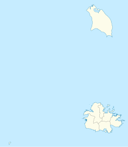
Coordinates: 17°38′N61°50′W / 17.633°N 61.833°W / 17.633; -61.833 Coordinates: 17°38′N61°50′W / 17.633°N 61.833°W / 17.633; -61.833
Country Antigua and Barbuda
Island Barbuda
Elevation
6 m (20 ft)
Population
 (1991)
  Total1,252
Time zone UTC-4 (AST)

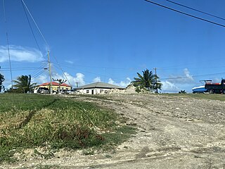
Codrington is a town located on the island of Barbuda, which is part of the country of Antigua and Barbuda. For travelers and visitors, Codrington is served by Barbuda Codrington Airport.

Contents

History

Codrington was founded by Christopher Codrington and his brother John in 1685, [1] to be the main residential centre on the island. They built a castle which dominated the town, but it was badly damaged by an earthquake in 1843 and little trace of it now remains. It had a population of 914 in 2001.

In 1741, the first slave rebellion happened in Codrington. Beach's Rebellion arose as a consequence of manager Thomas Beach's "cruel and tyrannical" behaviour. Several herds of cattle were slaughtered, with additional damage being done to the Codrington's[ clarification needed ] property and equipment.

The population of Codrington was recorded as 700 in the census of 1904, and 1,252 in the census of 1991. The town, along with the rest of the island, was completely evacuated in September 2017 following catastrophic damage caused by Hurricane Irma, but much of the population has now returned to the island. [2]

Hurricane Irma

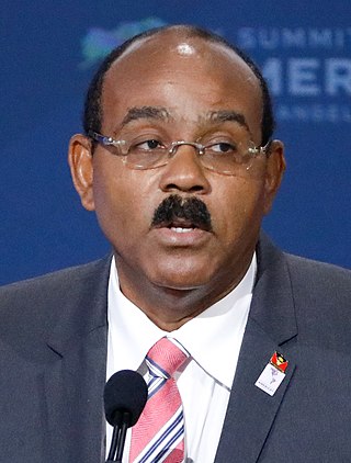
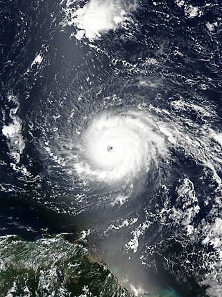
On 6 September 2017, Hurricane Irma, at Category 5, swept through the town. Prime Minister Gaston Browne stated that there had been damage to 95% of the structures on the small island and that he was "of the view that the island [Barbuda] is barely habitable". [3] As of October 2017 residents were coming back to Codrington and beginning the effort to rebuild. [4]

Demographics (2011)

The town has a Living Condition Index (unmet basic needs index) of 14.05 and an unemployment rate of 6.58. [5] The Antigua & Barbuda Statistics Department classifies the city as "Urban".

There are three Enumeration Districts "EDs". [6]

Ethnic Data for Codrington, Antigua and Barbuda [7]
EthnicityCount%
African descendent74193.09%
Mixed (Black/White)384.74%
Mixed (Other)101.28%
Hispanic20.26%
Syrian/Lebanese20.26%
Caucasian/White10.13%
Other10.13%
Don't know/Not stated10.13%
Country of Birth Data for Codrington, Antigua and Barbuda [7]
Q58. Country of birthCounts%
Other Latin or North American countries10.13%
Antigua and Barbuda 70388.35%
Other Caribbean countries20.26%
Canada 20.26%
Other European countries10.13%
Dominica 111.41%
Dominican Republic 20.26%
Guyana 212.69%
Jamaica 91.15%
Montserrat 40.51%
Saint Kitts and Nevis 50.64%
Saint Lucia 10.13%
Saint Vincent and the Grenadines 50.64%
Syria 20.26%
United Kingdom 20.26%
United States 121.54%
United States Virgin Islands (USVI)91.15%
Not Stated20.26%
Total796100.00%
Country of Citizenship for Codrington, Antigua and Barbuda [7]
Q71 Country of Citizenship 1Counts%
Antigua and Barbuda72491.04%
Other Caribbean countries40.51%
Canada20.26%
Other Asian and Middle Eastern countries10.13%
Dominica70.90%
Dominican Republic20.26%
Guyana202.56%
Jamaica70.90%
Monsterrat30.38%
St. Lucia10.13%
St. Vincent and the Grenadines30.38%
United Kingdom10.13%
USA162.05%
Other countries20.26%
Not Stated10.13%
Total796100.00%
Country of Second Citizenship for Codrington, Antigua and Barbuda [7]
Country of Second CitizenshipCounts%
Other Caribbean countries119.57%
Canada1513.04%
Other Asian and Middle Eastern countries10.87%
Dominica119.57%
Dominican Republic10.87%
Guyana65.22%
Jamaica54.35%
Monsterrat21.74%
St. Vincent and the Grenadines43.48%
United Kingdom2320.00%
USA3529.57%
Other countries21.74%
Total117100.00%
Religious Data for Codrington, Antigua and Barbuda [7]
Q49 ReligionCounts%
Adventist729.10%
Anglican16020.13%
Baptist9011.28%
Church of God30.38%
Evangelical10.13%
Jehovah Witness60.77%
Methodist50.64%
Moravian20.26%
Nazarene20.26%
None/no religion364.49%
Pentecostal15920.00%
Rastafarian222.82%
Roman Catholic111.41%
Weslyan Holiness17822.44%
Other313.85%
Don't know/Not stated162.05%
Total795100.00%

Related Research Articles

<span class="mw-page-title-main">Antigua and Barbuda</span> Country in the Lesser Antilles of the West Indies

Antigua and Barbuda is a sovereign island country in the West Indies. It lies at the juncture of the Caribbean Sea and the Atlantic Ocean in the Leeward Islands part of the Lesser Antilles, at 17°N latitude.

<span class="mw-page-title-main">Barbuda</span> Island in Antigua and Barbuda

Barbuda is an island located in the eastern Caribbean forming part of the sovereign state of Antigua and Barbuda. It is located north of the island of Antigua and is part of the Leeward Islands of the West Indies. The island is a popular tourist destination because of its moderate climate and coastline.

<span class="mw-page-title-main">Saint Philip, Antigua and Barbuda</span> Parish in Antigua and Barbuda

Saint Philip is a civil parish of Antigua and Barbuda, on northeastern Antigua island. It had a population of 3,347 in 2011, which makes it the least populous parish of Antigua and Barbuda.
<span class="mw-page-title-main">Saint Peter, Antigua and Barbuda</span> Parish in Antigua and Barbuda

Saint Peter is a civil parish of Antigua and Barbuda, located on northeastern Antigua island. It had a population of 5,325 in 2011.

<span class="mw-page-title-main">Antigua</span> Island in Antigua and Barbuda

Antigua, also known as Waladli or Wadadli by the native population, is an island in the Lesser Antilles. It is one of the Leeward Islands in the Caribbean region and the most populous island of the country of Antigua and Barbuda. Antigua and Barbuda became an independent state within the Commonwealth of Nations on 1 November 1981.

<span class="mw-page-title-main">All Saints, Antigua and Barbuda</span> Village in Antigua, Antigua and Barbuda

All Saints is the second largest town in Antigua and Barbuda, with a population of 3,412. It is located in the middle of Antigua, at 17°3′N61°47′W. Just 5 miles NW of here is the capital, St. John's. It had a population of 3,900 in 2001.

Barbuda Codrington Airport is a public airport serving the village of Codrington, on the island of Barbuda. It has a very short runway.

Parham Town is a coastal town and port located in and capital of Saint Peter Parish on the island of Antigua, in Antigua and Barbuda. It had a population of 1,491 in 2001.

Codrington Lagoon is a long lagoon which takes up much of the west of the Caribbean island of Barbuda. Its access to the sea was once only via Cuffy Creek, at the northern tip of the lagoon, but in 2019 the western edge of the lagoon was destroyed by storms and the lagoon is now completely open to the sea. The water is shallow, and much of the shore of the northern half of the lagoon is marshland. The town of Codrington, the main settlement on the island, is located on the eastern shore of the lagoon.

Piggotts, also known as St Mark's Village, is a small township in Saint George Parish on Antigua island in Antigua and Barbuda. It had a population of 1,478 in 2001.

Potters Village is a township located on Antigua in Antigua and Barbuda. It is located in the north of the island, to the east of the capital, St. John's and southwest of Piggotts.

Bethesda is a township in Saint Paul Parish on the island of Antigua, in Antigua and Barbuda.

<span class="mw-page-title-main">Geography of Antigua and Barbuda</span>

Antigua and Barbuda lie in the eastern arc of the Leeward Islands of the Lesser Antilles, separating the Atlantic Ocean from the Caribbean Sea. Antigua is 650 km (400 mi) southeast of Puerto Rico; Barbuda lies 48 km (30 mi) due north of Antigua, and the uninhabited island of Redonda is 56 km (35 mi) southwest of Antigua.

<span class="mw-page-title-main">Afro-Antiguans and Barbudans</span>

Afro-Antiguans and Afro-Barbudans are Antiguans and Barbudans of entirely or predominantly African ancestry.
<span class="mw-page-title-main">Gaston Browne</span> Prime Minister of Antigua and Barbuda

Gaston Alfonso Browne is an Antiguan politician serving as the prime minister of Antigua and Barbuda and leader of the Labour Party since 2014. Before entering politics, he was a banker and businessman.

<span class="mw-page-title-main">Five Islands, Antigua and Barbuda</span> Village in Antigua, Antigua and Barbuda

Five Islands Village is a village located on the northwest coast of Antigua, within Saint John Parish in Antigua and Barbuda.
<span class="mw-page-title-main">Hurricane Irma</span> Category 5 Atlantic hurricane in 2017

Hurricane Irma was an extremely powerful Cape Verde hurricane that caused widespread destruction across its path in September 2017. Irma was the first Category 5 hurricane to strike the Leeward Islands on record, followed by Maria two weeks later. At the time, it was considered the most powerful hurricane on record in the open Atlantic region, outside of the Caribbean Sea and Gulf of Mexico, until it was surpassed by Hurricane Dorian two years later. It was also the third-strongest Atlantic hurricane at landfall ever recorded, just behind the 1935 Labor Day Hurricane and Dorian.

The Barbuda Land Act of 2007 establishes that the citizens of Barbuda communally own the land. The act specifies that residents must provide consent for major development projects on the island. The Government of Antigua and Barbuda passed the act on January 17, 2008.

<span class="mw-page-title-main">Squatting in Antigua and Barbuda</span>

Squatting in the island country of Antigua and Barbuda in the West Indies is the occupation of unused land or derelict buildings without the permission of the owner. Historically, native Barbudans were seen as squatters and after Hurricane Irma in 2017, Prime Minister Gaston Browne offered people he termed squatters the chance to buy their land.

This article is about the demographic features of the population of Barbuda, including population density, internet access, crime rate, and other aspects of the population.
References

  1. "A tight-knit island nation hopes to rebuild while preserving 'the Barbudan way'". National Geographic. August 11, 2021.
  2. "After Irma, Disaster Capitalism Threatens Cultural Heritage in Barbuda". NACLA.
  3. Hanna, Jason; Sterling, Joe; Almasy, Steve (2017-09-06). "Hurricane Irma: Powerful storm blamed for three deaths". ABS TV Radio Antigua & Barbuda. CNN . Retrieved 2017-09-06.
  4. "Barbuda After The Hurricane: Residents Return To Pick Up Pieces". BBC News. 2017-10-17.
  5. "Living Conditions in Antigua and Barbuda: Poverty in a Services Economy in Transition Vol1" (PDF). statistics.gov.ag. Retrieved 2021-07-25.
  6. "Household ICT Survey 2008" (PDF). Archived (PDF) from the original on 2021-06-24. Retrieved December 8, 2021.
  7. 1 2 3 4 5 "Antigua and Barbuda::Statistics Division/Redatam Webserver | Statistical Process and Dissemination Tool". redatam.org. Retrieved 2021-12-08.