Colliford Lake

Last updated

Colliford Lake
Colliford Lake 05.jpg
Cornwall UK relief location map.jpg
Red pog.svg
Colliford Lake
Location Bodmin Moor, Cornwall, England, United Kingdom
Coordinates 50°31′40″N4°34′16″W / 50.5277°N 4.5710°W / 50.5277; -4.5710
Surface area900 acres (3.6 km2)
Northwest end of Colliford Lake Colliford Lake NW end on Bodmin Moor - geograph.org.uk - 130232.jpg
Northwest end of Colliford Lake

Colliford Lake is a reservoir on Bodmin Moor, Cornwall, England, United Kingdom. Covering more than 900 acres (3.6 km2), [1] it is the largest lake in Cornwall. [2] It is situated south of the A30 trunk road near the village of Bolventor, the approximate centre of the lake being at OS grid reference SX179730 . [3] Dozmary Pool outfalls into the lake and the lake's own outfall forms one of the tributaries of the River Fowey.

The northernmost point of the lake is approximately three-quarters of a mile (1 km) south of Bolventor at OS grid reference SX184756 and the headbank at the southernmost point is approximately three miles (5 km) south of Bolventor at OS grid reference SX177709 . [4]

Leisure facilities on the site include angling and a 50-acre (200,000 m2) adventure and nature park, Colliford Lake Park, [5] which features trails and footpaths, play areas, wetlands, picnic areas and a cafe. [6]

Colliford Lake is managed by the South West Lakes Trust, an environmental and recreational charity which manages fifty inland water sites in Cornwall, Devon, and Somerset. [7]

See also

Related Research Articles

<span class="mw-page-title-main">Bodmin Moor</span> Granite moorland in northeast Cornwall, England

<span class="mw-page-title-main">Bolventor</span> Human settlement in England

Bolventor is a hamlet on Bodmin Moor in Cornwall, England, United Kingdom. It is situated in Altarnun civil parish between Launceston and Bodmin.

<span class="mw-page-title-main">Fistral Beach</span> Beach on the north coast of Cornwall, England

<span class="mw-page-title-main">Altarnun</span> Human settlement in England

Altarnun is a village and civil parish in Cornwall, England, United Kingdom. It is located 7 miles (11 km) west of Launceston on the north-eastern edge of Bodmin Moor at grid reference SX 223 811.
<span class="mw-page-title-main">Caradon Hill</span> Hill on Bodmin Moor in Cornwall, England

<span class="mw-page-title-main">River Inny, Cornwall</span> River in east Cornwall, England

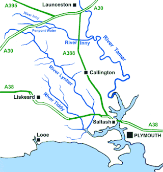
The River Inny is a small river in East Cornwall, England, United Kingdom. It is a tributary of the River Tamar and is about twenty miles (32 km) long from its source near Davidstow on the eastern flank of Bodmin Moor to its confluence with the Tamar at Inny Foot near Dunterton.
<span class="mw-page-title-main">North Hill, Cornwall</span> Human settlement in England

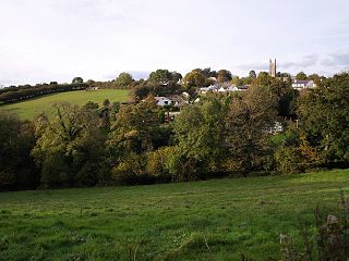
North Hill is a village and civil parish in Cornwall, England, United Kingdom. The village is situated on the east side of the River Lynher approximately six miles (10 km) southwest of Launceston.

Ball is a hamlet on the outskirts of Wadebridge in north Cornwall, England, United Kingdom.
<span class="mw-page-title-main">Crowdy Reservoir</span> Reservoir in Cornwall, England

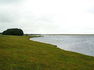
Crowdy Reservoir is located on Bodmin Moor near Camelford in north Cornwall. It is currently managed, jointly by the South West Lakes Trust and South West Water. There is public access to the reservoir away from the nature reserve. The reservoir supplies water to the North Cornwall water distribution network via treatment at the Lowermoor Water Treatment Works.

Bethel is a suburb on the east side of St Austell in Cornwall, England, United Kingdom. Bethel is included within the St Austell Bethel division of Cornwall Council. It is located at OS Grid Ref SX032529
<span class="mw-page-title-main">Tregirls</span>

<span class="mw-page-title-main">River Ottery</span> River in northeast Cornwall, England

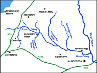
The River Ottery is a small river in northeast Cornwall, England, United Kingdom. The river is about twenty miles (32 km) long from its source southeast of Otterham to its confluence with the River Tamar at Nether Bridge, two miles (3.2 km) northeast of Launceston.

<span class="mw-page-title-main">De Lank River</span> River in north Cornwall, England

The De Lank River is a small river in north Cornwall, England. It is a tributary of the River Camel and is approximately nine miles (14.5 km) long from its source on Bodmin Moor to its confluence with the Camel two miles (3 km) south of St Breward.

<span class="mw-page-title-main">New Mills, Cornwall</span> Hamlet in Cornwall, England

<span class="mw-page-title-main">Mylor Creek</span> Tidal ria in south Cornwall, England

<span class="mw-page-title-main">Tolcarne</span>

Tolcarne is the name of a number of places in Cornwall, United Kingdom. The name Tolcarne is derived from Cornish Talkarn i.e. "hill-brow tor". A carn is a pile of stones and is the same as tor in Devon.

<span class="mw-page-title-main">Treburgett</span> Hamlet in Cornwall, England

Treburgett is a hamlet in the parish of St Teath, Cornwall, England, United Kingdom.

<span class="mw-page-title-main">Cornwall Birdwatching and Preservation Society</span>

The Cornwall BirdWatching and Preservation Society is a conservation body dedicated to the preservation and enjoyment of birds in the county of Cornwall, England, UK. The society is involved in the management of 6 reserves, and provides news of bird sightings in Cornwall through its website.
<span class="mw-page-title-main">Lanhydrock</span> Civil parish in Cornwall, England

Lanhydrock is a civil parish centred on a country estate and mansion in Cornwall, England, United Kingdom. The parish lies south of the town of Bodmin and is bounded to the north by Bodmin parish, to the south by Lanlivery parish and to the west by Lanivet parish. The population was 171 in the 2001 census. This increased to 186 in the 2011 census. The Parish Council meets every two months in Lanhydrock Memorial Hall.
References

  1. Cornwall Calling website. Retrieved April 2010
  2. Colliford Lake, Visit Cornwall, accessed 28 December 2015
  3. Ordnance Survey: Landranger map sheet 201 Plymouth & Launceston ISBN   978-0-319-23146-3
  4. Ordnance Survey: Explorer map sheet 109 Bodmin Moor ISBN   978-0-319-24047-2
  5. Colliford Lake Park
  6. Visit Britain website; Colliford Lake; retrieved April 2010 [ permanent dead link ]
  7. "South West Lakes Trust website. Retrieved April 2010". Archived from the original on 28 April 2010. Retrieved 26 April 2010.