Consejo, Guayanilla, Puerto Rico

Last updated
Consejo
Barrio
Consejo, Guayanilla, Puerto Rico locator map.png
Location of Consejo within the municipality of Guayanilla shown in red
Caribbean location map.svg
Red pog.svg
Consejo
Location of Puerto Rico
Coordinates: 18°03′16″N66°48′51″W / 18.05432°N 66.814035°W / 18.05432; -66.814035 [1]
Commonwealth Flag of Puerto Rico.svg  Puerto Rico
Municipality Flag of Guayanilla.svg Guayanilla
Area
[1]
  Total1.51 sq mi (3.9 km2)
  Land1.51 sq mi (3.9 km2)
  Water0 sq mi (0 km2)
Elevation
[2]
335 ft (102 m)
Population
 (2010)
  Total886
  Density586.8/sq mi (226.6/km2)
 Source: 2010 Census
Time zone UTC−4 (AST)

Consejo (Barrio Consejo) is a rural barrio in the municipality of Guayanilla, Puerto Rico. Its population in 2010 was 886. [3] [4] [5]

Contents

Features and demographics

Consejo has 1.51 square miles (3.9 km2) of land area and no water area. In 2010, its population was 886 with a population density of 586.8 inhabitants per square mile (226.6/km2).

Historical population
CensusPop.Note
1910 457
1920 51913.6%
1930 507−2.3%
1940 56010.5%
1950 72729.8%
1960 548−24.6%
1980 799
1990 723−9.5%
2000 88322.1%
2010 8860.3%
U.S. Decennial Census
1900 (N/A) [6] 1910-1930 [7]
1930-1950 [8] 1980-2000 [9] 2010 [10]

History

Collores was in Spain's gazetteers [11] until Puerto Rico was ceded by Spain in the aftermath of the Spanish–American War under the terms of the Treaty of Paris of 1898 and became an unincorporated territory of the United States. In 1899, the United States Department of War conducted a census of Puerto Rico finding that the combined population of Consejo (which was Concejo) barrio and Jaguas (which was Jagua) barrio was 1,162. [12]

See also

Related Research Articles

<span class="mw-page-title-main">Minillas, Bayamón, Puerto Rico</span> Barrio of Puerto Rico

Minillas is a barrio in the municipality of Bayamón, Puerto Rico. Its population in 2010 was 39,540.

<span class="mw-page-title-main">Nuevo, Bayamón, Puerto Rico</span> Barrio of Puerto Rico

Nuevo is a barrio in the municipality of Bayamón, Puerto Rico. Its population in 2010 was 2,965.

<span class="mw-page-title-main">Lomas, Naranjito, Puerto Rico</span> Barrio of Puerto Rico

Lomas is a barrio in the municipality of Naranjito, Puerto Rico. Its population in 2010 was 3,865.

<span class="mw-page-title-main">Sabana Yeguas</span> Barrio of Lajas, Puerto Rico

Sabana Yeguas is a barrio in the municipality of Lajas, Puerto Rico. Its population in 2010 was 2,082.

<span class="mw-page-title-main">Jaguas, Peñuelas, Puerto Rico</span> Barrio of Puerto Rico

Jaguas is a barrio in the municipality of Peñuelas, Puerto Rico. Its population in 2010 was 2,211.

<span class="mw-page-title-main">Jaguas, Ciales, Puerto Rico</span> Barrio of Puerto Rico

Jaguas is a barrio in the municipality of Ciales, Puerto Rico. Its population in 2010 was 4,545.

<span class="mw-page-title-main">Consejo, Utuado, Puerto Rico</span> Barrio of Puerto Rico

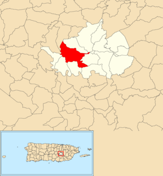
Consejo is a barrio in the municipality of Utuado, Puerto Rico. Its population in 2010 was 610.

<span class="mw-page-title-main">Jaguas, Guayanilla, Puerto Rico</span> Barrio of Puerto Rico

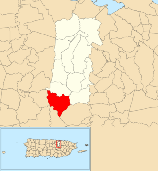
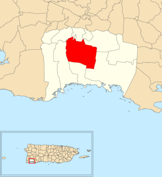
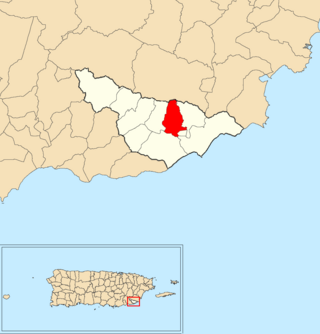
Jaguas is a rural barrio in the municipality of Guayanilla, Puerto Rico. Its population in 2010 was 1413.

<span class="mw-page-title-main">Jaguas, Gurabo, Puerto Rico</span> Barrio of Puerto Rico

Jaguas is a barrio in the municipality of Gurabo, Puerto Rico. Its population in 2010 was 2,083.

<span class="mw-page-title-main">Quebrada Honda, Guayanilla, Puerto Rico</span> Barrio of Puerto Rico

Quebrada Honda is a rural barrio in the municipality of Guayanilla, Puerto Rico. Its population in 2010 was 390.

<span class="mw-page-title-main">Jagua Pasto</span> Barrio of Guayanilla, Puerto Rico

Jagua Pasto is a rural barrio in the municipality of Guayanilla, Puerto Rico. Its population in 2010 was 108.

<span class="mw-page-title-main">Guamaní</span> Barrio of Guayama, Puerto Rico

Guamaní is a barrio in the municipality of Guayama, Puerto Rico. Its population in 2010 was 1,455.

<span class="mw-page-title-main">Sabana Abajo, Carolina, Puerto Rico</span> Barrio of Puerto Rico

Sabana Abajo is a barrio in the municipality of Carolina, Puerto Rico. Its population in 2010 was 55,600.

<span class="mw-page-title-main">Trujillo Bajo, Carolina, Puerto Rico</span> Barrio of Puerto Rico

Trujillo Bajo is a barrio in the municipality of Carolina, Puerto Rico. Its population in 2010 was 8,805.

<span class="mw-page-title-main">Pasto Viejo, Cayey, Puerto Rico</span> Barrio of Cayey, Puerto Rico

Pasto Viejo is a barrio in the municipality of Cayey, Puerto Rico. Its population in 2010 was 555.

<span class="mw-page-title-main">Pedro Ávila, Cayey, Puerto Rico</span> Barrio of Puerto Rico

Pedro Ávila is a barrio in the municipality of Cayey, Puerto Rico. Its population in 2010 was 125.

<span class="mw-page-title-main">Rabanal, Cidra, Puerto Rico</span> Barrio of Puerto Rico

Rabanal is a barrio in the municipality of Cidra, Puerto Rico. Its population in 2010 was 4,228.

<span class="mw-page-title-main">Jacaguas</span> Barrio of Juana Díaz, Puerto Rico

Jacaguas is a barrio in the municipality of Juana Díaz, Puerto Rico. Its population in 2010 was 3,957.

<span class="mw-page-title-main">Talante</span> Barrio of Maunabo, Puerto Rico

Talante is a barrio in the municipality of Maunabo, Puerto Rico. Its population in 2010 was 1,381.

<span class="mw-page-title-main">Maresúa</span> Barrio of San Germán, Puerto Rico

Maresúa is a barrio in the municipality of San Germán, Puerto Rico. Its population in 2010 was 1,794.

References

  1. 1 2 "US Gazetteer 2019". US Census. US Government.
  2. U.S. Geological Survey Geographic Names Information System: Consejo barrio
  3. Picó, Rafael; Buitrago de Santiago, Zayda; Berrios, Hector H. Nueva geografía de Puerto Rico: física, económica, y social, por Rafael Picó. Con la colaboración de Zayda Buitrago de Santiago y Héctor H. Berrios. San Juan Editorial Universitaria, Universidad de Puerto Rico,1969.
  4. Gwillim Law (20 May 2015). Administrative Subdivisions of Countries: A Comprehensive World Reference, 1900 through 1998. McFarland. p. 300. ISBN   978-1-4766-0447-3 . Retrieved 25 December 2018.
  5. Puerto Rico: 2010 Population and Housing Unit Counts.pdf (PDF). U.S. Dept. of Commerce, Economics and Statistics Administration, U.S. Census Bureau. 2010.
  6. "Report of the Census of Porto Rico 1899". War Department Office Director Census of Porto Rico. Archived from the original on July 16, 2017. Retrieved September 21, 2017.
  7. "Table 3-Population of Municipalities: 1930 1920 and 1910" (PDF). United States Census Bureau. Archived (PDF) from the original on August 17, 2017. Retrieved September 21, 2017.
  8. "Table 4-Area and Population of Municipalities Urban and Rural: 1930 to 1950" (PDF). United States Census Bureau. Archived (PDF) from the original on August 30, 2015. Retrieved September 21, 2014.
  9. "Table 2 Population and Housing Units: 1960 to 2000" (PDF). United States Census Bureau. Archived (PDF) from the original on July 24, 2017. Retrieved September 21, 2017.
  10. Puerto Rico: 2010 Population and Housing Unit Counts.pdf (PDF). U.S. Dept. of Commerce Economics and Statistics Administration U.S. Census Bureau. 2010. Archived (PDF) from the original on 2017-02-20. Retrieved 2019-08-02.
  11. "Anuario del comercio, de la industria, de la magistratura y de la administración. 1881". Biblioteca Nacional de España (in Spanish). p. 1614. Retrieved 4 April 2023.
  12. Joseph Prentiss Sanger; Henry Gannett; Walter Francis Willcox (1900). Informe sobre el censo de Puerto Rico, 1899, United States. War Dept. Porto Rico Census Office (in Spanish). Imprenta del gobierno. p.  165.