Conway, Michigan

Last updated
Conway, Michigan
Conway, MI location.png
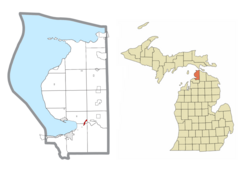
Location within Emmet County
USA Michigan location map.svg
Red pog.svg
Conway
Location within the state of Michigan
Usa edcp location map.svg
Red pog.svg
Conway
Conway (the United States)
Coordinates: 45°25′01″N84°51′55″W / 45.41694°N 84.86528°W / 45.41694; -84.86528 Coordinates: 45°25′01″N84°51′55″W / 45.41694°N 84.86528°W / 45.41694; -84.86528
Country United States
State Michigan
County Emmet
Townships Bear Creek and Little Traverse
Area
[1]
  Total0.42 sq mi (1.10 km2)
  Land0.42 sq mi (1.09 km2)
  Water0.00 sq mi (0.01 km2)
Elevation
603.0 ft (183.8 m)
Population
 (2020)
  Total338
  Density802.85/sq mi (309.91/km2)
Time zone UTC-5 (Eastern (EST))
  Summer (DST) UTC-4 (EDT)
ZIP code(s)
49722
Area code(s) 231
FIPS code 26-17900 [2]
GNIS feature ID623717 [3]

Conway is an unincorporated community and census-designated place (CDP) in Emmet County in the U.S. state of Michigan. As of the 2010 census, the CDP had a population of 204. [2]

Contents

Geography

Conway is located in southeastern Emmet County, in southeastern Little Traverse Township. A portion of the CDP extends south into Bear Creek Township. The community is at the western end of Crooked Lake. U.S. Route 31 passes through the CDP, leading southwest 6 miles (10 km) to Petoskey, the county seat, and northeast 5 miles (8 km) to Alanson.

The community of Conway was listed as a newly-organized census-designated place for the 2010 census, meaning it now has officially defined boundaries and population statistics for the first time. [4]

According to the U.S. Census Bureau, the Conway CDP has a total area of 0.42 square miles (1.1 km2), all of it land. [2]

Demographics

Historical population
CensusPop.
2020 338
U.S. Decennial Census [5]

Related Research Articles

Bay Shore, Michigan Census-designated place & unincorporated community in Michigan, United States

Bay Shore is an unincorporated community and census-designated place located on the boundary between Charlevoix and Emmet counties in the U.S. state of Michigan. As of the 2010 census it had a population of 754.

Cross Village, Michigan Census-designated place & unincorporated community in Michigan, United States

Cross Village is an unincorporated community and census-designated place (CDP) in Emmet County in the U.S. state of Michigan. As of the 2010 census, the CDP had a population of 93. It is located within Cross Village Township on the shores of Lake Michigan.

Carp Lake, Michigan Census-designated place & unincorporated community in Michigan, United States

Carp Lake is an unincorporated community and census-designated place (CDP) in Emmet County in the U.S. state of Michigan. As of the 2010 census, the CDP had a population of 357. It is located within Carp Lake Township.

Levering, Michigan Census-designated place & unincorporated community in Michigan, United States

Levering is an unincorporated community and census-designated place (CDP) in Emmet County in the U.S. state of Michigan. As of the 2010 census, the CDP had a population of 215.

Brutus, Michigan Census-designated place & unincorporated community in Michigan, United States

Brutus is an unincorporated community and census-designated place (CDP) in Emmet County in the U.S. state of Michigan. As of the 2010 census, the CDP had a population of 218. Brutus is located within Maple River Township.

Marenisco, Michigan Census-designated place & unincorporated community in Michigan, United States

Marenisco is an unincorporated community and census-designated place (CDP) in Marenisco Township, Gogebic County, Michigan, in the United States. As of the 2010 census, the CDP had a population of 254, out of a total population in the township of 1,727. The name of the community and the township was formed by combining the first three letters from Mary Enid Scott, the wife of E. H. Scott, a timber producer.

Watersmeet, Michigan Census-designated place & unincorporated community in Michigan, United States

Watersmeet is an unincorporated community and census-designated place (CDP) in Watersmeet Township, Gogebic County, Michigan, in the United States. As of the 2010 census, the CDP had a population of 428, out of a total population in the township of 1,417. The community was platted in 1884, designated as a station of the Milwaukee Lake Shore and Western Railroad.

Norwood, Michigan Census-designated place & unincorporated community in Michigan, United States

Norwood is an unincorporated community and census-designated place in Charlevoix County in the U.S. state of Michigan. As of the 2010 census it had a population of 142.

Walloon Lake, Michigan Census-designated place & unincorporated community in Michigan, United States

Walloon Lake is an unincorporated community and census-designated place in Charlevoix County in the U.S. state of Michigan. As of the 2010 census it had a population of 290.

Ponshewaing, Michigan Census-designated place & unincorporated community in Michigan, United States

Ponshewaing is an unincorporated community and census-designated place (CDP) in Emmet County in the U.S. state of Michigan. As of the 2010 census, the CDP had a population of 69. It is located within Littlefield Township.

Oden, Michigan Census-designated place & unincorporated community in Michigan, United States

Oden is an unincorporated community and census-designated place (CDP) in Emmet County in the U.S. state of Michigan. As of the 2010 census, the CDP had a population of 363. It is located within Littlefield Township.

Crystal Mountain, Michigan Census-designated place & unincorporated community in Michigan, United States

Crystal Mountain is an unincorporated community and census-designated place in Benzie County in the U.S. state of Michigan. The population was 54 at the 2010 census. Crystal Mountain is located within Weldon Township.

Lakes of the North, Michigan Census-designated place & unincorporated community in Michigan, United States

Lakes of the North is an unincorporated community and census-designated place (CDP) in Antrim County in the U.S. state of Michigan. The CDP is located in Mancelona and Star townships. The population was 925 at the 2010 census.

Hardwood Acres, Michigan Census-designated place & unincorporated community in Michigan, United States

Hardwood Acres is an unincorporated community and census-designated place in Benzie County in the U.S. state of Michigan. The population was 432 at the 2010 census. Hardwood Acres is located within Almira Township.

Maple Grove, Benzie County, Michigan Census-designated place & unincorporated community in Michigan, United States

Maple Grove is an unincorporated community and census-designated place in Benzie County in the U.S. state of Michigan. The population was 132 at the 2010 census. Maple Grove is located within Almira Township.

Nessen City, Michigan Census-designated place & unincorporated community in Michigan, United States

Nessen City is an unincorporated community and census-designated place in Benzie County in the U.S. state of Michigan. The population was 97 at the 2010 census. Nessen City is located within Colfax Township.

Pilgrim, Michigan Census-designated place & unincorporated community in Michigan, United States

Pilgrim is an unincorporated community and census-designated place (CDP) in Benzie County in the U.S. state of Michigan. At the 2010 census, the CDP had a permanent population of 11. Pilgrim is located within Crystal Lake Township.

Lake Victoria, Michigan Census-designated place & unincorporated community in Michigan, United States

Lake Victoria is an unincorporated community and census-designated place (CDP) in Clinton County in the U.S. state of Michigan. It is located in Victor Township. As of the 2010 census, it had a population of 930.

Manistee Lake, Michigan Census-designated place & unincorporated community in Michigan, United States

Manistee Lake is an unincorporated community and census-designated place (CDP) in Kalkaska County in the U.S. state of Michigan. At the 2010 census, the CDP had a population of 456. Manistee Lake is located within Coldsprings Township to the north and a small portion extending south into Excelsior Township.

Vineyard Lake, Michigan Census-designated place & unincorporated community in Michigan, United States

Vineyard Lake is an unincorporated community and census-designated place (CDP) in Jackson County in the U.S. state of Michigan. The CDP had a population of 980 at the 2010 census. It is located within Columbia Township to the west and Norvell Township to the east.

References

  1. "2020 U.S. Gazetteer Files". United States Census Bureau. Retrieved May 21, 2022.
  2. 1 2 3 "Geographic Identifiers: 2010 Demographic Profile Data (G001): Conway CDP, Michigan". U.S. Census Bureau, American Factfinder. Retrieved February 12, 2016.[ dead link ]
  3. U.S. Geological Survey Geographic Names Information System: Conway, Michigan
  4. "Michigan: 2010 Population and Housing Unit Counts 2010 Census of Population and Housing" (PDF). 2010 United States Census . United States Census Bureau. September 2012. p. III-5. Retrieved February 29, 2020.
  5. "Census of Population and Housing". Census.gov. Retrieved June 4, 2016.