Stone County is located in the Ozark Mountains in the U.S. state of Arkansas. The county is named for rugged, rocky area terrain of the Ozarks. Created as Arkansas's 74th county on April 21, 1873, Stone County has two incorporated cities: Mountain View, the county seat and most populous city, and Fifty-Six. The county is also the site of numerous unincorporated communities and ghost towns.

Marion County is located in the Ozark Mountains in the U.S. state of Arkansas. The county is named for Francis Marion, the famous "Swamp Fox" of the Revolutionary War. Created as Arkansas's 35th county in 1836, Marion County is home to one incorporated town and four incorporated cities, including Yellville, the county seat. The county is also the site of numerous unincorporated communities and ghost towns. The county included part of what is now Searcy County, Arkansas, with many opposing to dividing them, which helped fueled the bloody Tutt-Everett War between 1844 and 1850.
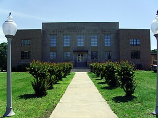
Lincoln County is located between the Arkansas Timberlands and Arkansas Delta in the U.S. state of Arkansas. It is also within the Pine Bluff metro area, and on the outer edge of the Central Arkansas region. The county is named for President Abraham Lincoln. Created as Arkansas's 65th county on March 28, 1871, Lincoln County has three incorporated cities, including Star City, the county seat and most populous city. The county contains 46 unincorporated communities and ghost towns, Cane Creek State Park at the confluence of Cane Creek and Bayou Bartholomew, and nine listings on the National Register of Historic Places to preserve the history and culture of the county.

Lafayette County is a county located in the U.S. state of Arkansas. As of the 2020 census, the population was 6,308, making it the third-least populous county in Arkansas. The county seat is Lewisville. Lafayette County was formed on October 15, 1827, and named in honor of the Marquis de Lafayette, a French military hero of the American Revolutionary War. It is a dry county; therefore, the sale of alcohol is prohibited.
Jackson County is located in the Arkansas Delta in the U.S. state of Arkansas. The county is named for Andrew Jackson, a national hero during the War of 1812. By the county's formation in 1829, Jackson had become the seventh President of the United States. Jackson County is home to seven incorporated towns and four incorporated cities, including Newport, the largest city and county seat. The county is also the site of numerous unincorporated communities and ghost towns. Occupying 633.94 square miles (164,190 ha), Jackson County is the 41st largest county of the 75 in Arkansas. As of the 2020 Census, the county's population was 16,755. Based on population, the county is the 44th-largest county in Arkansas. Although terrain rises in the west, most of Jackson County is within the Arkansas Delta, characterized by largely flat terrain with fertile soils. Historically covered in forest, bayous and swamps, the area was cleared for agriculture by early settlers. It is drained by the White River.

Howard County is a county located in the U.S. state of Arkansas. As of the 2020 census, the population was 12,785. The county seat is Nashville. Howard County is Arkansas's 74th county, formed on April 17, 1873, and named for James Howard, a state senator. It is a dry county.

Bradley County is a county located in the U.S. state of Arkansas. As of the 2020 census, the population was 10,545. The county seat is Warren. It is Arkansas's 43rd county, formed on December 18, 1840, and named for Captain Hugh Bradley, who fought in the War of 1812.

Ashley County is a rural South Arkansas county with a culture, economy, and history based on timber and agriculture. Created as Arkansas's 52nd county on November 30, 1848, Ashley County has seven incorporated municipalities, including Hamburg, the county seat and Crossett, the most populous city. The county is also the site of numerous unincorporated communities and ghost towns. The county is named for Chester Ashley, a prominent lawyer in the Arkansas Territory and U.S. senator from the state from 1844 to 1848.

Highway 7 is a north–south state highway that runs across the state of Arkansas. As Arkansas's longest state highway, the route runs 297.27 miles (478.41 km) from Louisiana Highway 558 at the Louisiana state line north to Bull Shoals Lake at Diamond City near the Missouri state line. With the exception of the segment north of Harrison, Highway 7 has been designated as an Arkansas Scenic Byway and a National Forest Scenic Byway. The road passes through the heart of both the Ozark Mountains and the Ouachita Mountains, and features scenic views. It's the route favored by motorcycle riders touring the region.

Highway 32 is a designation for three state highways in South Arkansas. One route of 34.22 miles (55.07 km) runs from Oklahoma State Highway 3 (SH-3) at the Oklahoma state line east to Highway 355 at Saratoga. A second route of 3.96 miles (6.37 km) begins near Hope Municipal Airport and runs through Oakhaven to Highway 29. A third segment of 18.87 miles (30.37 km) begins at US 278 and runs east to US 371 in Willisville.
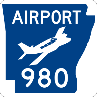
Highway 980 is a state highway designation for all state maintained airport roads in Arkansas.

Highway 160 is a designation for four state highways in South Arkansas. The northernmost segment of 51.55 miles (82.96 km) runs from Farm to Market Road 249 at the Texas state line near Bloomburg, Texas east to Highway 19 at Macedonia. A second segment of 14.73 miles (23.71 km) runs east from Highway 57 east to Highway 7 Business in Smackover. In southern Calhoun County, Highway 160 begins at US Route 278 (US 278) and runs east to US 425 in Fountain Hill. A fourth segment begins at US 82 and runs 22.73 miles (36.58 km) east to US 65 at Chicot Junction.

Twelve special routes of U.S. Route 63 currently exist. Arkansas and Missouri each contain five, with two in Iowa. There are also five former routings that have been removed from the system.

Arkansas Highway 15 is the designation for two state highways in Arkansas. The northern segment of 34.45 miles (55.44 km) runs from Altheimer north across Interstate 40 to Furlow. The southern segment of 21.10 miles (33.96 km) is entirely in Union County, and runs from Louisiana Highway 161 north to U.S. Route 82 in El Dorado.

Nine special routes of U.S. Route 278 currently exist. Four of them lie within the state of Arkansas. One more existed in the past but has since been decommissioned.
Corinth is an unincorporated community in Howard County, Arkansas, United States. Corinth is located on Arkansas Highway 26, 6.7 miles (10.8 km) north of Nashville.
Corinth is an unincorporated community in Polk County, Arkansas, United States. Corinth is located on Arkansas Highway 88, 3.2 miles (5.1 km) east of Mena.

Highway 369 is a designation for three north–south state highways in Arkansas. All are maintained by the Arkansas Department of Transportation (ArDOT). One segment provides connectivity in the Ouachita Mountains, with the other two serving as short industrial access roads. The longest segment was designated in 1966 and extended thrice, with the two industrial access roads created in 1978 and 1980. All three segments are maintained by the Arkansas Department of Transportation (ArDOT).