Geography
On the south coast of the peninsula is the French research station of Port-aux-Français, the only permanent settlement in the archipelago. Molloy, 10 km to the west of Port-aux-Francais along the north shore of the Gulf of Morbihan, is the site of a former observatory, established on 7 September 1874, by an American expedition led by G. P. Ryan, to observe the 1874 Transit of Venus.
The Courbet Peninsula occupies the northeastern portion of the main island. The eastern portion of the peninsula is relatively flat, with the surface composed mainly of alluvial deposits of glacial origin, and altitudes not exceeding 200 m. However, the western part is hillier and reaches 900 m at Mont Crozier near the isthmus. [1] The hills and the slopes of Mont Crozier are olivine basalt with thicknesses up to 1000 m. [2] [3] Some 55 km long, the peninsula is about 10 km wide at its western base and widens to more than 30 km across further east. The Golfe des Baleiniers is on the northern and northwestern shore of the peninsula and includes smaller Hillsborough Bay (Baie du Hillsborough) and Accessible Bay on the northern coast further to the east. The southern coast forms the northern limit of the Gulf of Morbihan. At its south-eastern end is the small Prince of Wales Peninsula which encloses small Norwegian Bay (Baie Norvégienne). The easternmost point of the peninsula, and of Grande Terre, is Cape Ratmanoff, north of which is coastal Lake Marly. Further north still is Cape Digby, marking the north-eastern end of the peninsula. The northernmost point of the peninsula is Cape Cotter. The peninsula contains many lakes with boggy margins, the largest of which is Lake Marville, a coastal lake located at the eastern end. Even so, much of the inland area is quite arid and mostly bare, without vegetation. [4]
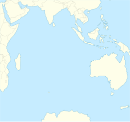
The Kerguelen Islands, also known as the Desolation Islands, are a group of islands in the sub-Antarctic constituting one of the two exposed parts of the Kerguelen Plateau, a large igneous province mostly submerged in the southern Indian Ocean. They are among the most isolated places on Earth, located more than 3,300 kilometres from Madagascar. The islands, along with Adélie Land, the Crozet Islands, Amsterdam and Saint Paul islands, and France's Scattered Islands in the Indian Ocean, are part of the French Southern and Antarctic Lands and are administered as a separate district.

The Crozet Islands are a sub-Antarctic archipelago of small islands in the southern Indian Ocean. They form one of the five administrative districts of the French Southern and Antarctic Lands.

The Îlots des Apôtres or Îles des Apôtres are a group of small and uninhabited rocky islands in the north-western part of the Crozet Archipelago in the southern Indian Ocean, 10 km (6.2 mi) north of Île aux Cochons. Their total area is about 2 km2 (0.77 sq mi).
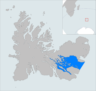
The Golfe du Morbihan is a bay on the eastern coast of Grande Terre, the largest of the Kerguelen islands. It forms a deep and broad notch in the central section of the island.

The Rallier du Baty Peninsula is a peninsula of Grande Terre, the main island of the subantarctic Kerguelen archipelago in the southern Indian Ocean. It occupies the south-western corner of the island, and is about 35 km long, extending from north to south, and 25 km across at its widest. The 1,202 m high Bicorne rises in the southern coast of the peninsula. It is named for Raymond Rallier du Baty, a French sailor who charted the archipelago in the early 20th century. The Îles Boynes, France's southernmost land apart from Adélie Land in Antarctica, lie 30 km south of the tip of the peninsula.

Baie Norvégienne is a small bay to the southeast of the Péninsule Courbet, a vast peninsula constituting the northeast quarter of the Kerguelen Islands in the Indian Ocean.
The Kerguelen Islands are part of the Southern Indian Ocean Islands tundra ecoregion that includes several subantarctic islands. In this cold climate plant life is mainly limited to grasses, mosses and lichens, although the islands are also known for the indigenous edible Kerguelen cabbage. The islands are at the Antarctic Convergence, where cold water moving up from the Antarctic mixes with the warmer water of the Indian Ocean. As a consequence, marine mammals, especially seals, and seabirds and penguins are numerous.
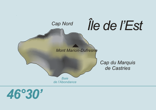
Île de l'Est, or East Island, is a part of the subantarctic archipelago of the Crozet Islands. With an area of 130 km2 (50 sq mi) it is the second largest island of the group. It is part of the French Southern and Antarctic Lands.
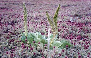
The Southern Indian Ocean Islands tundra is a tundra ecoregion that includes several subantarctic islands in the southern Indian Ocean.

Île aux Cochons, or Pig Island, is an uninhabited island in the subantarctic Crozet Archipelago. With an area of 67 km2 (26 sq mi) it is the third largest island of the group. Administratively, it is part of the French Southern and Antarctic Lands.

Île de la Possession, or Possession Island, formerly Île de la Prise de Possession, is part of the Subantarctic Crozet Archipelago. Administratively, it is part of the French Southern and Antarctic Lands. It is an important nesting site for seabirds.

Île des Pingouins, or Penguin Island, is an uninhabited island in the subantarctic Crozet Archipelago of the southern Indian Ocean. With an area of only 3 km2 (1 sq mi) it is one of the smaller islands of the group. Administratively, it is part of the French Southern and Antarctic Lands. It is an important nesting site for seabirds.

Péninsule Jeanne d'Arc, also known as Presqu'île Jeanne d'Arc, is a peninsula of Grande Terre, the main island of the subantarctic Kerguelen archipelago in the southern Indian Ocean.

The Péninsule Loranchet, also known as Presqu'île Loranchet, is a peninsula of Grande Terre, the main island of the subantarctic Kerguelen archipelago in the southern Indian Ocean.

Baie Larose, or Larose Bay in English, is a bay of Grande Terre, the main island of the subantarctic Kerguelen archipelago, a French territory in the southern Indian Ocean. It is important as a breeding site for seabirds, especially penguins.
The Îles Nuageuses comprise a group of small islands that are part of the Kerguelen archipelago, a French territory in the southern Indian Ocean. They are an important breeding spot for seabirds, especially penguins and albatrosses, and for fur seals.

Lac Marville is a lagoon in the Kerguelen islands, part of the French Southern and Antarctic Lands. Extending over approximately 27 km2 (10 sq mi), it is the largest lake in the archipelago and one of the largest in France.
Baie de l'Oiseau is a natural harbour in the Loranchet Peninsula, in the North-Western part of the island Grande Terre, part of the Kerguelen Islands. It was the landing site of the expedition under Yves de Kerguelen in 1772, and later of the expedition under James Cook in 1776. The site of Port-Christmas is part of the bay.
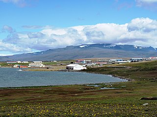
Mont Crozier is a summit of the Kerguelen Archipelago, a group of volcanic islands in the southern Indian Ocean, southeast of Africa. Mont Crozier is located on the Courbet Peninsula of Grande Terre and rises to 979 metres (3,212 ft) above sea level.
The Kerguelen Islands, an archipelago in the southern Indian Ocean, were discovered uninhabited on February 12, 1772 by Breton navigator Yves Joseph de Kerguelen de Trémarec, and have remained without a permanent population ever since. The only residents were during an attempt to set up a farm, a few occasional occupations for whaling activities, and since the 1950s, a French scientific presence. Its toponymy was thus given ex nihilo, by the various explorers, whalers and sealers who frequented its waters and anchorages, and then in the 20th century, once French possession of the archipelago had been reaffirmed, by a few French institutions.

