Courtenay—Alberni

Last updated • 1 min readFrom Wikipedia, The Free Encyclopedia

Courtenay—Alberni
Flag of British Columbia.svg British Columbia electoral district
Courtenay--Alberni (Canadian electoral district).svg
Courtenay—Alberni in relation to other electoral districts in the Vancouver Island area
Federal electoral district
Legislature House of Commons
MP


Gord Johns
New Democratic
District created 2013
First contested 2015
Last contested 2021
District webpage profile, map
Demographics
Population (2011) [1] 110,391
Electors (2019)100,510
Area (km²) [2] 8,571
Pop. density (per km²)12.9
Census division(s) Alberni-Clayoquot, Comox Valley, Nanaimo, Powell River
Census subdivision(s) Ahahswinis 1, Alberni 2, Alberni-Clayoquot A, Alberni-Clayoquot B, Alberni-Clayoquot C, Alberni-Clayoquot D, Alberni-Clayoquot E, Alberni-Clayoquot F, Anacla 12, Clakamucus 2, Comox Valley A, Courtenay, Cumberland, Elhlateese 2, Esowista 3, Hesquiat 1, Ittatsoo 1, Klehkoot 2, Macoah 1, Marktosis 15, Nanaimo E, Nanaimo F, Nanaimo G, Nanaimo H, Numukamis 1, Opitsat 1, Parksville, Port Alberni, Powell River E, Qualicum, Qualicum Beach, Refuge Cove 6, Sachsa 4, Tin Wis 11, Tofino, Tsahaheh 1, Ucluelet

Courtenay—Alberni is a federal electoral district in British Columbia, Canada. It is around the latitudinal centre of Vancouver Island. It encompasses a portion of B.C. formerly included in the electoral districts of Nanaimo—Alberni and Vancouver Island North. [3]

Contents

Courtenay—Alberni was created by the 2012 federal electoral boundaries redistribution and was legally defined in the 2013 representation order. It came into effect upon the call of the 42nd Canadian federal election, polling for which took place in October 2015. [4]

Demographics

Panethnic groups in Courtenay—Alberni (2011−2021)
Panethnic
group
2021 [5] 2016 [6] 2011 [7]
Pop. %Pop.%Pop.%
European [lower-alpha 1] 104,32596,50595,360
Indigenous 11,62510,4758,585
East Asian [lower-alpha 2] 1,8351,7351,460
Southeast Asian [lower-alpha 3] 1,6651,105870
South Asian 1,3201,110615
African 570520330
Latin American 465170290
Middle Eastern [lower-alpha 4] 1908060
Other [lower-alpha 5] 410275260
Total responses122,395111,970107,825
Total population125,116114,647110,324
Notes: Totals greater than 100% due to multiple origin responses.
Demographics based on 2012 Canadian federal electoral redistribution riding boundaries.
According to the 2011 Canadian census [8] [9]

Languages: 90.8% English, 2.2% French, 1.8% German
Religions: 45.1% Christian (11.9% Catholic, 8.3% United Church, 7.7% Anglican, 2.5% Baptist, 2.0% Lutheran, 1.3% Presbyterian, 1.2% Pentecostal, 10.2% Other), 3.0% Other, 51.9% No religion
Median income (2010): $26,754
Average income (2010): $34,319
Main industries: Retail trade (14.4% of labour force), Health care and social assistance (12.1%)

Members of Parliament

This riding has elected the following members of the House of Commons of Canada:

ParliamentYearsMemberParty
Courtenay—Alberni
Riding created from Nanaimo—Alberni and Vancouver Island North
42nd  2015–2019   Gord Johns New Democratic
43rd  2019–2021
44th  2021–present

Election results

Graph of election results in Courtenay—Alberni (minor parties that never got 2% of the vote or didn't run consistently are omitted)

2023 representation order

2021 federal election redistributed results [10]
PartyVote %
  New Democratic 29,04542.88
  Conservative 21,20531.30
  Liberal 9,22213.61
  Green 4,7767.05
  People's 3,3845.00
 Others1080.16

2013 representation order

Map of the election results of the 2019 Canadian Federal Election by polling station in Courtenay--Alberni Courtenay--Alberni2019.svg
Map of the election results of the 2019 Canadian Federal Election by polling station in Courtenay—Alberni
2021 Canadian federal election
PartyCandidateVotes%±%Expenditures
New Democratic Gord Johns 30,61244.2+3.0$97,029.16
Conservative Mary Lee22,18132.0-1.1$108,059.72
Liberal Susan Farlinger9,27613.4+1.5$37,061.04
Green Susanne Lawson3,5905.2-8.3$9,378.63
People's Robert Eppich3,4675.0N/A$6,474.87
Marxist–Leninist Barbara Biley1240.2±0.0$0.00
Total valid votes/Expense limit69,25099.7$131.260.27
Total rejected ballots2150.3
Turnout69,46565.8
Eligible voters105,605
New Democratic hold Swing +2.1
Source: Elections Canada [11]
2019 Canadian federal election
PartyCandidateVotes%±%Expenditures
New Democratic Gord Johns 29,79041.21+3.16$120,371.26
Conservative Byron Horner23,93633.12+4.89$93,314.71
Green Sean Wood9,76213.51+1.76$15,677.21
Liberal Jonah Baden Gowans8,62011.93-9.85$13,538.18
Marxist–Leninist Barbara Biley1720.24+0.04
Total valid votes/expense limit72,28099.51
Total rejected ballots3590.49+0.23
Turnout72,63971.40-4.50
Eligible voters101,730
New Democratic hold Swing -0.87
Source: Elections Canada [12] [13]
2015 Canadian federal election
PartyCandidateVotes%±%Expenditures
New Democratic Gord Johns 26,58238.06-2.66$124,072.44
Conservative John Duncan 19,71428.22-16.66$92,251.34
Liberal Carrie Powell-Davidson15,21221.78+15.06$32,002.88
Green Glenn Sollitt8,20111.74+4.89$124,891.17
Marxist–Leninist Barbara Biley1400.20
Total valid votes/expense limit69,84999.74 $231,958.67
Total rejected ballots1850.26
Turnout70,03475.90
Eligible voters92,266
New Democratic notional gain from Conservative Swing -7.00
This riding was created from Nanaimo—Alberni and Vancouver Island North, both of which elected a Conservative candidate in the last election. John Duncan was the incumbent from Vancouver Island North.
Source: Elections Canada [14] [15] [16]
2011 federal election redistributed results [17]
PartyVote %
  Conservative 25,79744.89
  New Democratic 23,40040.72
  Green 3,9356.85
  Liberal 3,8606.72
 Others4800.84

See also

Notes

  1. Statistic includes all persons that did not make up part of a visible minority or an indigenous identity.
  2. Statistic includes total responses of "Chinese", "Korean", and "Japanese" under visible minority section on census.
  3. Statistic includes total responses of "Filipino" and "Southeast Asian" under visible minority section on census.
  4. Statistic includes total responses of "West Asian" and "Arab" under visible minority section on census.
  5. Statistic includes total responses of "Visible minority, n.i.e." and "Multiple visible minorities" under visible minority section on census.

Related Research Articles

<span class="mw-page-title-main">Elgin—Middlesex—London (federal electoral district)</span> Federal electoral district in Ontario, Canada

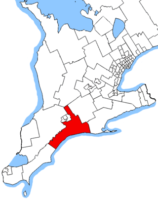
Elgin—Middlesex—London is a federal electoral district in Ontario, Canada, that has been represented in the House of Commons of Canada since 1997.

<span class="mw-page-title-main">Bow River (electoral district)</span> Federal electoral district in Alberta, Canada

Bow River is a federal electoral district in southern Alberta, Canada, that has been represented in the House of Commons of Canada from 1917 to 1968, from 1979 to 1988 and since 2015.

<span class="mw-page-title-main">Winnipeg Centre</span> Federal electoral district in Manitoba, Canada

Winnipeg Centre is a federal electoral district in Manitoba, Canada, that has been represented in the House of Commons of Canada from 1917 to 1925 and since 1997.

<span class="mw-page-title-main">Edmonton Riverbend</span> Federal electoral district in Alberta, Canada

Edmonton Riverbend is a federal electoral district in Alberta. Edmonton Riverbend was created by the 2012 federal electoral boundaries redistribution and was legally defined in the 2013 representation order. It came into effect upon the call of the 42nd Canadian federal election, scheduled for October 2015.

<span class="mw-page-title-main">Sherwood Park—Fort Saskatchewan</span> Federal electoral district in Alberta, Canada

Sherwood Park—Fort Saskatchewan is a federal electoral district in Alberta, Canada, that has been represented in the House of Commons of Canada since 2015.

<span class="mw-page-title-main">St. Albert—Edmonton</span> Federal electoral district in Alberta, Canada

St. Albert—Edmonton is a federal electoral district in Alberta, Canada, that has been represented in the House of Commons of Canada since 2015.
<span class="mw-page-title-main">Central Okanagan—Similkameen—Nicola</span> Federal electoral district in British Columbia, Canada

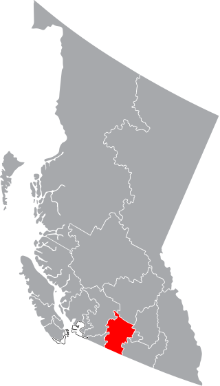
Central Okanagan—Similkameen—Nicola is a federal electoral district in British Columbia. It encompasses a portion of British Columbia formerly included in the electoral districts of Okanagan—Coquihalla (66%), Kelowna—Lake Country (25%) and British Columbia Southern Interior (10%).

<span class="mw-page-title-main">Cloverdale—Langley City</span> Federal electoral district in British Columbia, Canada

Cloverdale—Langley City is a federal electoral district in British Columbia. It encompasses a portion of B.C. previously included in the electoral districts of Langley, South Surrey—White Rock—Cloverdale and Fleetwood—Port Kells.

<span class="mw-page-title-main">Coquitlam—Port Coquitlam</span> Federal electoral district in British Columbia, Canada

Coquitlam—Port Coquitlam is a federal electoral district in British Columbia. It encompasses a portion of the former electoral district of Port Moody—Westwood—Port Coquitlam.

<span class="mw-page-title-main">Brampton North (federal electoral district)</span> Federal electoral district in Ontario, Canada

Brampton North is a federal electoral district in Ontario, Canada. It encompass portions of Ontario formerly included in the electoral districts of Brampton—Springdale, Bramalea—Gore—Malton and Brampton West.

<span class="mw-page-title-main">Langley—Aldergrove</span> Federal electoral district in British Columbia, Canada

Langley—Aldergrove is a federal electoral district in British Columbia. It encompasses a portion of British Columbia previously included in the electoral districts of Langley and Abbotsford.
<span class="mw-page-title-main">Nanaimo—Ladysmith</span> Federal electoral district in British Columbia, Canada

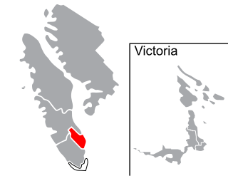
Nanaimo—Ladysmith is a federal electoral district in British Columbia, in southeastern Vancouver Island.

Pitt Meadows—Maple Ridge is a federal electoral district in British Columbia. It encompasses a portion of British Columbia previously included in the electoral district of Pitt Meadows—Maple Ridge—Mission.

<span class="mw-page-title-main">Surrey Centre</span> Federal electoral district in British Columbia, Canada

Surrey Centre is a federal electoral district in British Columbia. It encompasses a portion of British Columbia previously included in the electoral district of Surrey North.

<span class="mw-page-title-main">Surrey—Newton (federal electoral district)</span> Federal electoral district in British Columbia, Canada

Surrey—Newton is a federal electoral district in British Columbia. It encompasses a portion of British Columbia previously included in the electoral districts of Fleetwood—Port Kells, Newton—North Delta and Surrey North.

<span class="mw-page-title-main">Carlton Trail—Eagle Creek</span> Federal electoral district in Saskatchewan, Canada

Carlton Trail—Eagle Creek is a federal electoral district in Saskatchewan. It encompasses a portion of Saskatchewan formerly included in the electoral districts of Saskatoon—Humboldt, Saskatoon—Rosetown—Biggar, and Saskatoon—Wanuskewin.
<span class="mw-page-title-main">Saskatoon—Grasswood</span> Federal electoral district in Saskatchewan, Canada

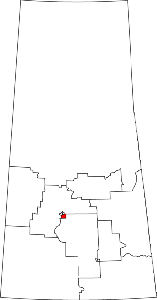
Saskatoon—Grasswood is a federal electoral district in Saskatchewan, Canada, that has been represented in the House of Commons of Canada since 2015. It encompasses most of the portions of Blackstrap (93%) and Saskatoon—Humboldt (7%) that had been located in the city of Saskatoon.

<span class="mw-page-title-main">Bay of Quinte (federal electoral district)</span> Federal electoral district in Ontario, Canada

Bay of Quinte is a federal electoral district in central Ontario, Canada, centred on the Bay of Quinte.
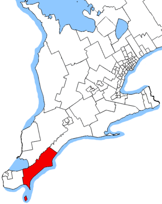
<span class="mw-page-title-main">Chatham-Kent—Leamington (federal electoral district)</span> Federal electoral district in Ontario, Canada

Chatham-Kent—Leamington is a federal electoral district in Ontario. It encompasses a portion of Ontario previously included in the electoral districts of Chatham-Kent—Essex and Essex and Lambton—Kent—Middlesex.

<span class="mw-page-title-main">Hastings—Lennox and Addington (federal electoral district)</span> Federal electoral district in Ontario, Canada

Hastings—Lennox and Addington is a federal electoral district in Ontario.

References

  1. Statistics Canada: 2011
  2. Statistics Canada: 2011
  3. Final Report – British Columbia
  4. Timeline for the Redistribution of Federal Electoral Districts
  5. Government of Canada, Statistics Canada (October 26, 2022). "Census Profile, 2021 Census of Population". www12.statcan.gc.ca. Retrieved February 14, 2023.
  6. Government of Canada, Statistics Canada (October 27, 2021). "Census Profile, 2016 Census". www12.statcan.gc.ca. Retrieved February 14, 2023.
  7. Government of Canada, Statistics Canada (November 27, 2015). "NHS Profile". www12.statcan.gc.ca. Retrieved February 14, 2023.
  8. "Statistics Canada: 2011 Census Profile". February 8, 2012.
  9. "2011 National Household Survey Profile - Federal electoral district (2013 Representation Order)". May 8, 2013.
  10. "Transposition of Votes from the 44th General Election to the 2023 Representation Orders". Elections Canada . Retrieved April 9, 2024.
  11. "List of confirmed candidates – September 20, 2021 Federal Election". Elections Canada . Retrieved September 2, 2021.
  12. "List of confirmed candidates". Elections Canada. Retrieved October 4, 2019.
  13. "Official Voting Results". Elections Canada. Retrieved August 7, 2021.
  14. Elections Canada – Confirmed candidates for Courtenay—Alberni, 30 September 2015
  15. Official Voting Results - Courtenay—Alberni
  16. "Elections Canada – Preliminary Election Expenses Limits for Candidates". Archived from the original on August 15, 2015.
  17. Pundits' Guide to Canadian Elections