Culebras Alto, Cayey, Puerto Rico

Last updated
Culebras Alto
Barrio
Culebras Alto, Cayey, Puerto Rico locator map.png
Location of Culebras Alto within the municipality of Cayey shown in red
Caribbean location map.svg
Red pog.svg
Culebras Alto
Location of Puerto Rico
Coordinates: 18°04′17″N66°07′51″W / 18.071364°N 66.130913°W / 18.071364; -66.130913 [1]
Commonwealth Flag of Puerto Rico.svg  Puerto Rico
Municipality Flag puertorico cayey.jpg Cayey
Area
[1]
  Total1.32 sq mi (3.4 km2)
  Land1.32 sq mi (3.4 km2)
  Water0 sq mi (0 km2)
Elevation
[2]
2,526 ft (770 m)
Population
 (2010)
  Total252
  Density190.9/sq mi (73.7/km2)
 Source: 2010 Census
Time zone UTC−4 (AST)

Culebras Alto is a barrio in the municipality of Cayey, Puerto Rico. Its population in 2010 was 252. [3] [4] [5]

Contents

History

Culebras Alto was in Spain's gazetteers [6] until Puerto Rico was ceded by Spain in the aftermath of the Spanish–American War under the terms of the Treaty of Paris of 1898 and became an unincorporated territory of the United States. In 1899, the United States Department of War conducted a census of Puerto Rico finding that the combined population of Culebras Alto, Quebrada Arriba, and Culebras Bajo barrios was 914. [7]

Historical population
CensusPop.Note
1910 168
1920 20622.6%
1930 26227.2%
1940 216−17.6%
1950 25116.2%
1960 171−31.9%
1980 160
1990 28477.5%
2000 68−76.1%
2010 252270.6%
U.S. Decennial Census
1900 (N/A) [8] 1910-1930 [9]
1930-1950 [10] 1980-2000 [11] 2010 [12]

See also

Related Research Articles

<span class="mw-page-title-main">Fraile, Culebra, Puerto Rico</span> Barrio of Puerto Rico

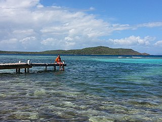
Fraile is a barrio in the island-municipality of Culebra, Puerto Rico. Its population in 2010 was 42.

<span class="mw-page-title-main">Cacao Alto</span> Barrio of Patillas, Puerto Rico

Cacao Alto is a barrio in the municipality of Patillas, Puerto Rico. Its population in 2010 was 2,449.

<span class="mw-page-title-main">Quebrada Arriba, Cayey, Puerto Rico</span> Barrio of Puerto Rico

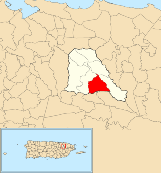
Quebrada Arriba is a barrio in the municipality of Cayey, Puerto Rico. Its population in 2010 was 1,451.

<span class="mw-page-title-main">Flamenco, Culebra, Puerto Rico</span> Barrio of Puerto Rico

Flamenco is a barrio in the island-municipality of Culebra, Puerto Rico. Its population in 2010 was 1,048.

<span class="mw-page-title-main">Playa Sardinas II</span> Barrio of Culebra, Puerto Rico

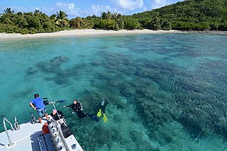
Playa Sardinas II is a barrio in the municipality of Culebra, Puerto Rico. Its population in 2010 was 64.

<span class="mw-page-title-main">Tejas, Las Piedras, Puerto Rico</span> Barrio of Puerto Rico

Tejas is a barrio in the municipality of Las Piedras, Puerto Rico. Its population in 2010 was 9,488.

<span class="mw-page-title-main">Quebrada Grande, Trujillo Alto, Puerto Rico</span> Barrio of Puerto Rico

Quebrada Grande is a barrio in the municipality of Trujillo Alto, Puerto Rico. Its population in 2010 was 4,376.

<span class="mw-page-title-main">Arenales Altos</span> Barrio of Isabela, Puerto Rico

Arenales Altos is a barrio in the municipality of Isabela, Puerto Rico. Its population in 2010 was 4,101.

<span class="mw-page-title-main">Caín Alto</span> Barrio of San Germán, Puerto Rico

Caín Alto is a barrio in the municipality of San Germán, Puerto Rico. Its population in 2010 was 2,830.

<span class="mw-page-title-main">Hoconuco Alto</span> Barrio of San Germán, Puerto Rico

Hoconuco Alto is a barrio in the municipality of San Germán, Puerto Rico. Its population in 2010 was 572.

<span class="mw-page-title-main">Rosario Alto</span> Barrio of San Germán, Puerto Rico

Rosario Alto is a barrio in the municipality of San Germán, Puerto Rico. Its population in 2010 was 721.

<span class="mw-page-title-main">Almácigo Bajo</span> Barrio of Yauco, Puerto Rico

Almácigo Bajo is a barrio in the municipality of Yauco, Puerto Rico. Its population in 2010 was 5,443.

<span class="mw-page-title-main">Culebras Bajo, Cayey, Puerto Rico</span> Barrio of Puerto Rico

Culebras Bajo is a barrio in the municipality of Cayey, Puerto Rico. Its population in 2010 was 238.

<span class="mw-page-title-main">Matuyas Alto</span> Barrio of Maunabo, Puerto Rico

Matuyas Alto is a barrio in the municipality of Maunabo, Puerto Rico. Its population in 2010 was 288.

<span class="mw-page-title-main">Matuyas Bajo</span> Barrio of Maunabo, Puerto Rico

Matuyas Bajo is a barrio in the municipality of Maunabo, Puerto Rico. Its population in 2010 was 327.

<span class="mw-page-title-main">Duey Alto, San Germán, Puerto Rico</span> Barrio of Puerto Rico

Duey Alto is a barrio in the municipality of San Germán, Puerto Rico. Its population in 2010 was 1,350.

<span class="mw-page-title-main">Rosario Peñón</span> Barrio of San Germán, Puerto Rico

Rosario Peñón is a barrio in the municipality of San Germán, Puerto Rico. Its population in 2010 was 805.

<span class="mw-page-title-main">Quebrada Negrito</span> Barrio of Trujillo Alto, Puerto Rico

Quebrada Negrito is a barrio in the municipality of Trujillo Alto, Puerto Rico. Its population in 2010 was 5,610. The barrio was created in 1899.

<span class="mw-page-title-main">Almácigo Alto</span> Barrio of Yauco, Puerto Rico

Almácigo Alto is a barrio in the municipality of Yauco, Puerto Rico. Its population in 2010 was 1,659.

<span class="mw-page-title-main">Jácana, Yauco, Puerto Rico</span> Barrio of Puerto Rico

Jácana is a barrio in the municipality of Yauco, Puerto Rico. Its population in 2010 was 1,690.

References

  1. 1 2 "US Gazetteer 2019". US Census. US Government.
  2. U.S. Geological Survey Geographic Names Information System: Culebras Alto barrio
  3. Picó, Rafael; Buitrago de Santiago, Zayda; Berrios, Hector H. Nueva geografía de Puerto Rico: física, económica, y social, por Rafael Picó. Con la colaboración de Zayda Buitrago de Santiago y Héctor H. Berrios. San Juan Editorial Universitaria, Universidad de Puerto Rico,1969.
  4. Gwillim Law (20 May 2015). Administrative Subdivisions of Countries: A Comprehensive World Reference, 1900 through 1998. McFarland. p. 300. ISBN   978-1-4766-0447-3 . Retrieved 25 December 2018.
  5. Puerto Rico: 2010 Population and Housing Unit Counts.pdf (PDF). U.S. Dept. of Commerce, Economics and Statistics Administration, U.S. Census Bureau. 2010.
  6. "Anuario del comercio, de la industria, de la magistratura y de la administración. 1881". Biblioteca Nacional de España (in Spanish). p. 1614. Retrieved 4 April 2023.
  7. Joseph Prentiss Sanger; Henry Gannett; Walter Francis Willcox (1900). Informe sobre el censo de Puerto Rico, 1899, United States. War Dept. Porto Rico Census Office (in Spanish). Imprenta del gobierno. p.  163.
  8. "Report of the Census of Porto Rico 1899". War Department Office Director Census of Porto Rico. Archived from the original on July 16, 2017. Retrieved September 21, 2017.
  9. "Table 3-Population of Municipalities: 1930 1920 and 1910" (PDF). United States Census Bureau. Archived (PDF) from the original on August 17, 2017. Retrieved September 21, 2017.
  10. "Table 4-Area and Population of Municipalities Urban and Rural: 1930 to 1950" (PDF). United States Census Bureau. Archived (PDF) from the original on August 30, 2015. Retrieved September 21, 2014.
  11. "Table 2 Population and Housing Units: 1960 to 2000" (PDF). United States Census Bureau. Archived (PDF) from the original on July 24, 2017. Retrieved September 21, 2017.
  12. Puerto Rico: 2010 Population and Housing Unit Counts.pdf (PDF). U.S. Dept. of Commerce Economics and Statistics Administration U.S. Census Bureau. 2010. Archived (PDF) from the original on 2017-02-20. Retrieved 2019-08-02.