
The Columbia River Gorge is a canyon of the Columbia River in the Pacific Northwest of the United States. Up to 4,000 feet (1,200 m) deep, the canyon stretches for over eighty miles (130 km) as the river winds westward through the Cascade Range, forming the boundary between the state of Washington to the north and Oregon to the south. Extending roughly from the confluence of the Columbia with the Deschutes River in the east down to the eastern reaches of the Portland metropolitan area, the water gap furnishes the only navigable route through the Cascades and the only water connection between the Columbia Plateau and the Pacific Ocean. It is thus that the routes of Interstate 84, U.S. Route 30, Washington State Route 14, and railroad tracks on both sides run through the gorge.

Multnomah Falls is a waterfall located on Multnomah Creek in the Columbia River Gorge, east of Troutdale, between Corbett and Dodson, Oregon, United States. The waterfall is accessible from the Historic Columbia River Highway and Interstate 84. Spanning two tiers on basalt cliffs, it is the tallest waterfall in the state of Oregon at 620 ft (189 m) in height. The Multnomah Creek Bridge, built in 1914, crosses below the falls, and is listed on the National Register of Historic Places.

Wahkeena Falls is a 242-foot (74 m) waterfall in the Columbia River Gorge in the state of Oregon.
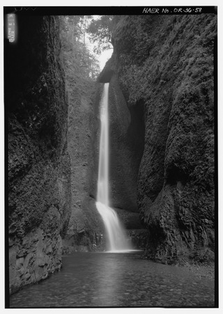
Oneonta Gorge is a scenic gorge located in the Columbia River Gorge area of the American state of Oregon. The U.S. Forest Service has designated it as a botanical area because of the unique aquatic and woodland plants that grow there. Exposed walls of 25-million-year-old basalt are home to a wide variety of ferns, mosses, hepatics, and lichens, many of which grow only in the Columbia River Gorge. Oneonta Gorge with its 50 species of wildflowers, flowering shrubs and trees has been described as "one of the true dramatic chasms in the state." The Oneonta Gorge Creek Bridge is listed on the National Register of Historic Places.
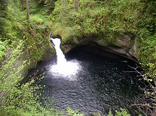
Punch Bowl Falls is a waterfall on Eagle Creek in the Columbia River Gorge National Scenic Area, Oregon, United States. Eagle Creek drains into the Columbia River, with its outlet on the Columbia River Gorge in Multnomah County.

The Bridal Veil Falls is a waterfall located on Bridal Veil Creek along the Columbia River Gorge in Multnomah County, Oregon, United States. The waterfall is accessible from the historic Columbia River Highway and Interstate 84. Spanning two tiers on basalt cliffs, it is the only waterfall which occurs below the historic Columbia Gorge Scenic Highway. The Bridal Veil Falls Bridge, built in 1914, crosses over the falls, and is listed on the National Register of Historic Places.
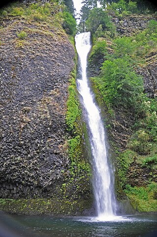
Horsetail Falls is a waterfall located on Horsetail Creek along the Columbia River Gorge in Multnomah County, in the U.S. state of Oregon. The falls drop over a cut over the columnar basalt cliff within the Oneonta Gorge. It is one of the waterfalls along the Columbia River Highway's waterfall corridor.

Latourell Falls is a waterfall along the Columbia River Gorge in the U.S. state of Oregon, within Guy W. Talbot State Park.
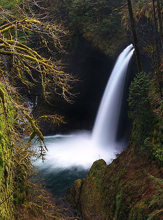
Eagle Creek is a creek located mainly in Hood River County, Oregon, in the Columbia River Gorge, with its last roughly 0.5 miles (0.80 km) and mouth in Multnomah County. A tributary of the Columbia River, the creek flows for approximately 15 miles (24 km) from the Thrush Pond between Eagle Butte and Tanner Butte to its mouth near Bonneville Dam. The East Fork Eagle Creek is a major tributary that begins at Wahtum Lake and joins the main stem approximately 2/3 the way between the Thrush Pond and the Columbia River, separated by Indian Mountain.
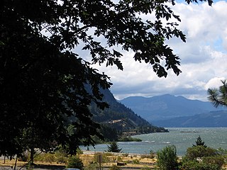
Starvation Creek State Park is a state park located west of Hood River, Oregon in the Columbia River Gorge. It was named Starvation Creek because a train was stopped there by snow drifts and passengers had to dig out the train. No one starved there.

Wahclella Falls is a waterfall along Tanner Creek, a tributary of the Columbia River, Multnomah County, Oregon, United States. It enters the river within the Columbia River Gorge.

Hole-in-the-Wall Falls, also known as Warren Falls, is a 96-foot man-made waterfall on Warren Creek in Starvation Creek State Park, Hood River County, Oregon, United States. Its main drop is 60 feet. It was created in 1938 when Warren Creek was diverted through a tunnel to prevent washouts of the Columbia River Highway. The creation of the falls shut off a natural cascade known as Warren Creek Falls named after the creek that formed it.

Fairy Falls is a 20-foot waterfall on the Oregon side of the Columbia River Gorge in the United States. As part of a tributary of Wahkeena Creek, Fairy Falls is located upstream from the much larger Wahkeena Falls. While small, this fan-shaped waterfall is a destination for photographers, mainly because of the scenic view. The creek cascades through a mossy rock slide lined with ferns, until rocky ledges of basalt break the water into various lacy streams.

Coopey Falls is a waterfall on Coopey Creek in the Columbia River Gorge, on the Historic Columbia River Highway in Multnomah County, Oregon. The falls is a horsetail waterfall with a drop of 150 feet (46 m).

Eagle Creek is a tributary of the Columbia River in Multnomah and Hood River counties in the U.S. state of Oregon. It cuts through a narrow canyon in its 3,200 feet (980 m) descent to the Columbia River Gorge and is known for its concentration of 13 waterfalls in about 5 miles (8.0 km) distance. Eight major falls are on Eagle Creek and the East Fork Eagle Creek itself, while five are on its tributaries.

Starvation Creek Falls, is a two tier waterfall located in the Starvation Creek State Park at the north skirt of the Columbia River Gorge, in Hood River County, in the U.S. state of Oregon. It is located in a privileged area along the Historic Columbia River Highway, where four waterfalls are located in the Starvation Creek State Park: Cabin Creek Falls, Hole In the Wall Falls, Lancaster Falls, and Starvation Creek Falls—all within 2 miles from each other.

Wah Gwin Gwin Falls, also known as Lullaby Falls, is a waterfall of Phelps Creek located in the property of the historic Columbia Gorge Hotel, in Hood River County, in the U.S. state of Oregon. The waterfall is notable for its main drop of 207 feet (63 m) that plunges through steep cascades into the Columbia River, south of the city of Hood River, Oregon.

Warren Creek Falls was a waterfall located in Starvation Creek State Park at the north skirt of the Columbia River Gorge, in Hood River County in the U.S. state of Oregon. It was located in a privileged area along the Historic Columbia River Highway, where several waterfalls are located in Starvation Creek State Park, including Cabin Creek Falls, Lancaster Falls, and Starvation Creek Falls—all within 2 miles (3 km) of each other. It is frequently referred to as the name for Hole-in-the-Wall Falls, a few yards downstream of Warren Creek.
Wahe Falls, also called Moffett Creek Falls, is an 80-foot waterfall on the Columbia River Gorge, Multnomah County, Oregon, United States. Wahe Falls is the last of several waterfalls along Moffett Creek. The mouth of the Creek is within the limits of the John B. Yeon State Scenic Corridor.

Elowah Falls, also called McCord Creek Falls, is a 213-foot waterfall on the Columbia River Gorge, Multnomah County, Oregon, United States. Elowah Falls is one of several waterfalls along McCord Creek. The Creek and the waterfall are within the limits of the John B. Yeon State Scenic Corridor.


