Cwmcarvan
| |
---|---|
Countryside at Cwmcarvan, pictured from the top of the church tower | |
Location within Monmouthshire | |
OS grid reference | SO476075 |
Community | |
Principal area | |
Preserved county | |
Country | Wales |
Sovereign state | United Kingdom |
Post town | MONMOUTH |
Postcode district | NP25 |
Dialling code | 01600 |
Police | Gwent |
Fire | South Wales |
Ambulance | Welsh |
UK Parliament | |
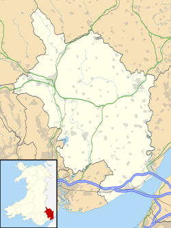
Cwmcarvan (Welsh : Cwmcarfan) is a small rural village in Monmouthshire, south east Wales. It is located 4 miles south west of Monmouth and about 4 miles east of Raglan, off the old A40 road two miles NW of Trellech.
The church dates from the 13th or 14th century. It is in the Early English and Perpendicular styles, with some 16th-century features. It was heavily restored in the 1870s. [1] The dedication is to St Catwg or Cadoc, a Welsh saint of the 6th century. There are porches on both the south and north sides, supposedly so that the squires of Cwmbychan and Trevildu within the parish did not have to enter through the same door as each other. [2]
The hill of Craig-y-dorth, 1 mile north east of the church, was the site of a battle in 1404 between Owain Glyndŵr's army and English forces. According to the Annals of Owain Glyn Dwr, "There the English were killed for the most part and they were pursued up to the gates of the town" (of Monmouth). [3] The hamlet of Craig-y-dorth is one of the only two communities in Monmouthshire with its own flag, the other being the town of Monmouth. [4]
The house at High Glanau was built in 1923 for the writer and garden designer Henry Avray Tipping. [1]
Abergavenny is a market town and community in Monmouthshire, Wales. Abergavenny is promoted as a "Gateway to Wales"; it is approximately 6 miles (10 km) from the border with England and is located where the A40 trunk road and the recently upgraded A465 Heads of the Valleys road meet.
Monmouth is a market town and community in Monmouthshire, Wales, situated on where the River Monnow joins the River Wye, two miles from the Wales–England border. The population in the 2011 census was 10,508, rising from 8,877 in 2001. Monmouth was the county town of historic Monmouthshire, although Abergavenny is the largest settlement and Monmouthshire County Council has its main offices at Rhadyr, just outside Usk. Monmouth is in the UK Parliament constituency of Monmouthshire and the Senedd constituency of Monmouth.
Usk is a town and community in Monmouthshire, Wales, 10 miles (16 km) northeast of Newport. It is located on the River Usk, which is spanned by an arched stone bridge at the western entrance to the town. Usk Castle, above the town, overlooks the ancient crossing point. It developed as a small market town, with some industry including the making of Japanware, and with a notable prison built in 1841–42. In recent years, Usk has become known for its history of success in Britain in Bloom competitions, winning the "Wales in Bloom" competition 35 times in a row between 1982 and 2016. The resident population of the town in 2011 was 2,834, decreasing to roughly 2,600 in 2021. 6.8% of the population are recorded as being able to speak Welsh.
Chepstow is a town and community in Monmouthshire, Wales, adjoining the border with Gloucestershire, England. It is located on the tidal River Wye, about 2 miles (3 km) above its confluence with the River Severn, and adjoining the western end of the Severn Bridge. It is the easternmost settlement in Wales, situated 16 miles (26 km) east of Newport, 28 miles (45 km) east-northeast of Cardiff, 18 miles (29 km) northwest of Bristol and 110 miles (180 km) west of London.
Trellech is a village and parish in Monmouthshire, south-east Wales. Located 5 miles (8 km) south of Monmouth and 4 miles (6.4 km) north-north-west of Tintern, Trellech lies on a plateau above the Wye Valley on the southern fringes of 320 acres (130 ha) of woodland in an Area of Outstanding Natural Beauty. Three Bronze Age standing stones are situated in the village, known as Harold's Stones, which overlook the historic church of St Nicholas, a Grade I listed building.
Newport Cathedral, also known as St Gwynllyw's or St Woolos' Cathedral, is the cathedral of the Diocese of Monmouth within the Church in Wales, and the seat of the Bishop of Monmouth. Its official title is Newport Cathedral of St Woolos, King and Confessor. The name of the saint, Woolos, is an anglicisation of the Welsh name Gwynllyw.
Monmouthshire is a county in the south east of Wales. It borders Powys to the north; the English counties of Herefordshire and Gloucestershire to the north and east; the Severn Estuary to the south, and Torfaen, Newport and Blaenau Gwent to the west. The largest town is Abergavenny, and the administrative centre is Usk.
Until 1974, Monmouthshire, also formerly known as the County of Monmouth, was an administrative county in the south-east of Wales, on the border with England, and later classed as one of the thirteen historic counties of Wales. Its area now corresponds approximately to the present principal areas of Monmouthshire, Blaenau Gwent, Newport and Torfaen, and those parts of Caerphilly and Cardiff east of the Rhymney River.
Tintern is a village in the community of Wye Valley, on the west bank of the River Wye in Monmouthshire, Wales, close to the border with England, about 5 miles (8 km) north of Chepstow. It is popular with tourists, in particular for the scenery and the ruined Tintern Abbey. Modern Tintern has been formed by the coalescence of two historic villages: Tintern Parva, forming the northern end of the village, and Chapel Hill, which forms the southern end. The village is designated as a Conservation Area.
Mathern is a historic community (parish) and village in Monmouthshire, south east Wales, about 3 miles (4.8 km) south west of the town of Chepstow, close to the Severn estuary, the Bristol Channel and the M48 motorway. The village is designated as a Conservation Area. It is now bisected by the motorway, which passes over the road through the village, with the original village located to the south and the more recent development, known as Newton Green, to the north.
Tretower Court is a medieval fortified manor house in Wales, situated in the village of Tretower, near Crickhowell in modern-day Powys, previously within the historical county of Breconshire or Brecknockshire.
Llangattock-Vibon-Avel is a rural parish and former community, now in the community of Whitecastle in Monmouthshire, south-east Wales, in the United Kingdom. It is located 5 miles (8.0 km) west of Monmouth and some 13 miles (21 km) east of Abergavenny, just off the B4233 old road between the two. Villages within the former community include Llangattock itself, Skenfrith, Rockfield, and Newcastle.
Dingestow is a small village in Monmouthshire, Wales. It is located 4 miles (6.4 km) south-west of Monmouth and approximately the same distance north-east of Raglan in rural Monmouthshire. The River Trothy passes through the village.
Mitchel Troy is a village and community in Monmouthshire, south east Wales, in the United Kingdom. It is located 3 miles south west of the county town of Monmouth, just off the A40 road leading towards Raglan. Settlements within the community include Tregare, Dingestow, Cwmcarvan and Wonastow.
Rockfield is a small village in the community of Whitecastle, Monmouthshire, Southeast Wales. It is located beside the River Monnow, about 2 miles (3.2 km) north-west of Monmouth, at the junction of the B4233 to Abergavenny and the B4347 to Grosmont. Rockfield Studios is situated just south of the village.
Dixton is a small village located 1 mile (1.6 km) north east of Monmouth, on the banks of the River Wye, in Monmouthshire, south east Wales. The parish originally comprised the two manors of Dixton Newton and Dixton Hadnock, on either side of the river.
Llanishen is a village in Monmouthshire, southeast Wales, United Kingdom. It is located 7 miles (11 km) southwest of Monmouth and 3 miles (4.8 km) south of Trellech on the B4293 road, although the main part of the village is set immediately to the west of the road, overlooking the Vale of Usk.
The England–Wales border, sometimes referred to as the Wales–England border or the Anglo-Welsh border, runs for 160 miles (260 km) from the Dee estuary, in the north, to the Severn estuary in the south, separating England and Wales.
Croft-Y-Bwla is a country house and farm 1.5 miles (2.4 km) north-west of Monmouth, south-east Wales. The house was built around 1830 and was designed by the noted Monmouth architect George Vaughan Maddox. It has been listed as Grade II since 1974.