This article needs additional citations for verification . (June 2014) (Learn how and when to remove this template message) |
Dangcagan | |
---|---|
Municipality of Dangcagan | |
Map of Bukidnon with Dangcagan highlighted | |
Location within the Philippines | |
Coordinates: 7°37′N125°00′E / 7.62°N 125°E Coordinates: 7°37′N125°00′E / 7.62°N 125°E | |
Country | |
Region | Northern Mindanao (Region X) |
Province | Bukidnon |
District | 3rd district of Bukidnon |
Barangays | 14 (see Barangays) |
Government | |
• Type | Sangguniang Bayan |
• Mayor | Fruto B. Dandasan Jr. |
• Vice Mayor | Edilberto F. Ayuban |
• Congressman | Manuel F. Zubiri |
• Electorate | 17,007 voters (2019) |
Area | |
• Total | 422.69 km2 (163.20 sq mi) |
Elevation | 357.5 m (1,172.9 ft) |
Population (2015 census) [4] | |
• Total | 23,723 |
• Density | 56/km2 (150/sq mi) |
• Households | 5,163 |
Economy | |
• Income class | 3rd municipal income class |
• Poverty incidence | 43.13% (2015) [5] |
• Revenue (₱) | 117,230,263.00 (2016) |
Time zone | UTC+8 (PST) |
ZIP code | 8719 |
PSGC | |
IDD : area code | +63 (0)88 |
Climate type | tropical rainforest climate |
Native languages | Western Bukidnon language Binukid Cebuano Ata Manobo Tagalog |
Website | www |
Dangcagan, officially the Municipality of Dangcagan, is a 3rd class municipality in the province of Bukidnon, Philippines. According to the 2015 census, it has a population of 23,723 people. [4]
Dangcagan used to be an abode of the Manobos under the leadership of Datu Dangaan (meaning “to praise”), a prominent chieftain ruler known for his courage and affluence. The place was then a little Sitio of Maramag. As the Christian settlers from Luzon & Visayas began to flock and settle in the area. Datu Dangaan followers ran and hide their families in the forest and returned to their home only when they knew the settlers were not around.
This leads the settler to call the “Dagandagan”. It took ample time for the settler to befriend the natives. When the natives and the Christian settlers finally united, they made representation to the Municipal Government of Maramag to form a regular barrio within the territory of Datu Dangaan. They agreed to call the barrio Dangcagan in honor of the natives.
The first set of officers was headed by Mayor Vicente Cabiling, originally appointed to the position in 1961 and was elected and served for ten (10) consecutive years, he constructed the old Municipal Hall on top of the hill in the poblacion. And from 1972 until March 1986 Mayor Fruto Ll. Dandasan assumed the office. During his time he constructed new roads and maintained the barangay road network of Dangcagan
In 1992, Mayor Norberta B. Dandasan assumed as Municipal Mayor until June 1995. She pursued the programs and projects that were initiated by her late husband and other predecessors. The municipal gymnasium was completed.
In the May 1995 election, Roberto Cabunoc took over the mayorship of the town and implemented the road concreting projects, beautification of the municipal plaza, installation of water system, construction of the new municipal hall and completion of different barangay projects. After three terms of Mayor Cabunoc, Mayor Edilberto F. Ayuban followed with 3 consecutive terms.
In the mayoral election of 2013, Mayor Fruto B. Dandasan who used to be one of the town's elected councilor, became the town vice mayor for two consecutive terms and now elected as the municipal mayor of the town.
Dangcagan is located in the southern part of the province. It is 72 kilometres (45 mi) from the provincial capital, Malaybalay City, and 162 kilometres (101 mi) from regional center, Cagayan de Oro City, which is the main outlet for its agricultural products. The town is sandwiched by municipality of Kitaotao in the northern and eastern part, by Kibawe, in its southern part and by Kadingilan on its western part. The Pulangi River and Muleta River serves as its natural boundary with Kitaotao (eastern side) and Kadingilan (western side), respectively.
The municipality has an aggregate land area of more or less 42,269 hectares (104,450 acres).
It has distinct dry and wet season; the wettest Month is usually September and the driest month is March.
Climate data for Dancagan, Bukidnon | |||||||||||||
---|---|---|---|---|---|---|---|---|---|---|---|---|---|
Month | Jan | Feb | Mar | Apr | May | Jun | Jul | Aug | Sep | Oct | Nov | Dec | Year |
Average high °C (°F) | 28 (82) | 28 (82) | 29 (84) | 31 (88) | 30 (86) | 29 (84) | 28 (82) | 29 (84) | 29 (84) | 29 (84) | 29 (84) | 29 (84) | 29 (84) |
Average low °C (°F) | 20 (68) | 20 (68) | 20 (68) | 21 (70) | 22 (72) | 22 (72) | 22 (72) | 22 (72) | 22 (72) | 22 (72) | 21 (70) | 20 (68) | 21 (70) |
Average precipitation mm (inches) | 44 (1.7) | 27 (1.1) | 32 (1.3) | 35 (1.4) | 76 (3.0) | 117 (4.6) | 108 (4.3) | 108 (4.3) | 94 (3.7) | 100 (3.9) | 76 (3.0) | 46 (1.8) | 863 (34.1) |
Average rainy days | 10.3 | 8.1 | 8.5 | 9.6 | 21.0 | 24.9 | 25.0 | 24.2 | 22.5 | 23.4 | 17.7 | 11.4 | 206.6 |
Source: Meteoblue (modeled/calculated data, not measured locally) [6] |
It has a fertile soil ranging from clay to sandy loam. Its topography is 70% flat and 30% rolling, which is suitable for agricultural crops such as corn, rice and other commercial crops like coconut, coffee, cacao, rubber, banana and sugar cane.
Dangcagan is politically subdivided into 14 barangays.
PSGC | Barangay | Population | ±% p.a. | |||
---|---|---|---|---|---|---|
2015 [4] | 2010 [7] | |||||
101303001 | Barongcot | 9.2% | 2,192 | 2,006 | 1.70% | |
101303002 | Bugwak | 2.8% | 653 | 596 | 1.75% | |
101303003 | Dolorosa | 4.8% | 1,134 | 1,015 | 2.13% | |
101303004 | Kapalaran | 6.3% | 1,503 | 1,458 | 0.58% | |
101303005 | Kianggat | 7.0% | 1,654 | 1,527 | 1.53% | |
101303006 | Lourdes | 2.7% | 636 | 749 | −3.07% | |
101303007 | Macarthur | 3.5% | 822 | 802 | 0.47% | |
101303008 | Miaray | 15.2% | 3,607 | 3,268 | 1.90% | |
101303009 | Migcuya | 4.6% | 1,094 | 1,075 | 0.33% | |
101303010 | New Visayas | 4.2% | 995 | 977 | 0.35% | |
101303011 | Osmeña | 6.3% | 1,487 | 1,383 | 1.39% | |
101303012 | Poblacion | 25.1% | 5,956 | 5,782 | 0.57% | |
101303013 | Sagbayan | 4.6% | 1,093 | 1,019 | 1.34% | |
101303014 | San Vicente | 3.8% | 897 | 791 | 2.42% | |
Total | 23,723 | 22,448 | 1.06% |
Population census of Dangcagan | ||
---|---|---|
Year | Pop. | ±% p.a. |
1970 | 13,464 | — |
1975 | 13,386 | −0.12% |
1980 | 13,652 | +0.39% |
1990 | 14,823 | +0.83% |
1995 | 16,660 | +2.21% |
2000 | 18,857 | +2.69% |
2007 | 21,254 | +1.66% |
2010 | 22,448 | +2.01% |
2015 | 23,723 | +1.06% |
Source: Philippine Statistics Authority [4] [7] [8] [9] |
In the 2015 census, the population of Dangcagan was 23,723 people, [4] with a density of 56 inhabitants per square kilometre or 150 inhabitants per square mile.
The majority of the municipality's inhabitants speak Cebuano, although some inhabitants also speak the Hiligaynon/Ilonggo language and many still speak Binukid (Manobo language).
Bukidnon, officially the Province of Bukidnon, is a landlocked province in the Philippines located in the Northern Mindanao region. Its capital is the city of Malaybalay. The province borders, clockwise starting from the north, Misamis Oriental, Agusan del Sur, Davao del Norte, Cotabato, Lanao del Sur, and Lanao del Norte. According to the 2015 census, the province is inhabited by 1,415,226 residents. The province is composed of 2 component cities and 20 municipalities. It is the third largest province in the country in terms of total area of jurisdiction behind Palawan and Isabela respectively.
Wao, officially the Municipality of Wao, is a 2nd class municipality in the province of Lanao del Sur, Philippines. According to the 2015 census, it has a population of 45,862 people.
Arakan, officially the Municipality of Arakan, is a 1st class municipality in the province of Cotabato, Philippines. According to the 2015 census, it has a population of 48,228 people.
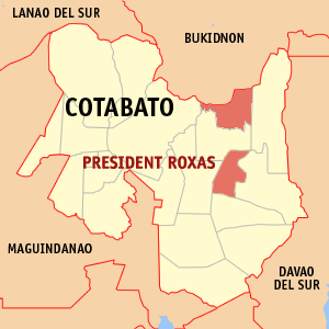
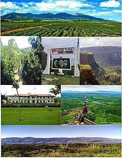
President Roxas, officially the Municipality of President Roxas, is a 1st class municipality in the province of Cotabato, Philippines. According to the 2015 census, it has a population of 47,575 people.
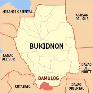
Damulog, officially the Municipality of Damulog, is a 4th class municipality in the province of Bukidnon, Philippines. According to the 2015 census, it has a population of 30,302 people.
Don Carlos, officially the Municipality of Don Carlos, is a 1st class municipality in the province of Bukidnon, Philippines. According to the 2015 census, it has a population of 66,959 people.
Kadingilan, officially the Municipality of Kadingilan, is a 3rd class municipality in the province of Bukidnon, Philippines. According to the 2015 census, it has a population of 33,778 people.
Kibawe, officially the Municipality of Kibawe, is a 2nd class municipality in the province of Bukidnon, Philippines. According to the 2015 census, it has a population of 39,612 people.
Kitaotao, officially the Municipality of Kitaotao, is a 1st class municipality in the province of Bukidnon, Philippines. According to the 2015 census, it has a population of 50,260 people.
Libona, officially the Municipality of Libona, is a 1st class municipality in the province of Bukidnon, Philippines. According to the 2015 census, it has a population of 43,969 people.
Manolo Fortich, officially the Municipality of Manolo Fortich, is a 1st class municipality in the province of Bukidnon, Philippines. According to the 2015 census, it has a population of 100,210 people.
Maramag, officially the Municipality of Maramag, is a 1st class municipality in the province of Bukidnon, Philippines. According to the 2015 census, it has a population of 102,089 people.
Pangantucan, officially the Municipality of Pangantucan, is a 1st class municipality in the province of Bukidnon, Philippines. According to the 2015 census, it has a population of 53,126 people.
Quezon, officially the Municipality of Quezon, is a 1st class municipality in the province of Bukidnon, Philippines. According to the 2015 census, it has a population of 104,116 people.
San Fernando, officially the Municipality of San Fernando, is a 1st class municipality in the province of Bukidnon, Philippines. According to the 2015 census, it has a population of 56,138 people.
Talakag, officially the Municipality of Talakag, is a 1st class municipality in the province of Bukidnon, Philippines. According to the 2015 census, it has a population of 71,644 people.
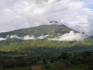
Claveria, officially the Municipality of Claveria, is a 1st class municipality in the province of Misamis Oriental, Philippines. According to the 2015 census, it has a population of 48,906 people.
Datu Unsay, officially the Municipality of Datu Unsay, is a 5th class municipality in the province of Maguindanao, Philippines. According to the 2015 census, it has a population of 11,813 people.
The Legislative Districts of Bukidnon are the representations of the province of Bukidnon in the various national legislatures of the Philippines. The province is currently represented in the lower house of the Congress of the Philippines through its first, second, third, and fourth congressional districts.
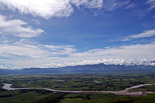
The Pulangi River, also spelled Pulangui, is one of the major tributaries of the Rio Grande de Mindanao, an extensive river system in Mindanao, Philippines. With a length of 320 kilometres (199 mi), it is the longest river in Bukidnon and the 5th longest river in the Philippines. It traverses through majority of the cities and municipalities of Bukidnon from its source in Barangay Kalabugao, Impasugong, Bukidnon.