Dawei Airport | |||||||||||
|---|---|---|---|---|---|---|---|---|---|---|---|
 | |||||||||||
| Summary | |||||||||||
| Airport type | Public | ||||||||||
| Operator | Government | ||||||||||
| Serves | Dawei, Myanmar | ||||||||||
| Elevation AMSL | 84 ft / 26 m | ||||||||||
| Coordinates | 14°06′13″N098°12′13″E / 14.10361°N 98.20361°E | ||||||||||
| Map | |||||||||||
 TVY Location of airport in Myanmar | |||||||||||
 | |||||||||||
| Runways | |||||||||||
| |||||||||||
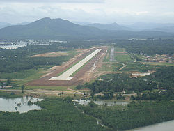
Dawei Airport( IATA : TVY, ICAO : VYDW) is a public airport serving Dawei [1] (formerly known as Tavoy), a city in the Tanintharyi Division in southeastern Myanmar. The airport that caters only to domestic flights is located in the northeastern part of the town, running from north to south.