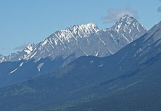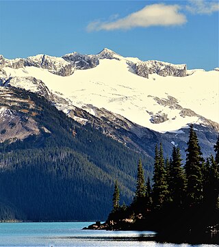
Mount Robson is the most prominent mountain in North America's Rocky Mountain range; it is also the highest point in the Canadian Rockies. The mountain is located entirely within Mount Robson Provincial Park of British Columbia, and is part of the Rainbow Range. Mount Robson is the second highest peak entirely in British Columbia, behind Mount Waddington in the Coast Range. The south face of Mount Robson is clearly visible from the Yellowhead Highway, and is commonly photographed along this route.

Mount Assiniboine, also known as Assiniboine Mountain, is a pyramidal peak mountain on the Great Divide, on the British Columbia/Alberta border in Canada.

Mount Columbia is a mountain located in the Winston Churchill Range of the Rocky Mountains. It is the highest point in Alberta, Canada, and is second only to Mount Robson for height and topographical prominence in the Canadian Rockies. It is located on the border between Alberta and British Columbia on the northern edge of the Columbia Icefield. Its highest point, however, lies within Jasper National Park in Alberta.

The Columbia Mountains are a group of mountain ranges along the Upper Columbia River in British Columbia, Montana, Idaho and Washington. The mountain range covers 135,952 km². The range is bounded by the Rocky Mountain Trench on the east, and the Kootenai River on the south; their western boundary is the edge of the Interior Plateau. Seventy-five percent of the range is located in Canada and the remaining twenty-five percent in the United States; American geographic classifications place the Columbia Mountains as part of the Rocky Mountains complex, but this designation does not apply in Canada. Mount Sir Sandford is the highest mountain in the range, reaching 3,519 metres (11,545 ft).

The Rainbow Range is a small subrange of the Park Ranges subdivisions of the Northern Continental Ranges of the Rocky Mountains on the border between Alberta and British Columbia in Mount Robson Provincial Park.
Mount Queen Bess is one of the principal summits of the Pacific Ranges of the Coast Mountains of southern British Columbia. It stands west of Chilko Lake and to the south of Tatlayoko Lake, and crowns a peak-studded ridge to the north of the Homathko Icefield.
Mount Raleigh, elevation 3,132 m (10,276 ft), is one of the principal summits of the Pacific Ranges of the Coast Mountains of southern British Columbia in Canada. It is located just southeast of the confluence of the Southgate and Bishop Rivers, northeast of the head of Bute Inlet, and is the highest summit south of the Bishop River's divide with the Lillooet River at Ring Pass, which is at the southeastern edge of the Lillooet Icefield and just north of the Pemberton Icecap. It is also the highest peak south of the pass between the upper basins of Chilko Lake and the Taseko Lakes, just north of which is Monmouth Mountain at 3,182 m (10,440 ft).

Tŝ’ilʔoŝ, also known as Mount Tatlow, is one of the principal summits of the Chilcotin Ranges subdivision of the Pacific Ranges of the Coast Mountains of southern British Columbia. Standing on an isolated ridge between the lower end of Chilko Lake and the Taseko Lakes, it is 3,063 m (10,049 ft) in elevation.

Kakwa Provincial Park and Protected Area is a 170,890 ha provincial park in northeastern British Columbia, Canada. The park preserves the southernmost portion of the Hart Ranges and the northernmost portion of the Continental Ranges. The park also preserves significant marine fossil deposits located in the region.
The Waputik Range lies west of the upper Bow Valley, east of Bath Creek, and south of Balfour Creek in the Canadian Rockies. "Waputik" means "white goat" in Stoney. The range was named in 1884 by George Mercer Dawson of the Geological Survey of Canada. The President Range lies within the Waputik Range.

The Hart Ranges are a major subrange of the Canadian Rockies located in northeastern British Columbia and western Alberta. The mountains constitute the southernmost portion of the Northern Rocky Mountains.

Mount Silverthrone, officially named Silverthrone Mountain, is a mountain in the Pacific Ranges of the Coast Mountains of British Columbia, Canada, located over 320 km (200 mi) northwest of the city of Vancouver and about 50 km (30 mi) west of Mount Waddington, British Columbia, Canada. It is the highest peak in the Ha-Iltzuk Icefield, which is the largest icefield in the Coast Mountains south of the Alaska Panhandle.
ḵ’els is a mountain located at the head of lekw’emin above the ancestral shíshálh village site of x̱enichen and within the Pacific Ranges of the Coast Mountains of British Columbia, Canada. The mountain is associated with a shíshálh legend about a great flood.
Mount Thomlinson is a mountain in the Babine Range of the Skeena Mountains in northern British Columbia, Canada, located at the head of Thomlinson Creek, southeast of the junction of Babine River and Skeena River and north of Hazelton. It has a prominence of 1,661 m (5,449 ft), created by the Babine-Stuart Pass, thus making it one of Canada's many Ultra peaks. Thomlinson is one of the most isolated mountains of Canada.
Mount Ulysses, is the highest mountain in the Muskwa Ranges of the Northern Canadian Rockies in British Columbia. It and neighbouring peaks are part of a group of names drawing on the epic poem The Odyssey, in which here Ulysses wanders for 10 years before being able to return home to Ithaca.

Mount Dawson, elevation 3,377 metres (11,079 ft), is a massif in the Selkirk Mountains of British Columbia, Canada, located in Glacier National Park to the southeast of Rogers Pass. It is a double summit, the highest of which is Hasler Peak, the second peak being Feuz Peak, with Hasler Peak's elevation making it the highest summit in Glacier National Park and the second highest in the Selkirks. Mount Dawson is ranked as the 58th highest mountain in British Columbia. The Dawson Glacier is located on its eastern flank.

Mount Selkirk is a 2,930-metre (9,610-foot) mountain summit located in the Vermilion River Valley along the eastern border of Kootenay National Park. Park visitors can see the peak from Highway 93, also known as the Banff–Windermere Highway. It is part of the Mitchell Range, which is a sub-range of the Canadian Rockies of British Columbia, Canada. The nearest higher neighbor is Catlin Peak, 1.6 km (0.99 mi) to the northwest.

Gladsheim Peak is a prominent 2,830-metre (9,280-foot) mountain summit located in the Valhalla Ranges of the Selkirk Mountains in British Columbia, Canada. Gladsheim is the highest point in the Valhalla Ranges. It is situated in the southern part of Valhalla Provincial Park, 2.7 km (1.7 mi) northeast of Gimli Peak, and 12 km (7.5 mi) west of Slocan and Slocan Lake. The name "Valhalla Mountains" first appeared in George Mercer Dawson's Geological Survey of Canada map published in 1890. Dawson applied names derived from Scandinavian mythology to several of the mountain ranges and peaks in Southern Kootenay. Gladsheim is the magnificent meeting hall containing thirteen council seats where, according to Norse mythology, Odin presided over all the realms. In keeping with the Valhalla theme, this peak's name was submitted in 1900 by R. W. Brock to the Geological Survey of Canada for consideration, and it was officially adopted March 31, 1924, by the Geographical Names Board of Canada.

Mount Carr is a 2,590-metre (8,497-foot) mountain summit located in British Columbia, Canada.

Mount McLean is a 2,427-metre (7,963-foot) mountain summit located in British Columbia, Canada.


