
Mount Columbia is a mountain located in the Winston Churchill Range of the Rocky Mountains. It is the highest point in Alberta, Canada, and is second only to Mount Robson for height and topographical prominence in the Canadian Rockies. It is located on the border between Alberta and British Columbia on the northern edge of the Columbia Icefield. Its highest point, however, lies within Jasper National Park in Alberta.

Mount Fox in the Selkirk Mountains of Canada was named, by William Green, in honour of Harry Fox who perished with William Donkin and two Swiss guides, in the Caucasus Mountains. Mount Donkin is nearby.

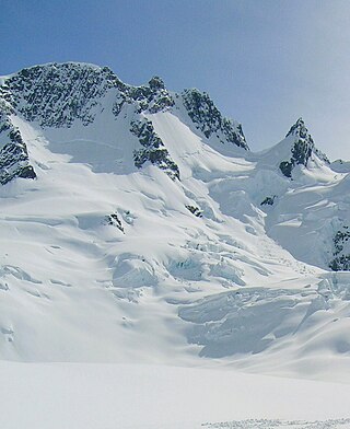
Mount Bonney, is a 3,100-metre (10,200-foot) mountain summit located in Glacier National Park in the Selkirk Mountains of British Columbia, Canada. Mount Bonney is surrounded by ice including the Bonney Glacier, Clarke Glacier, Swanzy Glacier, and Bonney Névé. Its nearest higher peak is Mount Sir Donald, 10.0 km (6.2 mi) to the northeast. Mount Bonney is visible from Highway 1, the Trans-Canada Highway at Rogers Pass.
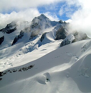
Mount Swanzy is a 2,891-metre (9,485-foot) mountain summit located in Glacier National Park in the Selkirk Mountains of British Columbia, Canada. Mount Swanzy is surrounded by ice including the Bonney Glacier, Clarke Glacier, and Swanzy Glacier. Its nearest higher peak is Mount Bonney, 1.0 km (0.62 mi) to the west.

Mount Wheeler, is a 3,336-metre (10,945-foot) mountain summit located in Glacier National Park of British Columbia, Canada. It is the third-highest peak in the park, and sixth-highest in the Selkirk Mountains range. The mountain is a remote 60 km (37 mi) east of Revelstoke, and 40 km (25 mi) southwest of Golden. Its nearest higher peak is Mount Selwyn, 5.1 km (3.2 mi) to the north-northwest. Mount Wheeler is surrounded by ice, including the Deville Glacier, Deville Névé, Black Glacier, and Thor Glacier. Precipitation runoff from the mountain and meltwater from its glaciers drains into tributaries of the Incomappleux and Beaver Rivers.

Mount Topham, is a 2,872-metre (9,423-foot) mountain summit located in Glacier National Park of British Columbia, Canada. It is part of the Selkirk Mountains range. The mountain is a remote 60 km (37 mi) east of Revelstoke, and 32 km (20 mi) southwest of Golden. Its nearest higher peak is Mount Selwyn, 2.66 km (1.65 mi) to the west. Mount Topham is situated along the western edge of the Deville Glacier. Precipitation runoff from the mountain drains into the Beaver River. Mount Topham was named in 1902 by Arthur Oliver Wheeler to honor Harold Ward Topham (1857–1915), an English mountaineer who explored and mapped the Selkirks. The mountain's name was officially adopted September 8, 1932, by the Geographical Names Board of Canada. Based on the Köppen climate classification, Mount Topham is located in a subarctic climate zone with cold, snowy winters, and mild summers. Winter temperatures can drop below −20 °C with wind chill factors below −30 °C.

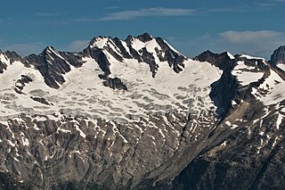
Mount Macoun is a 3,030-metre (9,940-foot) mountain summit located in Glacier National Park of British Columbia, Canada. It is part of the Selkirk Mountains range. The mountain is a remote 61 km (38 mi) east of Revelstoke, and 32 km (20 mi) southwest of Golden. Its nearest higher peak is Mount Fox, 3.7 km (2.3 mi) to the southwest, and Mount Topham rises 4.4 km (2.7 mi) to the south. The expansive Illecillewaet Névé lies to the northwest, and two small unnamed glaciers lie at the bottom of the steep east face. Precipitation runoff from the mountain drains into the Beaver River.

North Albert Peak is a 2,934-metre (9,626-foot) mountain summit located in British Columbia, Canada.
Albert Peak is a 3,045-metre (9,990-foot) mountain summit located in British Columbia, Canada.
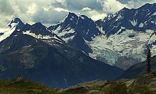
Mount Butters is a 3,141-metre (10,305-foot) mountain summit in British Columbia, Canada.

Beaver Mountain is a 3,212-metre (10,538-foot) mountain summit in British Columbia, Canada.
Moby Dick Mountain is a 3,154-metre (10,348-foot) summit in British Columbia, Canada.

Purity Mountain is a 3,149-metre (10,331-foot) summit in British Columbia, Canada.

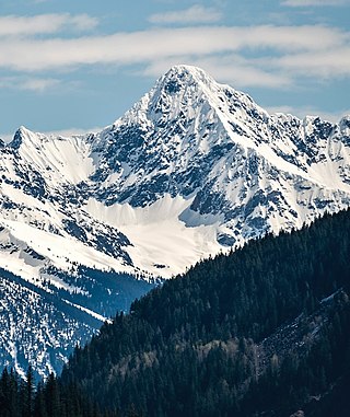
Mount Duncan is a 3,202-metre (10,505-foot) summit in British Columbia, Canada.

Mount Nemo is a 2,901-metre (9,518-foot) summit in British Columbia, Canada.

Houdini Needles is a 2,663-metre (8,737-foot) mountain in British Columbia, Canada.
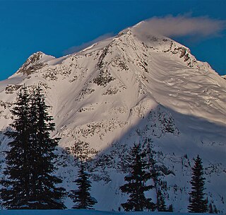
Austerity Mountain is a 3,337-metre (10,948-foot) mountain in British Columbia, Canada.
Pioneer Peak is a 3,245-metre (10,646-foot) mountain in British Columbia, Canada.

Mount Swiderski is a 3,133-metre (10,279-foot) mountain summit in British Columbia, Canada.

Mount Wilkie is a 2,699-metre (8,855-foot) summit in British Columbia, Canada.


