Related Research Articles

Fort Jones is a city in the Scott Valley area of Siskiyou County, California, United States. The population was 839 at the 2010 census, up from 600 as of the 2000 census.

Carson Hill is a ghost town in Calaveras County, California. It sits at an elevation of 1447 feet above sea level and is located at 38°01′42″N120°30′24″W, about 4 miles (6.4 km) south-southeast of Angels Camp. It was one of the most productive mining camps in the state, with nearly $26 million in gold and quartz found in the area. Carson Hill is registered as California Historical Landmark #274. The town was served by the Sierra Railway's branchline to Angels Camp until 1935.

The Dimond District is a neighborhood centered on the intersection of MacArthur Boulevard and Fruitvale Avenue in East Oakland, Oakland, California, in the United States. It is located about two miles east of Lake Merritt, north of the Fruitvale District, and west of the Laurel District. It lies at an elevation of 213 feet. Dimond's ZIP code is 94602. It is a multicultural neighborhood where the hills meet the flatlands and is a unique melting pot of cultures and social classes. Dimond Park is located in the district.

Raglesville is an unincorporated community and census-designated place (CDP) in Van Buren Township, Daviess County, Indiana, United States. As of the 2010 census it had a population of 141.
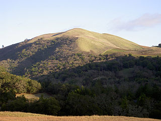
Bald Mountain is a name given to over fifty summits in California.
CKRX-FM is a Canadian radio station that broadcasts an active rock format at 102.3 FM in Fort Nelson, British Columbia. The station is branded as 102.3 The Bear and is owned by Bell Media.
Cadenasso is an unincorporated community in Yolo County, California, between two other unincorporated communities: Brooks and Capay. Cadenasso lies at an elevation of 325 feet. The settlement is named after Nicola Cadenasso, a rancher who came from Genoa, Italy in the late 19th century. A post office was run in the town between 1894–95 and again in 1915–18.
Deadwood is an unincorporated community in Butte County, California. It lies at an elevation of 1719 feet.

Lorenzo Station in Alameda County, California is located on the Southern Pacific Railroad 2.5 miles (4.0 km) south-southeast of San Leandro, at an elevation of 33 feet.

Crannell is a former settlement in Humboldt County, California. It is located 4.5 miles (7.2 km) southeast of Trinidad, at an elevation of 203 feet (62 m).
Araz Junction is an unincorporated community in Imperial County, California. It is located on the Southern Pacific Railroad 2.5 miles (4 km) east-northeast of Pilot Knob, at an elevation of 203 feet. It is located within the Fort Yuma Indian Reservation.
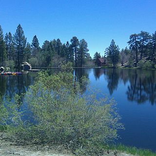
Cedar Lake is an artificial lake in the San Bernardino Mountains of California that has appeared in dozens of Western films. It is the centerpiece of Cedar Lake Camp, a private retreat center owned and operated by Cedar Lake Camp, Inc., a non profit public benefit corporation.

Sawyers Bar is an unincorporated community located on the North Fork Salmon River in unincorporated Siskiyou County, California, not to be confused with a Sawyers or Lawyers Bar in Del Norte County.

Rochford is an unincorporated community in Pennington County, South Dakota, United States. It is not tracked by the U.S. Census Bureau.
Black Bear is a populated place, originally a gold mining town in Klamath County, now in unincorporated Siskiyou County, California.
Hooperville, a former gold mining camp, near Fort Jones in the 1850s in Siskiyou County, California. Its site lies at an elevation of 3054 feet,. The village site is on Indian Creek road, and Schoolhouse Gap fort jones ca. There are a few mines left(private) and the obvious remains of the stamp mill footings.

Oro Fino is a populated place, formerly a gold mining town near Fort Jones in the 1850s, in unincorporated Siskiyou County, California. Its site lies at an elevation of 2,871 ft (875 m). Oro Fino addresses are all within Fort Jones.
Cheeseville is an unincorporated community in Siskiyou County, California, in the United States. Cheeseville has not been included in the past census counts, therefore does not have population information.
Lucky Jim Camp sometimes called Lucky Camp is a ghost town site in Clark County, Nevada. It was within New Mexico Territory when founded in 1862.
Redfern, South Dakota is the site of an old Black Hills Gold Rush community. The area is located at the eastern base of Redfern Mountain, 6,076 feet in elevation, in Pennington County, South Dakota. The mountain and the Redfern townsite is located on the gravel road to Mystic, South Dakota, and is about a mile from the old town site of Tigerville. The Mystic Road is about 7 miles from Hill City, SD on the Deerfield Road.
References
- ↑ U.S. Geological Survey Geographic Names Information System: Deadwood
- ↑ Gudde, Erwin G. (1998). California place names : the origin and etymology of current geographical names (4th ed., rev. and enl. ed.). Berkeley: University of California Press. p. 104. ISBN 0520213165.
Coordinates: 41°42′52″N122°48′12″W / 41.71444°N 122.80333°W
Municipalities and communities of Siskiyou County, California, United States | ||
|---|---|---|
| Cities |  | |
| CDPs | ||
| Unincorporated communities | ||
| Indian reservation | ||
| Ghost towns | ||
| Footnotes | ‡This populated place also has portions in an adjacent county or counties | |
| This Siskiyou County, California-related article is a stub. You can help Wikipedia by expanding it. |