Deer Creek (Arizona)

Last updated
Deer Creek
Grand Canyon National Park Deer Creek 0104 (6081561662).jpg
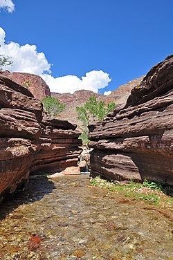
Tapeats Sandstone in lower Deer Creek
USA Arizona relief location map.svg
Red pog.svg
Location of mouth
Location
Country United States
State Arizona
Physical characteristics
Mouth  
  coordinates
36°23′53″N112°30′20″W / 36.3980°N 112.5055°W / 36.3980; -112.5055 Coordinates: 36°23′53″N112°30′20″W / 36.3980°N 112.5055°W / 36.3980; -112.5055

Deer Creek is a stream that flows through the western part of the Grand Canyon, in the U.S. state of Arizona, as a right-bank tributary of the Colorado River. A series of natural springs provide for a perennial flow in Deer Creek. During periods of intense rainfall, Deer Creek can experience severe flash flooding. In the final half mile above the Colorado River, Deer Creek flows through a narrow slot canyon before plunging over a 150-foot (46 m) waterfall named Deer Creek Falls. [1]

Deer Creek and its waterfall are within the boundaries of Grand Canyon National Park and are a popular stopping point for river trips through the canyon. Backpackers can also access the falls by hiking from the North Rim. The Surprise Valley trail connects the Deer Creek drainage with the adjacent Thunder River/Tapeats Creek drainage.

See also

Related Research Articles

Little Colorado River River in Arizona, United States

The Little Colorado River is a tributary of the Colorado River in the U.S. state of Arizona, providing the principal drainage from the Painted Desert region. Together with its major tributary, the Puerco River, it drains an area of about 26,500 square miles (69,000 km2) in eastern Arizona and western New Mexico. Although it stretches almost 340 miles (550 km), only the headwaters and the lowermost reaches flow year-round. Between St. Johns and Cameron, most of the river is a wide, braided wash, only containing water after heavy snowmelt or flash flooding.

Gunnison River Tributary of the Colorado River

The Gunnison River is located in western Colorado, and it is one of the largest tributaries of the Colorado river. The 180-mile (289-km) long river flows east to west, and it has a drainage area of 7,923 square miles (20,520 km2) according to the USGS. The drainage basin of the Gunnison River collects water from different habitats, such as forests and alpine meadows, located the along Continental Divide. As the river flows westward, it carves through the San Juan Mountains. It flows into the Colorado River at Grand Junction.

Pend Oreille River River, tributary of the Columbia

The Pend Oreille River is a tributary of the Columbia River, approximately 130 miles (209 km) long, in northern Idaho and northeastern Washington in the United States, as well as southeastern British Columbia in Canada. In its passage through British Columbia its name is spelled Pend-d'Oreille River. It drains a scenic area of the Rocky Mountains along the U.S.-Canada border on the east side of the Columbia. The river is sometimes defined as the lower part of the Clark Fork, which rises in western Montana. The river drains an area of 66,800 square kilometres (25,792 sq mi), mostly through the Clark Fork and its tributaries in western Montana and including a portion of the Flathead River in southeastern British Columbia. The full drainage basin of the river and its tributaries accounts for 43% of the entire Columbia River Basin above the confluence with the Columbia. The total area of the Pend Oreille basin is just under 10% of the entire 258,000-square-mile (670,000 km2) Columbia Basin. Box Canyon Dam is currently underway on a multimillion-dollar project for a fish ladder.

Dirty Devil River

The Dirty Devil River is an 80-mile-long (130 km) tributary of the Colorado River, located in the U.S. state of Utah. It flows through southern Utah from the confluence of the Fremont River and Muddy Creek before emptying into the Colorado River at Lake Powell.

Skykomish River River in northwest Washington, United States

The Skykomish River is a 29-mile (47 km) long river in the U.S. state of Washington which drains the west side of the Cascade Mountains in the southeast section of Snohomish County and the northeast corner of King County. The river starts with the confluence of the North Fork Skykomish River and South Fork Skykomish River approximately one mile west of Index, then flowing northwesterly towards Puget Sound. It is joined by the Sultan River and the Wallace River at Sultan. It then meets the Snoqualmie River to form the Snohomish River at Monroe. The Snohomish River continues along the river valley eventually dumping into Port Gardner Bay on Possession Sound.

Zion Canyon

Zion Canyon is a deep and narrow gorge in southwestern Utah, United States, carved by the North Fork of the Virgin River. Nearly the entire canyon is located within the western half of Zion National Park.

Rio Chama

The Rio Chama, a major tributary river of the Rio Grande, is located in the U.S. states of Colorado and New Mexico. The river is about 130 miles (210 km) long altogether. From its source to El Vado Dam its length is about 50 miles (80 km), from El Vado Dam to Abiquiu Dam is about 51 miles (82 km), and from Abiquiu Dam to its confluence with the Rio Grande is about 34 miles (55 km).

Canyons of the Escalante

The Canyons of the Escalante is a collective name for the erosional landforms created by the Escalante River and its tributaries—the Escalante River Basin. Located in southern Utah in the western United States, these sandstone features include high vertical canyon walls, numerous slot canyons, waterpockets, domes, hoodoos, natural arches and bridges. This area—extending over 1,500 square miles (3,885 km2) and rising in elevation from 3,600 ft (1,097 m) to over 11,000 ft (3,353 m)—is one of the three main sections of the Grand Staircase-Escalante National Monument, and also a part of the Glen Canyon National Recreation Area, with Capitol Reef National Park being adjacent to the east.

Mount Shuksan Waterfalls

There are four prominent waterfalls in the basin of a short tributary of Sulphide Creek, on the southeast flank of 9,127-foot (2,781m) Mount Shuksan in North Cascades National Park, Washington. Seahpo Peak Falls and Cloudcap Falls, the taller two of the three, are located on separate streams that converge and plunge over Rockflow Canyon Falls. The unnamed outlet stream from these waterfalls flows into Sulphide Creek, which flows into the Baker River. Another waterfall is Jagged Ridge Falls, on a tributary of the unnamed stream.

Sulphide Creek River in the United States of America

Sulphide Creek is a 2.5-mile (4.0 km) glacial tributary of the Baker River in Whatcom County in the U.S. state of Washington, draining a steep and narrow canyon on the southeast flank of Mount Shuksan, inside North Cascades National Park. Although called a creek, it is river-like due to its high volume. The creek is fed by the "massive" Sulphide and Crystal glaciers above Sulphide Lake and it runs east collecting several small tributaries before flowing into the Baker River at elevation 869 feet (265 m). There are several very tall waterfalls occurring on the creek and its tributaries, the largest of which is Sulphide Creek Falls.

Havasu Creek

Havasu Creek is a stream in the U.S. state of Arizona associated with the Havasupai people. It is a tributary to the Colorado River, which it enters in the Grand Canyon.

Falls Creek (California)

Falls Creek, also known as the Falls River, is a tributary of the Tuolumne River in Yosemite National Park, California, United States. The creek begins at the northern boundary of the national park and flows 24 miles (39 km) to empty into the Tuolumne at Hetch Hetchy Reservoir, dropping over two well-known waterfalls. The Pacific Crest Trail and other national park trails follow the creek for much of its course.

Rock River Canyon Wilderness

The Rock River Canyon Wilderness is a 4,640-acre (18.8 km2) unit within the Hiawatha National Forest. It is located in Alger County, Michigan. The wilderness is accessible from M-94, which runs south of the unit in a west-to-east direction. The nearest town is Chatham, Michigan, which is located approximately 3 miles (4.8 km) south of the wilderness unit's eastern end.

Course of the Colorado River

The Colorado River is a major river of the western United States and northwest Mexico in North America. Its headwaters are in the Rocky Mountains where La Poudre Pass Lake is its source. Located in north central Colorado it flows southwest through the Colorado Plateau country of western Colorado, southeastern Utah and northwestern Arizona where it flows through the Grand Canyon. It turns south near Las Vegas, Nevada, forming the Arizona–Nevada border in Lake Mead and the Arizona–California border a few miles below Davis Dam between Laughlin, Nevada and Needles, California before entering Mexico in the Colorado Desert. Most of its waters are diverted into the Imperial Valley of Southern California. In Mexico its course forms the boundary between Sonora and Baja California before entering the Gulf of California. This article describes most of the major features along the river.

Silver Cord Cascade

Silver Cord Cascade is a horsetail type waterfall on Surface Creek, a tributary of the Yellowstone River in Yellowstone National Park. Surface Creek flows out of Ribbon Lake off the South rim of the Grand Canyon of the Yellowstone and plunges 1,200 feet (370 m) to the Yellowstone River. It is considered the tallest waterfall in Yellowstone.

Wahweap Creek

Wahweap Creek is a 55.6-mile (89.5 km) long intermittent stream in southern Utah in the United States, and is a tributary of the Colorado River. It drains a rugged, high elevation, largely roadless mesa and canyon country in the Colorado Plateau region. The creek flows into the Lake Powell reservoir at Wahweap Bay where it gives its name to the Wahweap Marina, a popular access point to the Glen Canyon National Recreation Area.

Tapeats Creek Creek in Grand Canyon National Park, Arizona, U.S.

Tapeats Creek is a creek located entirely within the Grand Canyon National Park. It flows southwest from its source near the North Rim of the canyon to the Colorado River at the base of the canyon. It was named by the Second Powell Expedition in the winter of 1871–1872 for a Southern Paiute Indian who claimed ownership of the stream. It contributes the largest amount of water to the Colorado of any tributary on the north side within the Grand Canyon.

Matilija Wilderness Protected wilderness area in California, United States

The Matilija Wilderness is a 29,207-acre (11,820 ha) wilderness area in Ventura and Santa Barbara Counties, Southern California. It is managed by the U.S. Forest Service, being situated within the Ojai Ranger District of the Los Padres National Forest. It is located adjacent to the Dick Smith Wilderness to the northwest and the Sespe Wilderness to the northeast, although it is much smaller than either one. The Matilija Wilderness was established in 1992 in part to protect California condor habitat.

References