Current listings
| [3] | Name on the Register | Image | Date listed [4] | Location | City or town | Description |
|---|---|---|---|---|---|---|
| 1 | 1956 Grand Canyon TWA – United Airlines Aviation Accident Site |  | April 22, 2014 (#14000280) | Near the confluence of the Colorado River and Little Colorado River 36°10′30″N111°50′00″W / 36.175°N 111.833333°W | Grand Canyon National Park | |
| 2 | Horace M. Albright Training Center |  | September 13, 2013 (#13000784) | Albright Ave. & Center Rd. 35°58′41″N111°59′26″W / 35.978006°N 111.990509°W | Grand Canyon National Park | |
| 3 | Desert View Watchtower Historic District |  | January 3, 1995 (#94001503) | East Rim Drive, about 17 miles (27 km) east of Grand Canyon Village, Desert View 36°02′42″N111°49′34″W / 36.045°N 111.826111°W | Grand Canyon National Park | Desert View Watchtower, designed by Mary Jane Colter, part of the Mary Jane Colter NHL district |
| 4 | El Tovar Hotel |  | September 6, 1974 (#74000334) | Grand Canyon National Park, Route 8A 36°03′27″N112°08′13″W / 36.0575°N 112.136944°W | Grand Canyon National Park | National Historic Landmark.hotel on the South Rim of the Grand Canyon |
| 5 | El Tovar Stables |  | September 6, 1974 (#74000336) | Off Grand Canyon National Park Route 8A 36°03′20″N112°08′28″W / 36.055556°N 112.141111°W | Grand Canyon National Park | Stables serving the mule trains that descend to the bottom of the Grand Canyon |
| 6 | Grand Canyon Inn and Campground |  | September 2, 1982 (#82001872) | North Rim 36°12′34″N112°03′35″W / 36.209444°N 112.059722°W | Grand Canyon National Park | Also known as the North Rim Inn, now a store about 1 mile north of the Grand Canyon Lodge |
| 7 | Grand Canyon Lodge |  | September 2, 1982 (#82001721) | North Rim on Bright Angel Point 36°11′57″N112°03′07″W / 36.199167°N 112.051944°W | Grand Canyon National Park | National Historic Landmark lodge and cabins on the edge of the North Rim of the Grand Canyon |
| 8 | Grand Canyon North Rim Headquarters |  | September 2, 1982 (#82001722) | North Rim 36°12′53″N112°03′42″W / 36.214722°N 112.061667°W | Grand Canyon National Park | Park Service administrative district of rustic buildings |
| 9 | Grand Canyon Park Operations Building |  | May 28, 1987 (#87001412) | Off West Rim Dr. 36°03′18″N112°08′13″W / 36.055°N 112.136944°W | Grand Canyon National Park | National Historic Landmark, rustic park administration building |
| 10 | Grand Canyon Power House |  | May 28, 1987 (#87001411) | Off West Rim Dr. 36°03′31″N112°08′26″W / 36.05854°N 112.14065°W | Grand Canyon National Park | National Historic Landmark, park power plant with creative use of scale and detailing |
| 11 | Grand Canyon Railroad Station |  | September 6, 1974 (#74000337) | Grand Canyon National Park Route 8A 36°03′22″N112°08′11″W / 36.056111°N 112.136389°W | Grand Canyon National Park | National Historic Landmark, rustic terminus to the Grand Canyon Railway |
| 12 | Grand Canyon Railway |  | August 23, 2000 (#00000319) | From Williams to Grand Canyon National Park 35°35′59″N112°12′44″W / 35.599722°N 112.212222°W | Williams | Former branch of the Atchison, Topeka and Santa Fe Railway to the South Rim |
| 13 | Grand Canyon Village Historic District |  | November 20, 1975 (#75000343) | State Route 64 36°03′22″N112°08′21″W / 36.056111°N 112.139167°W | Grand Canyon National Park | National Historic Landmark, the largest developed area in the national park system |
| 14 | Grandview Mine | 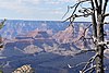 | July 9, 1974 (#74000347) | Grand Canyon National Park 36°01′05″N111°58′32″W / 36.018056°N 111.975556°W | Grand Canyon National Park | Remnant of former mining activity |
| 15 | Hermits Rest Concession Building |  | August 7, 1974 (#74000335) | Grand Canyon National Park 36°03′40″N112°12′40″W / 36.061111°N 112.211111°W | Grand Canyon National Park | Rustic store and museum designed by Mary Jane Colter to resemble a Hopi pueblo |
| 16 | Mary Jane Colter Buildings | | May 28, 1987 (#87001436) | Grand Canyon Village and East Rim Drive, about 17 miles (27 km) east of Grand Canyon Village, Desert View 36°03′29″N112°08′13″W / 36.0581°N 112.1369°W | Grand Canyon National Park | Four National Historic Landmark properties: Hopi House, Desert View Watchtower, Lookout Studio, Hermit's Rest |
| 17 | Navajo Steel Arch Highway Bridge |  | August 13, 1981 (#81000134) | Southwest of Lee 36°49′05″N111°37′52″W / 36.818056°N 111.631111°W | Lee's Ferry | Highway bridge over the upper Grand Canyon |
| 18 | Buckey O'Neill Cabin | 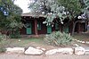 | October 29, 1975 (#75000227) | Off State Route 64 in Grand Canyon National Park 36°03′26″N112°08′26″W / 36.057222°N 112.140556°W | Grand Canyon National Park | Part of the Bright Angel Lodge, the cabin perches right on the rim of the canyon |
| 19 | Ranger's Dormitory |  | September 5, 1975 (#75000219) | Off State Route 64 in Grand Canyon National Park 36°03′20″N112°08′11″W / 36.055556°N 112.136389°W | Grand Canyon National Park | Rustic Park Service employee housing |
| 20 | Superintendent's Residence |  | September 6, 1974 (#74000450) | Off Route 8A in Grand Canyon National Park 36°03′22″N112°08′05″W / 36.056111°N 112.134722°W | Grand Canyon National Park | Highly-detailed National Park Service Rustic structure |
| 21 | Trans-Canyon Telephone Line, Grand Canyon National Park |  | May 13, 1986 (#86001102) | Grand Canyon along the Bright Angel and North Kaibab Trails from the South Rim to Roaring Springs and the South Kaibab Trail to Tipoff 36°06′36″N112°05′34″W / 36.11°N 112.092778°W | Grand Canyon National Park | Innovative communication line between the North and South Rims |
| 22 | Tusayan Ruins |  | July 10, 1974 (#74000285) | Grand Canyon National Park 36°00′49″N111°51′56″W / 36.013611°N 111.865556°W | Grand Canyon National Park | Pueblo culture ruins and museum |
| 23 | Water Reclamation Plant |  | September 6, 1974 (#74000348) | South of Grand Canyon National Park, Route 8A 36°02′54″N112°09′19″W / 36.048333°N 112.155278°W | Grand Canyon National Park | Innovative water treatment system, one of the first of its kind |