Deir Ammar Camp | |
|---|---|
| Arabic transcription(s) | |
| • Arabic | مخيّم دير عمّار |
 Deir Ammar Camp Location of Deir Ammar Camp within Palestine | |
| Coordinates: 31°57′57.22″N35°05′55.98″E / 31.9658944°N 35.0988833°E | |
| State | State of Palestine |
| Governorate | Ramallah and al-Bireh |
| Government | |
| • Type | Refugee Camp |
| Area | |
• Total | 145 dunams (14.5 ha or 36 acres) |
| Population (2017) [1] | |
• Total | 1,884 |
| • Density | 13,000/km2 (34,000/sq mi) |
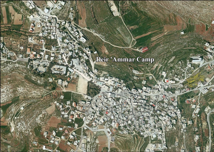
Deir Ammar Camp (Arabic : مخيّم دير عمّار) is a Palestinian refugee camp located in the Ramallah and al-Bireh Governorate, approximately 30 kilometers (19 mi) northwest of Ramallah in the northern West Bank. According to the Palestinian Central Bureau of Statistics (PCBS), the camp had a population of 1,884 inhabitants in 2017. [1]
Established in 1949, the camp was set up on land previously owned by non-refugee residents of the village of Deir Ammar. In return, UNRWA's facilities in the camp also provide services to the non-refugee villagers. The camp falls under joint Israeli-Palestinian control in "Area B". [2] The refugee camp has two schools: the boys' school which has 680 pupils, and the girls' school which has 735 pupils. [2]
